
Massive evacuations ahead of Tropical Cyclone “Yaas” landfall, India
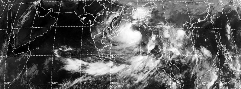
Image credit: IMD/RAPID
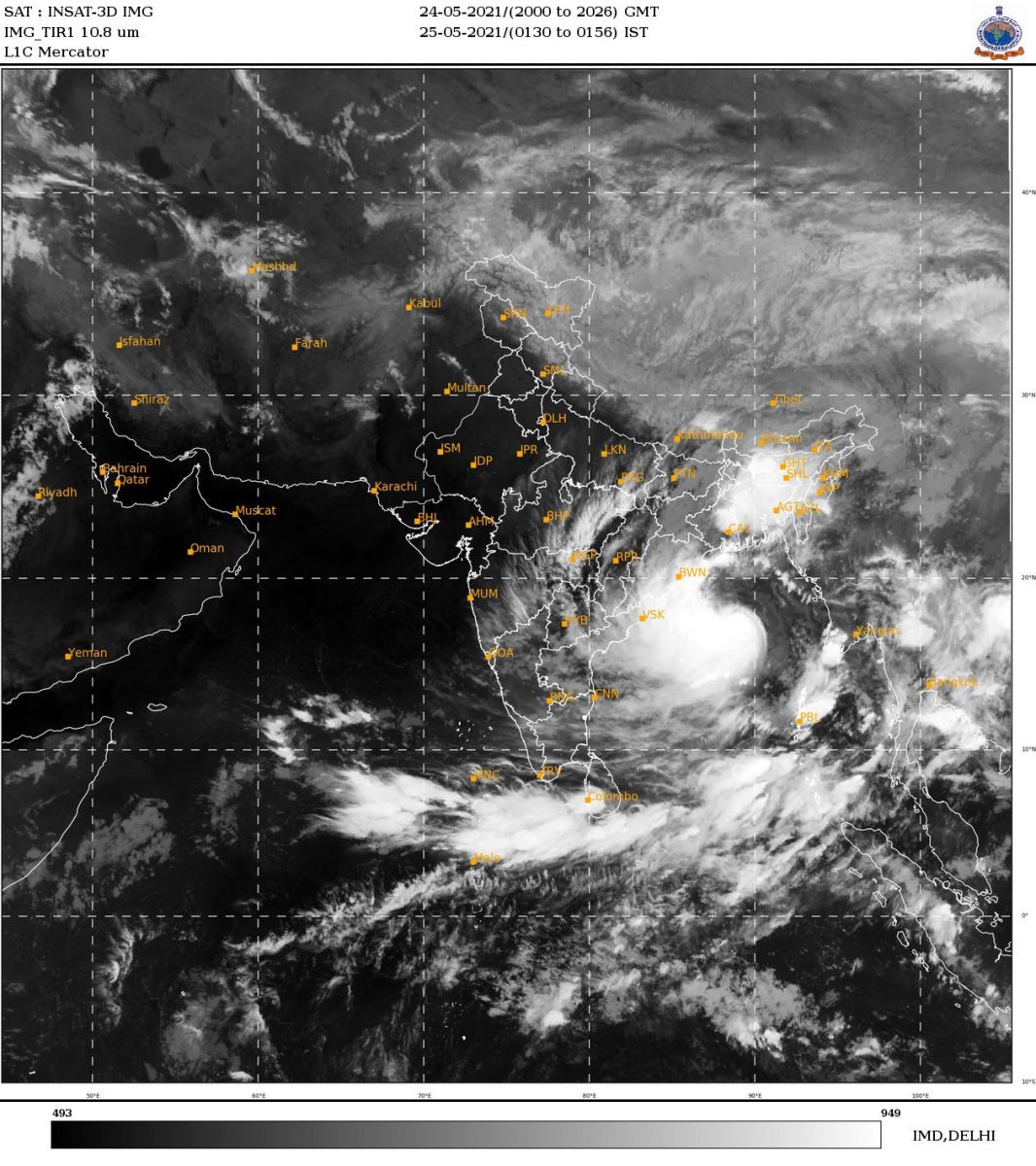
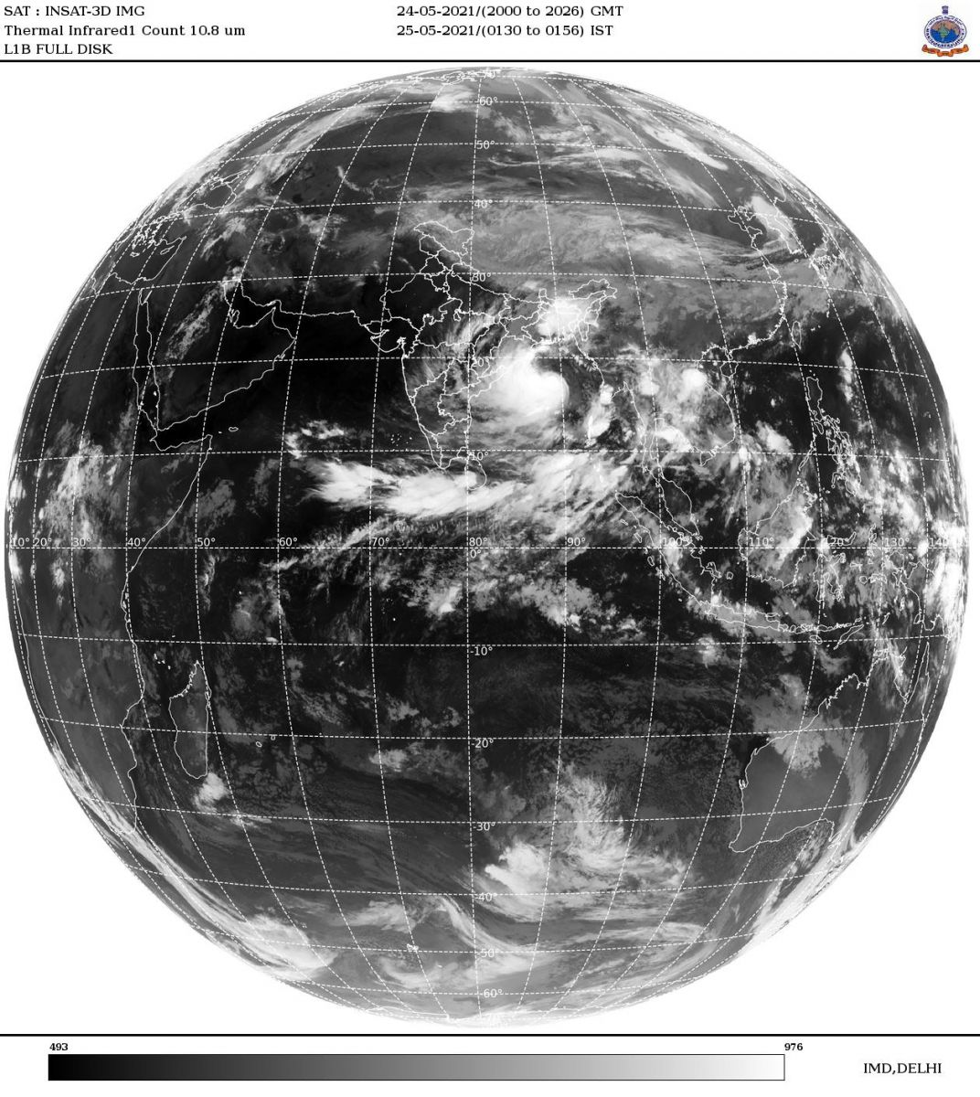
Tropical Cyclone "Yaas" formed at 03:00 UTC on May 24, 2021, as the second named storm of the 2021 North Indian Ocean cyclone season. The system is expected to cross the north Odisha – West Bengal coasts on May 26 as a Very Severe Cyclonic Storm, with wind speeds of 155 – 165 km/h (95 – 100 mph), gusting to 185 km/h (115 mph), according to the IMD. Rainfall is likely to be in the range of 300 mm (12 inches), storm surge 3 – 4 m (10 – 13 feet). Governments of Odisha and West Bengal have ordered the evacuation of more than 1 million people.
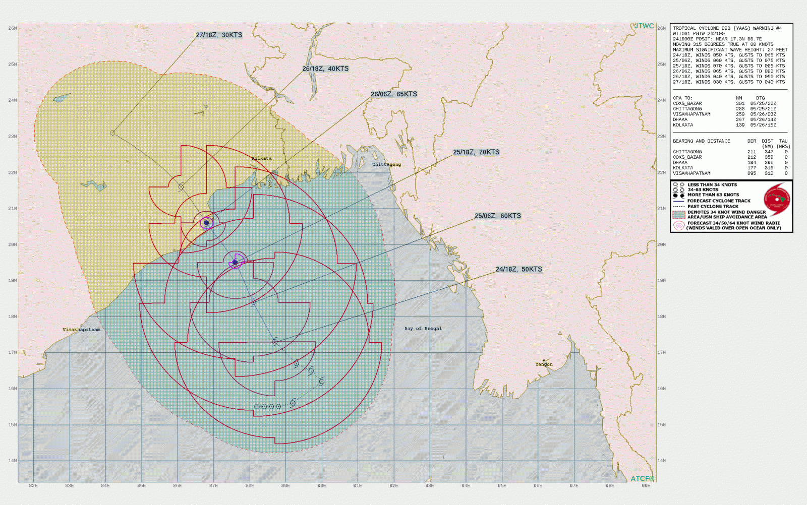
At 18:00 UTC on May 24, the center of Cyclonic Storm "Yaas" was located about 390 km (240 miles) SSE of Paradip, 490 km (305 miles) SSE of Balasore, and 500 km (310 miles) SSW of Khepupara.
Its maximum 3-minute sustained winds were at 95 km/h (60 mph), gusting up to 110 km/h (70 mph). Maximum 1-minute sustained winds were at 95 km/h (60 mph).
The system's central barometric pressure was 986 hPa. Yaas was moving NNW at 13 km/h (8.1 mph).
It is very likely to move NNW, intensify further into a Severe Cyclonic Storm during the next 12 hours, and into a Very Severe Cyclonic Storm during subsequent 12 hours, the India Meteorological Department (IMD) said.
IMD expects Yaas to continue moving NNW, intensify further and reach Northwest Bay of Bengal near north Odisha and West Bengal coasts by the early morning of May 26 (LT).
It is very likely to cross north Odisha – West Bengal coasts between Paradip and Sagar Island around Balasore, around 06:30 UTC (12:00 LT) of May 26 as a Very Severe Cyclonic Storm.
State governments of West Bengal and Odisha are on high alert and National Disaster Response Force (NDRF) teams have been deployed, DG Echo reports.
West Bengal Chief Minister Mamata Banerjee said Yaas's impact is expected to be much higher than Super Cyclonic Storm "Amphan," which hit the state last year.
Amphan was the strongest tropical cyclone to strike the Ganges Delta since Sidr of the 2007 season and the first super cyclonic storm to have formed in the Bay of Bengal since the 1999 Odisha cyclone. It was also the fourth super cyclone that hit West Bengal and Kolkata since 1582, after 1737, 1833, and 1942, as well as being one of the strongest storm to impact the area. With an estimated US$13 billion of damage, Amphan is the costliest cyclone ever recorded in the North Indian Ocean, surpassing the record held by Cyclone "Nargis" of 2008.
Banerjee said the cyclone might affect 20 districts of the state and her government is targeting to shift at least 1 million people to safer places.
"Yass is going to affect at least 20 districts in West Bengal. The districts of Kolkata, North and South 24 Parganas and Purba Medinipur will be severely affected," she said.
All ports have been advised to hoist distant warning signal number two in Bangladesh as heavy rainfall is expected to hit several parts of the country. A total of 3 million people may be exposed, of which 1 million may observe high impact as of today’s impact-based forecast model.
The Meteorological Department of Sri Lanka has issued red alert for heavy rains above 150 mm (5.9 inches) and strong wind up to 55 km/h (34 mph) in the southern part of the country — Western, Sabaragamuwa, Central and Southern provinces.
Forecast models
I'm a dedicated researcher, journalist, and editor at The Watchers. With over 20 years of experience in the media industry, I specialize in hard science news, focusing on extreme weather, seismic and volcanic activity, space weather, and astronomy, including near-Earth objects and planetary defense strategies. You can reach me at teo /at/ watchers.news.
Commenting rules and guidelines
We value the thoughts and opinions of our readers and welcome healthy discussions on our website. In order to maintain a respectful and positive community, we ask that all commenters follow these rules.