
Aerial images reveal invisible fault in Datong City, China
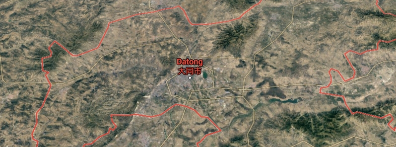
Image credit: Google Map
Aerial photos of Yudong District, Datong City in Shanxi Province, China, have aided scientists in their search for a hidden fault underneath the city, the team reported at the Seismological Society of America's 2021 Annual Meeting.
Photos taken from the 1960s and 70s allowed the team to reconstruct a digital elevation model along the Shuiyu fault, helping them determine the fault as it passes through Datong City.
The researchers, trenching along the hidden fault trace, discovered evidence of five previously unknown earthquakes along the fault, ranging in age from 9 930 years ago to 23 550 years ago, said Junjie Ren, a researcher at the National Institute of Natural Hazards, Ministry of Emergency Management of China.
"Our work is the first to determine the fault trace in the city area and find evidence of the past five surface-rupturing earthquakes in the latest Quaternary," he stated.
"Given the elapsed time of about 10 000 years, the Shuiyu fault beneath the Yudong District will increase the risk of a large earthquake in the future."
The previous mapping showed that the Shuiyu fault crossed the city, which is at the center of a basin bounded by Holocene-age normal faults.
However, studies indicated that the fault had not been active since 20 000 years ago, and landforms like fault scraps may have marked that its extent had vanished under urbanization starting in 2000.
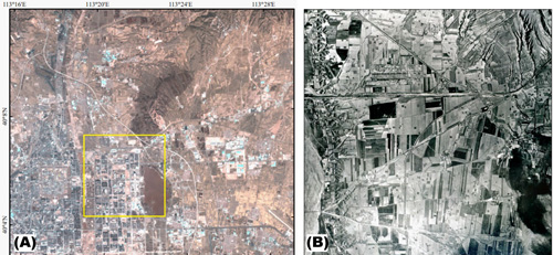
Image: (A) Landsat image in 2018 showing Datong City. (B) Aerial image in the 1960s. Credit: Seismological Society of America
"Generally, shallow seismic reflection imaging and drilling are used to explore the location of a potentially active fault beneath a city, but these techniques are costly and time-consuming," Ren explained.
Aerial images taken 50 to 60 years ago revealed a much less densely populated area. The team applied a technique called stereophotogrammetry to the images to calculate the 3D coordinates of features on the landscape.
This way, the scientists were able to reconstruct a digital elevation model of part of Datong City, as it was before urbanization, making features visible.
Ren said the technique is recommended for uncovering similar hidden active faults in other densely populated urban areas. "A big earthquake beneath a big city will bring a massive loss to the economy and significant casualties."
Commenting rules and guidelines
We value the thoughts and opinions of our readers and welcome healthy discussions on our website. In order to maintain a respectful and positive community, we ask that all commenters follow these rules.