
Red alert issued for La Soufriere volcano, evacuation ordered, St. Vincent and the Grenadines
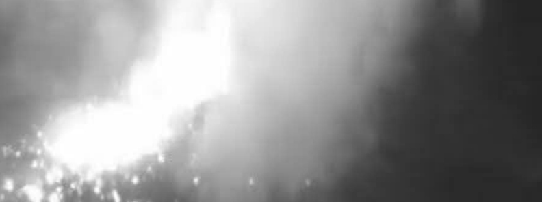
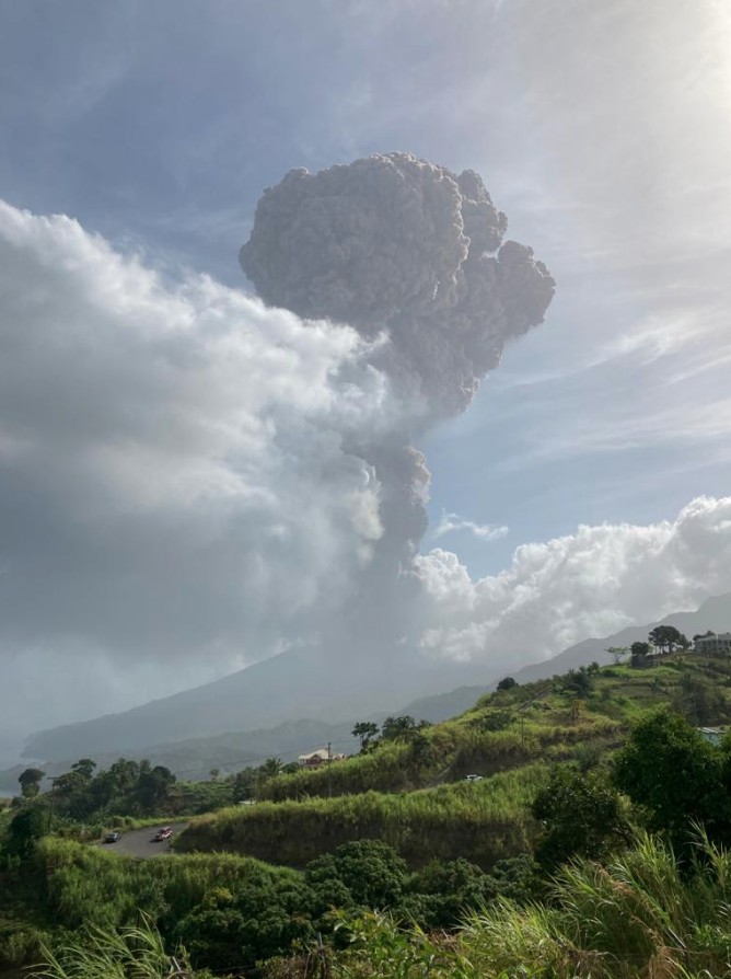
Featured image: La Soufriere volcano on April 8, 2021. Credit: UWI-SRC
Scientists monitoring La Soufriere volcano in St. VIncend and the Grenadines have observed a significant increase in activity at the volcano on April 8, 2021, which has prompted The Government of Saint Vincent and the Grenadines to raise the volcanic alert level to Red and issue an evacuation order for communities in the Red volcanic hazard zone.
The UWI-Seismic Research Centre (UWI-SRC) scientific team recorded six separate bands of volcanic tremor throughout the day.
This new type of seismic event has not yet been observed since the beginning of the eruption in December 2020.
The seismic signal recorded is usually associated with the movement of magma and fluids close to the surface.
Ash venting was also observed during the most recent tremor episode.
The effusive eruption is continuing and an explosive phase of the eruption may begin with very little warning, the center said.
As a result of increased activity, an evacuation order has been issued for communities in the Red volcanic hazard zone.
Prime Minister Ralph Gonsalves made the announcement during the second of two press conferences held in Kingstown on April 8.
View of the dome at 2:00 PM local time grabbed by @VincieRichie from the summit cam. We continue to monitor and advise @NEMOSVG #svg #lasoufrière #volcano #stilldangerous #uwi #uwiseimic pic.twitter.com/jgvw5YolJn
— UWISeismic Research (@uwiseismic) April 8, 2021
— UWISeismic Research (@uwiseismic) April 8, 2021
"We cannot give any clear warning that nothing can happen within the next 24 – 48 hours and we would not be surprised if there are explosions at the volcano during that period," the UWI-SRC Geologist and Scientific Team Lead, Prof. Richard Robertson said.
At Red alert level, the public is advised to urgently comply with directives issued by National Emergency Management Organisation (NEMO).
NEMO has advised that safe areas are those from North Union to Kingstown, on the Windward side of the island, Barouallie to Kingstown on the Leeward side and the Grenadine Islands.
In a bulletin released at 03:30 UTC on April 9, UWI-SRC said elevated and continuous periods of gas venting from the summit of the volcano coincided with the bands of tremor, with a well-defined plume at times.
Visual observations made from the Observatory at Belmont during the early evening indicate that the dome height increased significantly during the day. The glow from the dome was visible from Belmont.
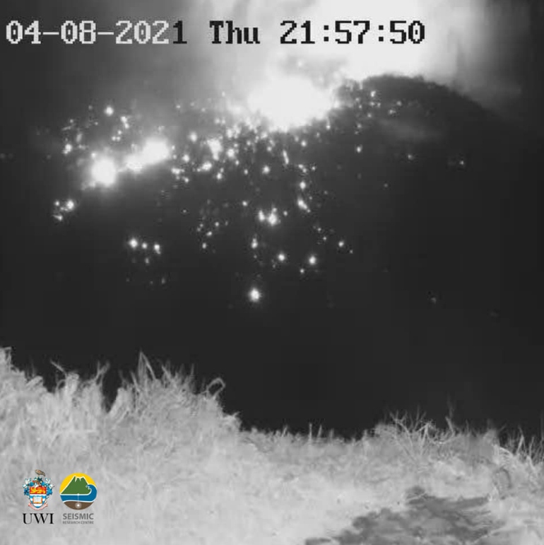
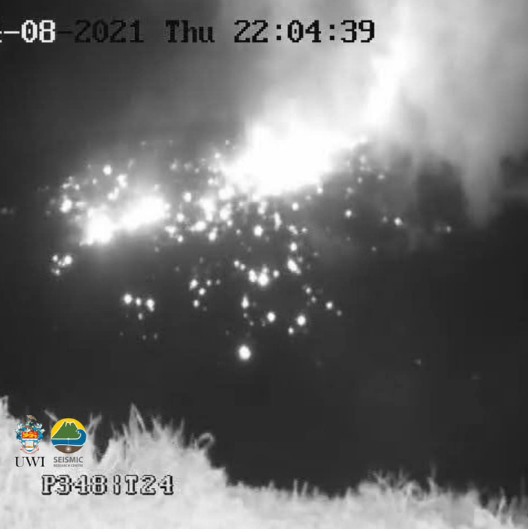
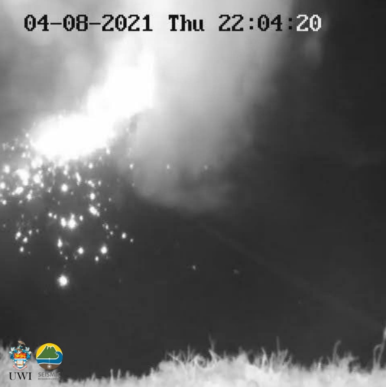
Images courtesy UWI-SRC
Update:
An explosive eruption took place at the volcano at 12:41 UTC (08:41 LT). "This is a culmination of the seismic activity that began on April 8," UWI-SRC said.
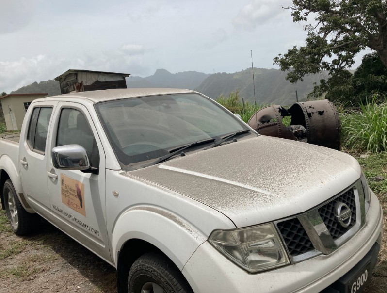
Ashfall was reported on the flanks of the volcano and surrounding communities, including Chateaubelair and Petite Bordel. "Some of it has gone offshore and reached the Observatory," UWI-SRC volcanologists said.
Video footage of eruption at #LaSoufriere #SVG today. Credit: MVO, Dr Thomas Christopher @soufriere_hills @mvoms pic.twitter.com/p91Z5yXYmS
— UWISeismic Research (@uwiseismic) April 9, 2021
The height of the ash column was estimated at 10 km (32 800 feet) above sea level.
The explosive eruption is likely to continue for days and possibly weeks.
Areas to be affected by pyroclastic flows and surges will be communities in the red and orange zones, the center said at a press conference held at 15:00 UTC today.
Communities across mainland St. Vincent will experience varying degrees of ashfall. The Grenadines may also be affected.
The Barbados Met Servies reported that light ashfall can be expected in approximately two hours – around 21:00 UTC. St. Lucia and Grenada may also experience ashfall in the coming hours.
The ash plume may cause flight delays.
Ash on the ground can cause discomfort in persons suffering from respiratory illnesses and will impact water resources.
Images courtesy UWI-SRC and Dr. Thomas Christopher
Geological summary
Soufrière St. Vincent is the northernmost and youngest volcano on St. Vincent Island. The NE rim of the 1.6 km (1 mile) wide summit crater is cut by a crater formed in 1812.
The crater itself lies on the SW margin of a larger 2.2 km (1.3 miles) wide Somma crater, which is breached widely to the SW as a result of slope failure.
Frequent explosive eruptions since about 4 300 years ago produced pyroclastic deposits of the Yellow Tephra Formation, which blanket much of the island.
The first historical eruption took place in 1718; it and the 1812 eruption produced major explosions.
Much of the northern end of the island was devastated by a major eruption in 1902 that coincided with the catastrophic Mont Pelée eruption on Martinique.
A lava dome was emplaced in the summit crater in 1971 during a strictly effusive eruption, forming an island in a lake that filled the crater prior to an eruption in 1979.
The lake was then largely ejected during a series of explosive eruptions, and the dome was replaced with another. (GVP)
I'm a dedicated researcher, journalist, and editor at The Watchers. With over 20 years of experience in the media industry, I specialize in hard science news, focusing on extreme weather, seismic and volcanic activity, space weather, and astronomy, including near-Earth objects and planetary defense strategies. You can reach me at teo /at/ watchers.news.
Commenting rules and guidelines
We value the thoughts and opinions of our readers and welcome healthy discussions on our website. In order to maintain a respectful and positive community, we ask that all commenters follow these rules.