
Significant explosive eruption at Sangay volcano, ash to 12.5 km (41 000 feet) a.s.l., Ecuador
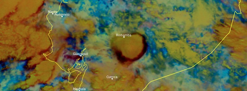
Image credit: IGEPN
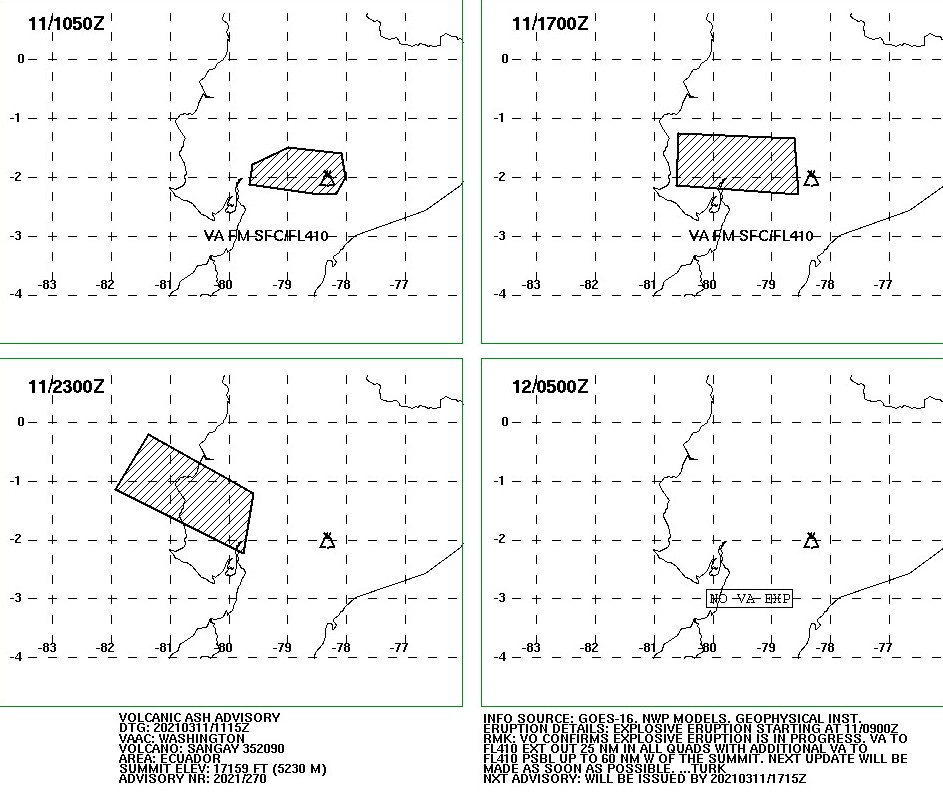
A significant explosive eruption took place at Sangay volcano, Ecuador from 08:15 to 10:45 UTC on Thursday, March 11, 2021.
According to the Washington VAAC, volcanic ash to 12.5 km (41 000 feet) above sea level is extending up to 46 km (29 miles) in all quadrants as of 10:50 UTC, with additional volcanic ash up to 12.5 km possible up to 111 km (70 miles) W of the summit.
IGEPN warned ashfall is likely in the province of Chimborazo and urged all affected residents to take necessary precautions.
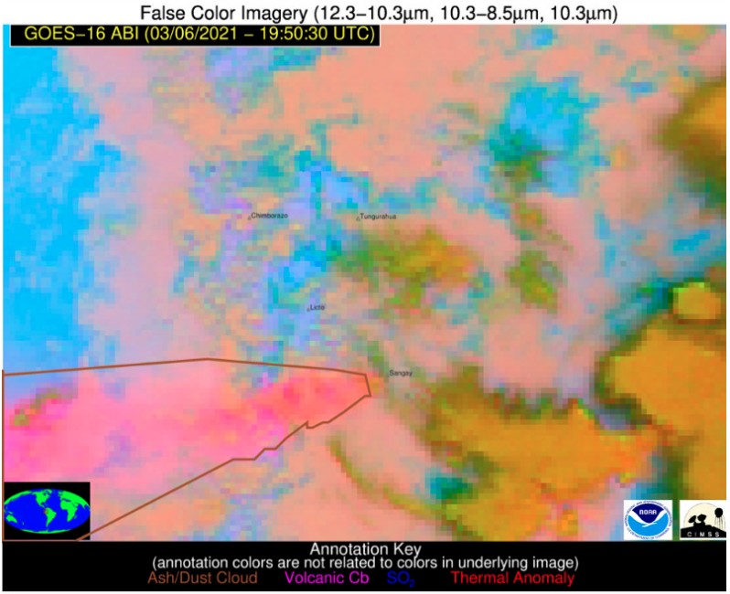
A large eruption started at the volcano at around 04:00 UTC on March 6, 2021, producing a volcanic ash column up to 12.2 km (40 000 feet) above sea level.
Strong ashfall was reported in Chimborazzo: Pallatanga, Chunichi, Guamote, Alausi, and Cumanda; moderate in Guayas: Alfredo Baquerizo Moreno; and mild in Milagro, San Jacinto de Yaguachi, El Triunfo; Los Rios: Babahoyo; Bolivar: Chillanes, San Miguel and Canar: Suscal.
Authorities urged citizens to keep calm and take the appropriate precautions to protect their health.
Cae y cae y cae, sur de #Guayaquil pic.twitter.com/Nep6J49u59
— Dªⓥîd ®. Z. (@xxDAVICHOxx) March 6, 2021
Ceniza en las vías del Ecuador
Precaución al conducir pic.twitter.com/KXzhO0MENv— C.U.P.S. (#QuédateEnCasa ) (@Cupsfire_gye) March 6, 2021
Caída de #ceniza por Simón Bolívar – Jujan pic.twitter.com/NrMzgG0VIo
— C.U.P.S. (#QuédateEnCasa ) (@Cupsfire_gye) March 6, 2021
[COMUNICADO] De acuerdo a monitoreo realizado por @Riesgos_Ec, al momento se registra caída de ceniza entre fuerte, moderada y leve en las provincias de #Chimborazo #Guayas y #Bolívar. Tome precauciones pic.twitter.com/xH3OsZfJcB
— Riesgos Ecuador (@Riesgos_Ec) March 6, 2021
By 21:20 UTC on March 6, the leading edge of volcanic ash to 12.2 km (40 000 feet) above sea level was 296 km (184 miles) west of the summit while volcanic ash to 8.2 km (27 000 feet) a.s.l. extended 130 km (80 miles) WSW of the summit.
A total of 11 198 ha (27 670 acres) of crops have been destroyed in the provinces of Bolivar, Chimborazo, Guayas, and Los Ríos, affecting at least 24 557 farmers, after the major eruption of Sangay volcano on September 20, 2020, when volcanic ash also rose to 12.2 km (40 000 feet) a.s.l.
The National Risk Management Service has distributed 26 250 volcano kits to those most affected in the provinces of Bolivar, Chimborazo and Guayas. The Ministry of Agriculture has delivered forage for the cattle.
IGEPN volcanologists said that explosions and ash emissions on September 20 were much more energetic than any of those observed in the past couple of months. A large ash cloud was reported at 09:40 UTC, with the highest part of the cloud heading east, while the lower part headed west of the volcano.
On September 24, El Comercio reported 55 000 ha (135 900 acres) of banana crops were affected by ashfall, especially in the provinces of Guayas and Los Rios.
This area's production accounts for 25 to 30% of the fruit that is exported to the world on a weekly basis, equivalent to 1.5 million boxes. The worst affected areas were Naranjito and El Triunfo in Guayas, and Mata de Cacao in Los Rios.
Sangay is located in the Morona Santiago province, 41 km (25 miles) north-west of the city of Macas.
The current eruptive period began in May 2019. The activity is characterized by lava flows, pyroclastic density currents (pyroclastic flows), and gas and ash emissions.
Geological summary
The isolated Sangay volcano, located east of the Andean crest, is the southernmost of Ecuador's volcanoes and its most active. The steep-sided, glacier-covered, dominantly andesitic volcano grew within horseshoe-shaped calderas of two previous edifices, which were destroyed by collapse to the east, producing large debris avalanches that reached the Amazonian lowlands.
The modern edifice dates back to at least 14 000 years ago. It towers above the tropical jungle on the east side; on the other sides flat plains of ash have been sculpted by heavy rains into steep-walled canyons up to 600 m (1 979 feet) deep.
The earliest report of a historical eruption was in 1628. More or less continuous eruptions were reported from 1728 until 1916, and again from 1934 to the present.
The almost constant activity has caused frequent changes to the morphology of the summit crater complex. This volcano is located within the Sangay National Park, a UNESCO World Heritage property.
I'm a dedicated researcher, journalist, and editor at The Watchers. With over 20 years of experience in the media industry, I specialize in hard science news, focusing on extreme weather, seismic and volcanic activity, space weather, and astronomy, including near-Earth objects and planetary defense strategies. You can reach me at teo /at/ watchers.news.
Commenting rules and guidelines
We value the thoughts and opinions of our readers and welcome healthy discussions on our website. In order to maintain a respectful and positive community, we ask that all commenters follow these rules.