
Declining vent temperatures at White Island volcano, New Zealand
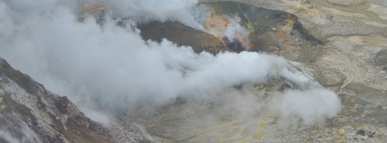
Image credit: GeoNet
Remote monitoring of the vent area at White Island volcano, New Zealand over the past 12 months revealed that the temperatures of gas emissions have declined from over 700 °C (1 290 °F) to 300 °C (570 °F). Current activity is characterized by steam and gas emissions at moderate-low levels. The Volcanic Alert Level remains at 1.
Since the deadly eruption in December 2019 — which claimed 22 lives, left people 2 missing and 25 injured, many of whom severely, a series of thermal infrared images have been regularly collected by helicopter to observe the temperature of steam and gas vents.
"These temperatures have shown a gradual decline since the December 2019 eruption, from over 700 °C (1 290 °F) in February 2020 to 300 °C (570 °F) on January 21, 2021," GeoNet Duty Volcanologist, Steven Sherburn, noted. "The gas emission temperatures are now similar to temperatures measured in July 2018."
Observations in January 2021, confirmed there is no evidence of recent eruptive activity or signs of collapse in or near the active vents. There is little water ponded on the floor of the 1978/90 Crater, Sherburn added.
Volcanic steam and gas continue to be emitted from active vents and lava extrusions in the area that erupted in December 2019.
The most recent observations are some of the lowest gas emissions measured since the 2019 eruption and are now close to those observed in early-2019.
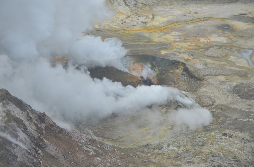
Image credit: GeoNet
The Volcanic Alert Level remains at 1 and the Aviation Colour Code remains at Green.
The Volcanic Alert Level reflects the current level of volcanic unrest or activity and is not a forecast of future activity. While alert level 1 is mostly associated with environmental hazards, eruptions can still occur with little or no warning.
The main plausible triggers for a sudden eruption remain the collapse of unstable material in an active vent and the possible ingress of water underground onto the shallow magma body.
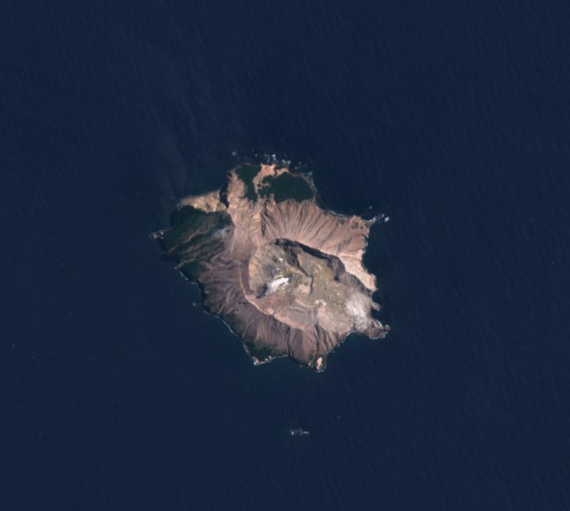
White Island volcano on January 30, 2021. Credit: Copernicus EU/Sentinel-2, TW
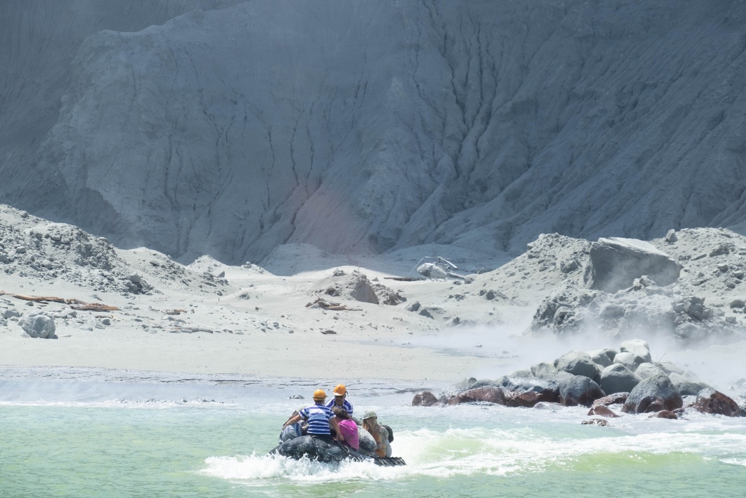
White Island Tour operators rescuing people. Images captured by Michael Schade 13 minutes after the eruption on December 9, 2019
Geological summary
Uninhabited 2 x 2.4 km (1.2 x 1.5 miles) White Island, one of New Zealand's most active volcanoes, is the emergent summit of a 16 x 18 km (10 x 11.2 miles) submarine volcano in the Bay of Plenty about 50 km (31 miles) offshore of North Island.
The island consists of two overlapping andesitic-to-dacitic stratovolcanoes; the summit crater appears to be breached to the SE, because the shoreline corresponds to the level of several notches in the SE crater wall. Volckner Rocks, four sea stacks that are remnants of a lava dome, lie 5 km (3.1 miles) NNE.
Intermittent moderate phreatomagmatic and strombolian eruptions have occurred throughout the short historical period beginning in 1826, but its activity also forms a prominent part of Maori legends.
Formation of many new vents during the 19th and 20th centuries has produced rapid changes in crater floor topography. The collapse of the crater wall in 1914 produced a debris avalanche that buried buildings and workers at a sulfur-mining project. (GVP)
I'm a dedicated researcher, journalist, and editor at The Watchers. With over 20 years of experience in the media industry, I specialize in hard science news, focusing on extreme weather, seismic and volcanic activity, space weather, and astronomy, including near-Earth objects and planetary defense strategies. You can reach me at teo /at/ watchers.news.
Commenting rules and guidelines
We value the thoughts and opinions of our readers and welcome healthy discussions on our website. In order to maintain a respectful and positive community, we ask that all commenters follow these rules.