
More than 500 evacuated after new eruption at Merapi volcano, Indonesia
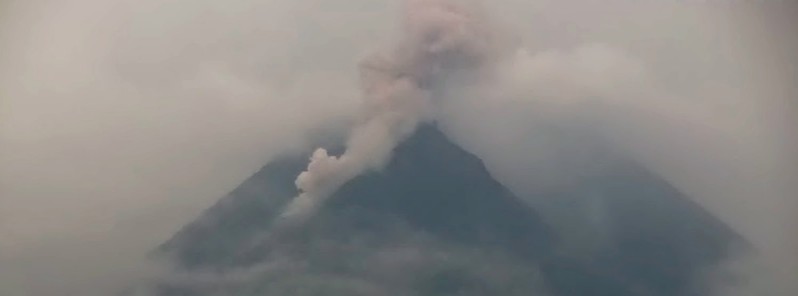
Image credit: CVGHM
More than 500 people living on the fertile slopes of Merapi volcano in Indonesia were forced to evacuate on January 7, 2021, after a brief eruption at 01:02 UTC produced a pyroclastic flow with ash rising up to 3 km (10 000 feet) above sea level.
The pyroclastic flow was only partially visible due to fog over the mountain, authorities said.
The flow spread less than 1 km (0.62 miles) from the crater.
Small-scale eruptions continued through the rest of the day, with ash rising 200 m (650 feet) above the crater.
The Alert Level remains at 3, and the public is urged to stay 5 km (3.1 miles) away from the summit.
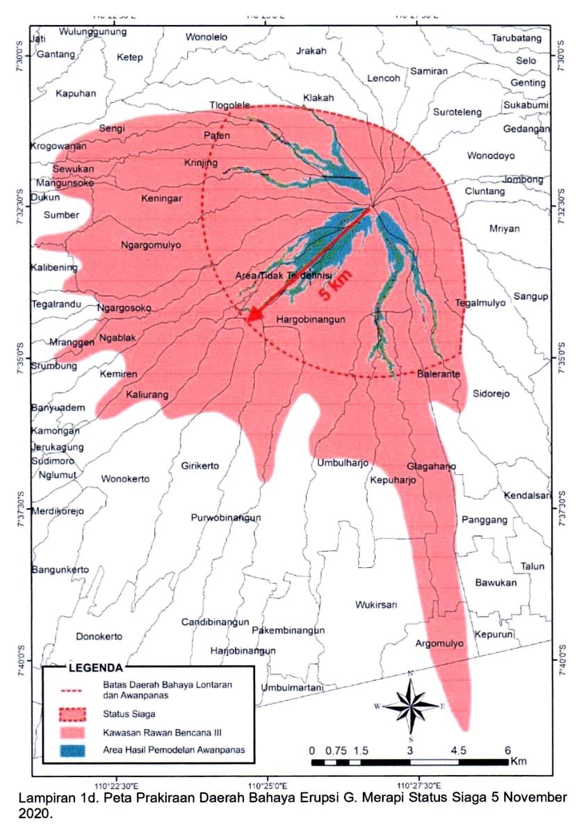

Merapi's alert level was raised from 2 to 3 (on a scale of 1 – 4) on November 5, 2020, after a significant increase in seismicity.
The volcano-tectonic activity has remained elevated since the powerful eruption on June 21, when the volcano ejected ash up to 6 000 m (20 000 feet) above sea level.
The seismicity started intensifying again in October, with all monitored conditions above those recorded before the formation of the lava dome on April 26, 2006.

Merapi's eruption in 2010 killed 347 people and forced the evacuation of nearly 400 000 people.
Geological summary
Merapi, one of Indonesia's most active volcanoes, lies in one of the world's most densely populated areas and dominates the landscape immediately north of the major city of Yogyakarta. It is the youngest and southernmost of a volcanic chain extending NNW to the Ungaran volcano.
Growth of Old Merapi during the Pleistocene ended with major edifice collapse perhaps about 2 000 years ago, leaving a large arcuate scarp cutting the eroded older Batulawang volcano.
Subsequently, the growth of the steep-sided Young Merapi edifice, its upper part unvegetated due to frequent eruptive activity, began SW of the earlier collapse scarp.
Pyroclastic flows and lahars accompanying growth and collapse of the steep-sided active summit lava dome have devastated cultivated lands on the western-to-southern flanks and caused many fatalities during historical time. (GVP)
I'm a dedicated researcher, journalist, and editor at The Watchers. With over 20 years of experience in the media industry, I specialize in hard science news, focusing on extreme weather, seismic and volcanic activity, space weather, and astronomy, including near-Earth objects and planetary defense strategies. You can reach me at teo /at/ watchers.news.
Commenting rules and guidelines
We value the thoughts and opinions of our readers and welcome healthy discussions on our website. In order to maintain a respectful and positive community, we ask that all commenters follow these rules.