
Major early-season winter storm brings heavy snow and record cold temperatures to U.S.
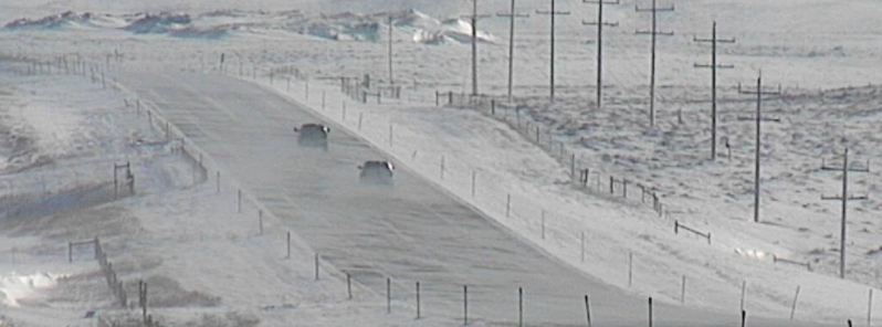
Image credit: NWS Great Falls
Widespread heavy snow falling across the central Rockies and central Plains is forecast to shift further south and develop into another major winter storm for the southern High Plains Monday into Tuesday, October 26 into 27, according to the National Weather Service (NWS). The station in Potomac, Montana, recorded -33 °C (-29 °F) on Sunday morning, October 25 — the lowest temperature at an official climate site in the U.S. this early in the season.
- More record cold temperatures are expected to engulf the affected regions over the next couple of days.
- An area of freezing rain and sleet is forecast to develop over portions of the southern Plains to start the week.
The new, early-season major winter storm across the central Rockies to the Plains is showing no sign of abating. It comes on the heels of another early-season winter storm which hit parts of the northern U.S. last week, breaking scores of snowfall records in Montana, Iowa, and Minnesota.
Storm warnings, winter storm watches, and winter weather advisories have been issued from the central and southern Rockies into the Plains, as far south as West Texas and Oklahoma.
Heavy snow started in Washington State, northern Idaho, and Montana on Friday, October 23. Up to 63 cm (25 inches) of snow already fell southwest of Helena, Montana. This was the sixth heaviest two-day snowfall on record in the area.
The Potomac station reported -33 °C (-29 °F) on Sunday morning– the lowest temperature measured at an official climate site in the U.S. this early in the season in any year. The previous record low by October 25 was -28 °C (-20 °F) set in 1919, according to climatologist Brian Bretschneider.
In Washington State, 19 cm (7.5 inches) of snow was recorded at the airport in Spokane, marking the city's snowiest October on record (since 1893). In Great Falls, 28 cm (11 inches) of snow fell, also marking the city's snowiest October on record.
Accumulating snow is forecast to spread as far south and east as northern New Mexico, the Texas Panhandle, northwest Oklahoma, Kansas, and northern Missouri into Monday.
More than 0.3 m (1 foot) of snow with gusty winds and below-freezing temperatures are forecast for the higher terrain of the central Rockies, while much of the southern High Plains will receive at least 15 cm (6 inches) of additional snow.
The Weather Channel noted that parts of West Texas into western and central Oklahoma and southern Kansas have the greatest chance of significant ice accumulations.
An early-season winter storm is expected to bring accumulating ice and snow over the next three days across the Panhandle, West Texas, Permian Basin, Big Country, and Northwest Texas. Monday Night & Tuesday could be 'interesting'.
Details: https://t.co/WuS2Y0PhTz pic.twitter.com/qloclOuTlE
— Texas Storm Chasers (@TxStormChasers) October 26, 2020
A winter storm will hit southern New Mexico and west Texas with much colder temperatures and good chances for snow…rain and even freezing rain across the region Monday night through Tuesday night. #txwx# nmwx pic.twitter.com/qPFQ5btAj1
— NWS El Paso (@NWSElPaso) October 24, 2020
11:15am. Winds are starting to pick up at East Glacier Park. This @mdtroadreport cam shows how a 15mph wind, gusting to 22mph, is enough to cause drifting snow. Expect wind gusts to 55mph in this area Mon/Tue, causing significant impacts to travel with local whiteout conditions. pic.twitter.com/CATZ3i3ImE
— NWS Great Falls (@NWSGreatFalls) October 25, 2020
Temperatures continue to drop this evening. Many places in the teens already. If you don't have to be outdoors this evening, don't be. Bundle up. It will be downright cold Monday morning. #wawx #idwx pic.twitter.com/PsJpfZJGLt
— NWS Spokane (@NWSSpokane) October 26, 2020
"The system will gradually evolve into an ice storm as it begins to tap in moisture and slightly milder air from the western Gulf of Mexico later today and especially on Tuesday," NWS wrote.
"It appears that areas from northern Texas into western Oklahoma will be most likely to see significant amounts of ice through Tuesday."
Freezing rain and sleet will occur in a narrow stretch from the Texas Panhandle into northwest and central Oklahoma.
Record cold temperatures will continue from the interior western U.S. to a large part of the Great Plains for the next couple of days before abating on Wednesday, October 28.
Hmmm
Wow! Talk about perfect timing! If this weather and cold temperatures persist until election day it will definitely curtail voting right through the the conservative heartland of America….And given that experts agree that the majority of Republican voters are planning on going to the polls rather than take the risk of their vote getting “lost”…..
Remember the Post office management may or may not have a political agenda, but the actual postal workers in positions that handle those mail in votes are overwhelmingly Democrats…..
What an amazing coincidence this might turn out to be… And what amazing good luck for Biden……