
Powerful eruption at Mount Sinabung, ash up to 10 km (32 000 feet) a.s.l., Indonesia
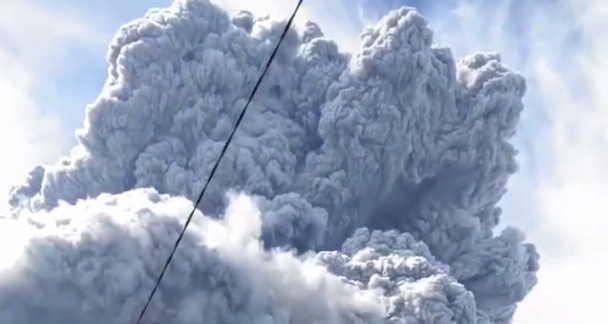
Featured image: Mount Sinabung on August 10, 2020. Credit: berlian sinulingga @BerlianMp
A high-level eruption took place at the Indonesian Sinabung volcano at around 03:16 UTC on August 10, 2020, ejecting ash up to 10 km (32 000 feet) above sea level and forcing authorities to evacuate nearby communities. The Aviation Color Code was briefly raised to Red. The Alert Level remains at III (Siaga/Alert).
The country's Volcanology and Geological Hazard Mitigation Center said there were no fatalities or injuries after today's eruption.
Armen Putra of the Mount Sinabung observation post said a thick layer of ash covered several villages up to 20 km (12.4 miles) from the volcano.
Villagers and tourists are advised to stay at least 5 km (3.1 miles) from the crater. The volcano is known for its violent pyroclastic and lava flows.
Sinabung meletus kembali #sinabung#sinabungmeletus#tanahkaro#BMKG @infoBMKG @bmkg pic.twitter.com/IC8aGtQVYG
— berlian sinulingga (@BerlianMp) August 10, 2020
#ÚltimaHora – se registró fuerte erupción del volcán #Sinabung, Indonesia. Alta columna eruptiva y descenso de flujos piroclásticos.
pic.twitter.com/MpliH8wSFl— SkyAlert (@SkyAlertMx) August 10, 2020
Apenas será mediodía en Indonesia y la ceniza ha ocultado la luz del Sol por completo en algunas localidades. #ErupciónSinabung
— SkyAlert (@SkyAlertMx) August 10, 2020
Foto erupsi #Sinabung berastagi pukul 10:22 wib (Credit Foto: Bayu) pic.twitter.com/dk7ha8vWs9
— INFOMITIGASI™ (@infomitigasi) August 10, 2020
Mediodía en Sumatra, Indonesia.
En completa oscuridad la localidad llamada “Naman Teran”, una de las más cercanas al Sinabung.#ErupciónSinabungpic.twitter.com/D0p4w0KWgH— SkyAlert (@SkyAlertMx) August 10, 2020
Semoga selalu dalam lindungan Allah. Sinabung kembali erupsi. Cepat membaik SUMUT, cepat membaik Indonesia, cepat membaik Dunia#sinabung #prayforsinabung pic.twitter.com/gtLuEMIk51
— Ifrah Allif Bainana (@iab_baina) August 10, 2020
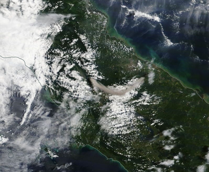
Image credit: NASA Terra/MODIS. Acquired on August 10, 2020
Sinabung started erupting at 18:58 UTC on August 7, for the first time since June 2019. According to the Darwin VAAC, the eruption ejected volcanic ash up to 4.5 km (15 000 feet) above sea level, drifting ESE. Volcanic ash was not discernable on satellite imagery due to the presence of a meteorological cloud.
Another eruption took place at 10:18 UTC, with volcanic ash rising up to 3.3 km (11 000 feet) a.s.l., moving ESE. Height was based on ground reports due to meteorological cloud obscuring ash on satellite imagery.
Sinabung awakened in 2010 after 400 years of sleep. The eruptions intensified in 2013 and continued over the next couple of years, claiming the lives of 23 people (16 in 2014 and 7 in 2016).
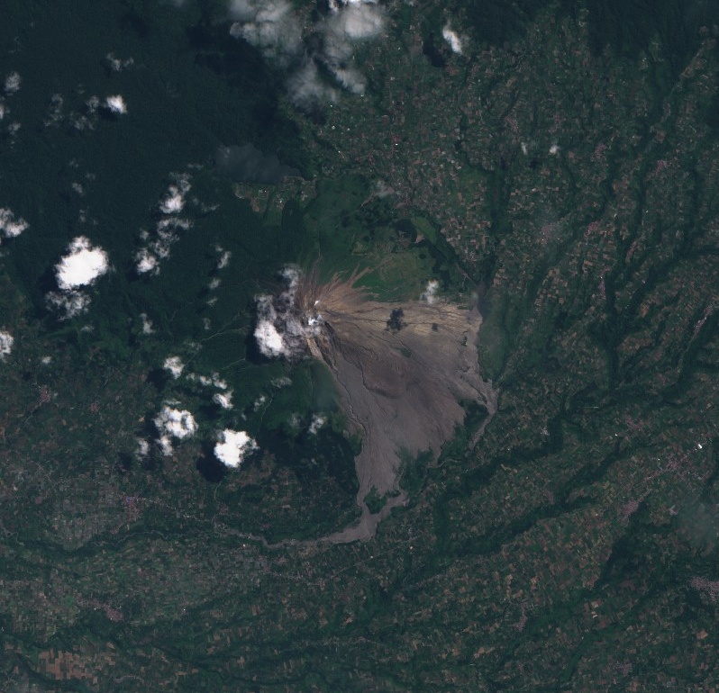
Sinabung on July 30, 2020. Credit: Copernicus EU/Sentinel-2, TW
Geological summary
Gunung Sinabung is a Pleistocene-to-Holocene stratovolcano with many lava flows on its flanks. The migration of summit vents along a N-S line gives the summit crater complex an elongated form. The youngest crater of this conical, 2 460-m-high (8 070 feet) andesitic-to-dacitic volcano is at the southern end of the four overlapping summit craters.
An unconfirmed eruption was noted in 1881, and solfataric activity was seen at the summit and upper flanks in 1912.
No confirmed historical eruptions were recorded prior to explosive eruptions during August – September 2010 that produced ash plumes to 5 km (16 404 feet) above the summit. (GVP)
I'm a dedicated researcher, journalist, and editor at The Watchers. With over 20 years of experience in the media industry, I specialize in hard science news, focusing on extreme weather, seismic and volcanic activity, space weather, and astronomy, including near-Earth objects and planetary defense strategies. You can reach me at teo /at/ watchers.news.
Commenting rules and guidelines
We value the thoughts and opinions of our readers and welcome healthy discussions on our website. In order to maintain a respectful and positive community, we ask that all commenters follow these rules.