
Typhoon “Kammuri” (Tisoy) forecast to make landfall over Bicol Region, Philippines
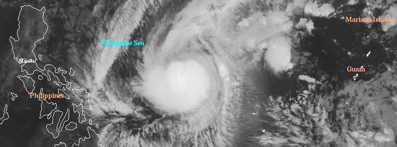
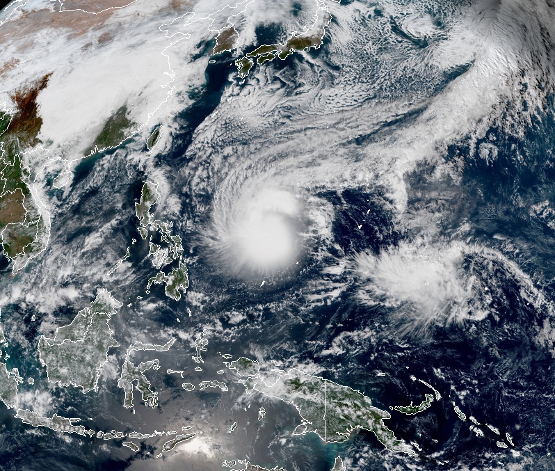
Featured image: Kammuri at 14:20 UTC on November 30. Credit: UW-CIMSS
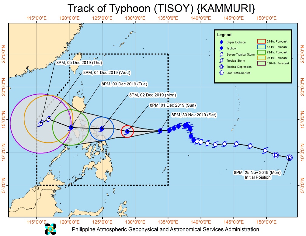
Typhoon "Kammuri," known as Tisoy in the Philippines, maintains its strength while moving westward toward the Philippines. Landfall is expected over Bicol Region late December 2 into 3, 2019 (local time). Kammuri is the 28th named storm of the 2019 Pacific typhoon season. Tropical Cyclone Wind Signal no. 1 (TCWS) is in effect for Luzon, Visayas, and Mindanao.
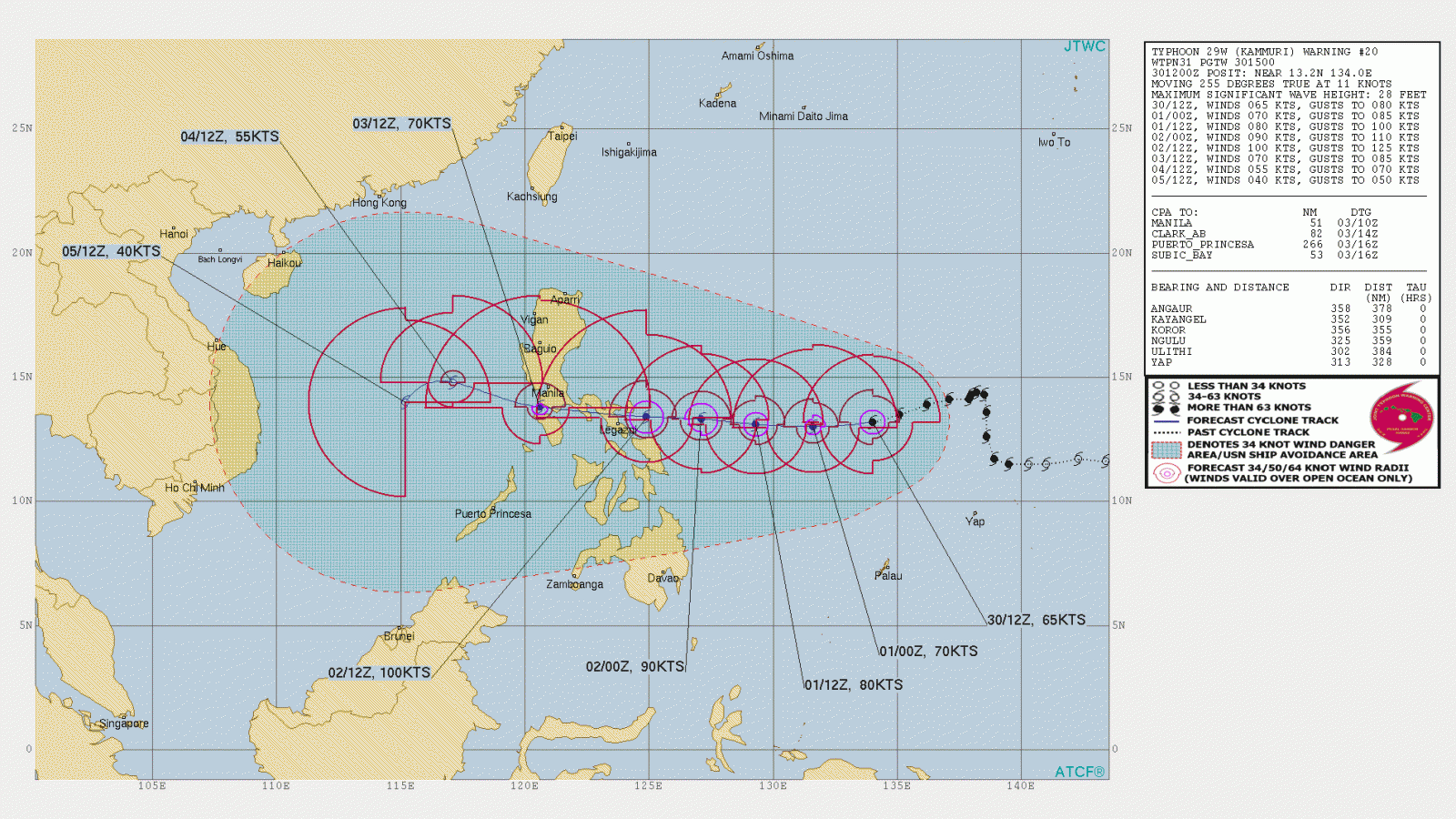
At 15:00 UTC on November 30, the center of Typhoon "Kammuri" was located about 995 km (618 miles) East of Virac, Catanduanes, according to data provided by PAGASA. Over the next 48 hours, the cyclone will be in the vicinity of Bicol, about 75 km (46 miles) East of Virac.
Kammuri is moving west at 15 km/h (9 mph) with maximum sustained winds of 150 km/h (93 mph) near the center and gusts up to 185 km/h (115 mph).
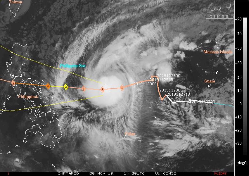
The typhoon is currently tracking along the southeastern periphery of an extension of the subtropical ridge to the north and is in a marginally favorable environment for development with low to moderate vertical wind shear offset by warm (29 °C / 84 °F) sea surface temperatures, very high ocean heat content values and robust poleward and equatorward outflow aloft, JTWC forecasters noted.
Over the next 36 hours, Kammuri is expected to continue tracking westward along the southeastern periphery of the subtropical ridge. After that, a passing shortwave trough to the north will erode the subtropical ridge to the west of typhoon and allow str to the northeast to steer the system westward. The erosion of this subtropical ridge to the west will also allow for enhanced poleward outflow allowing the system to intensify to 185 km/h (115 mph) by 15:00 UTC on December 2.
After that, Kammuri will begin to pass over Luzon where it will begin to weaken due to the frictional effects of land interaction.
Kammuri will begin to track southwestward after it enters the South China Sea on December 3 and weaken significantly as it begins to interact with a strong northeast surge event.
On November 28, PAGASA stated in a press conference that appropriate measures and linking with the 2019 SEA Games organizers have been in place in preparation for the typhoon, such as storm chasers and mobile radars dispatched to competition venues in Metro Manila and Central Luzon.
Local governments in Bicol Region have also begun their preparations. Rescue crews and equipment, and hospitals in Catanduanes, the province where Kammuri is forecast to make its first landfall, were placed on alert; preemptive evacuation, liquor ban, and suspension of work and classes were also ordered by the province's government.
Crops in Camalig town of Albay province were reaped early, while the region's transportation office suspended bus trips to ports to avoid stranding passengers.
SEA Games organizers reported that a contingency plan has been set up in preparation for Kammuri.
Typhoon "Kammuri" at 04:20 UTC on November 30, 2019. Credit: JMA/Himawari-8, RAMMB/CIRA
I'm a dedicated researcher, journalist, and editor at The Watchers. With over 20 years of experience in the media industry, I specialize in hard science news, focusing on extreme weather, seismic and volcanic activity, space weather, and astronomy, including near-Earth objects and planetary defense strategies. You can reach me at teo /at/ watchers.news.
Commenting rules and guidelines
We value the thoughts and opinions of our readers and welcome healthy discussions on our website. In order to maintain a respectful and positive community, we ask that all commenters follow these rules.