
San Francisco ties century-old record for coldest November day as North Bay freezes, California
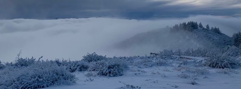
Image credit: @Maxreeese/Twitter
San Francisco registered 8.8 °C (48 °F) on Thursday, November 28, 2019, and tied with November 27, 1896, for the coldest November day on record. Meanwhile, North Bay dealt with below-freezing temperatures overnight, with Novato Airport hitting -5 °C (23 °F).
According to the National Weather Service, the coldest high-temperature day ever in the city was 1.6 °C (35 °F) on December 11, 1932. This date also holds the coldest temperature ever registered in San Francisco, which is -2.7 °C (27 °F).
North Bay was frigid in the same period, as Santa Rosa and Napa County Airport registered -3.3 °C (26 °F).
Sonoma Airport registered -2.7 °C (27 °F), Livermore Airport's temperature hit the freezing point, while Oakland Airport and Reid Hillview both registered 2.7 °C (37 °F).
Bay Area peaks including Mount Diablo and Mount Hamilton were blanketed in snow, while Sierra area was downright freezing. South Lake Tahoe registered -8.3 °C (17 °F) with light snow falling overnight.
Our Mt. Hamilton weather spotter reported 4.5 inches of snow from the storm yesterday. #CAwx #CASnow pic.twitter.com/slISGcCL18
— NWS Bay Area (@NWSBayArea) November 29, 2019
A winter weather advisory is in place for the Santa Lucia Mountains in Monterey County, where showers may dump 25 to 76 mm (1 to 3 inches) of snow on Friday, November 29.
@NWSBayArea Santa Lucias this morning pic.twitter.com/NvxmnQ8WgY
— Max Reese (@Maxreeese) November 28, 2019
Lows Saturday morning, November 30, are expected to be 5.4 to 9 °C (3 to 5 °F) higher than the lows on Friday morning.
"An incoming storm will eject the cold weather by Saturday afternoon as wind and rain take hold of the Greater Bay Area," said Ryan Walburn of NWS.
Beginning Saturday afternoon, the warm rain system is forecast to bring 51 to 152 mm (2 to 6 inches) of rain throughout the region.
Very chilly temperatures overnight! Overnight lows dipped into the 20s to low 30s for many inland valley locations. Both Novato and Santa Rosa airports reported freezing fog overnight.
Tonight is forecast to generally be 3-5 degrees warmer than last night. pic.twitter.com/6Cg8uOkkrY
— NWS Bay Area (@NWSBayArea) November 29, 2019
Temps were well below average for the West Coast. Now a shift in offshore winds has raised the night time lows almost 15 degrees F to the high 30s F for the next five days. Then back to 32 F with lots of rain over the next 10 days. Looks like winter has begun in earnest for the West Coast. Cloud cover over the eastern Pacific has increased greatly over the last week. … https://earth.nullschool.net/#current/wind/surface/level/overlay=total_cloud_water/orthographic=-128.04,36.41,1107/loc=-129.443,42.984