
Tropical Cyclone “Gelena” brings widespread flooding, leaves Rodrigues without power

Image credit: Force Thirteen
The center of Tropical Cyclone "Gelena" passed just south of the island of Rodrigues in Southwest Indian Ocean on February 10, 2019, causing widespread flooding and island-wide power outages.
Gelena brought wind speeds of up to 185 km/h (115 mph) and heavy rain, leaving 90% of the island's 41 669 inhabitants without power.
142 people have been evacuated to refuge centers but there are no reports of fatalities or serious injuries.
The main damage left by the storm are downed trees, broken electricity cables and blocked roads.
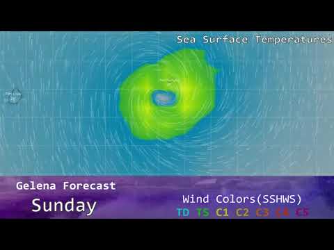
The cyclone is now moving away from the island with maximum 10-minute average wind speed of 140 km/h (85mph) and central pressure of 970 hPa.
Over the last 6 hours, the ragged eye disappeared on the visual imagery and the cloud pattern has deteriorated slightly on infrared images, RSMC La Reunion reported 12:00 UTC, February 10.

Tropical Cyclone "Gelena" at 11:00 UTC on February 10, 2019. Credit: UW-CIMSS

Tropical Cyclone "Gelena" at 11:00 UTC on February 10, 2019. Credit: UW-CIMSS

Gelena remains steered by the near equatorial ridge in the north-east, as the upper trough located in the south weakens and shifts eastwards, the center said.
Today and Monday, with the decrease of Gelena's speed, the effects of the vertical wind shear should be more important leading to a weakening of the intensity. On the other hand, the system should still benefit from the good upper level divergence ahead of the upper level trough and maintain a significant intensity until Monday evening, February 11
From Tuesday however, west of the trough axis, the upper divergence decreases and the system should weaken at a quicker pace, over waters with limited heat potential. In the upper and mid levels, the strong westerly winds located north of the subtropical jetstream do not allow intensification.
Dernière image Meteosat Eumetsat du #cyclone #GELENA se situe à 22H15UTC à 70 km dans l' ouest de #Rodrigues Vmax près du centre 180 km/h selon le modèle GFS. Il va continuer rapidement sa route vers le sud-est.https://t.co/pmuzWnf03Z … pic.twitter.com/np9dkcZD25
— meteophile (@meteophile) February 9, 2019
Dernière image Meteosat Eumetsat du #cyclone #GELENA. Dimanche à 10H45 UTC il est déjà loin de #Rodrigues et le soleil revient déjà.https://t.co/pmuzWnf03Z … … pic.twitter.com/iE9oua7rcC
— meteophile (@meteophile) February 10, 2019
Cyclone Gelena passing by the island of Rodrigues this morning. Here's a image as the sun rises over the cyclone.#Cyclone #Gelena #Rodrigues pic.twitter.com/5y3mgBYbfF
— Force Thirteen (@ForceThirteen) February 10, 2019

Teo Blašković founded The Watchers in 2011 and edited it until 2026, covering seismic and volcanic activity, extreme weather, space weather and near-Earth objects. Articles on this page are his archive.
Published in the last 24 hours
- Cyclone Akvan crossed the north Andhra Pradesh and south Odisha coasts close to Gopalpur on November 20 with 70-80 km/h winds gusting to 90, and has weakened into a deep depression
- High Risk of excessive rainfall covers Florida’s Space Coast as St. Johns River near Cocoa reaches 5.67 m
- Asteroid 2026 WJ to pass Earth at 1.7 lunar distances at 04:20 UTC on November 22, with 2026 WD following at 4.4 lunar distances on November 23
- A broad low over southeastern Florida and the northwestern Bahamas has a 30 percent chance of subtropical or tropical development within 48 hours and a 50 percent chance within 7 days, the National Hurricane Center says
