
The Watchers News Brief: August 14, 2018

Image credit: Flooding in Pennsylvania - August 2018.
Heavy rain to hit the central US this week
After a string of warm and dry days, heavy rain inundating the central Plains will soon overspread the region.
The AccuWeather Local StormMax is 152 mm (6 inches) with the event and most likely to be in the Ozark Mountains in northwestern Arkansas, southwestern Missouri, and northeastern Oklahoma.
Very dry ground is slower to absorb water, increasing the chance that any heavy storm produces dangerous flash flooding.
Creek beds and low-lying streets or those with poor drainage will flood quicker than other areas, and residents should exercise extreme caution around flood-prone areas.
State of Emergency issued for dam site in Hancock, New York
A State of Emergency has been declared for the Bear Brooke Road area in the Town of Hancock on August 13.
According to the proclamation, heavy rain has caused potential dam failure at the old town reservoir at Bear Brook Road.
"For the safety and well being of the citizens in the Town of Hancock, no unauthorized people should be near the dam site," the proclamation reads. "All persons who live ion this area should be aware of the conditions around them."
The State of Emergency was declared because the dam is located on private property and a State of Emergency allows local officials to gain access to the property. It will also allow County and State officials to request assets to mitigate the situation.
Fast-moving Howe Ridge fire in Glacier National Park prompts evacuations, Montana
Lightning started three fires in Glacier National Park on August 11, the worst of which is Howe Ridge fire.
In a press release issued August 14, Glacier National Park said that a full assessment of the damage could take quite some time. But already, the park has counted losses along the lake, the Missoulian reports.
Kelly’s Camp, first homesteaded in 1894, was hit especially hard, with approximately seven private residences, another cabin, the main camp house and various outbuildings destroyed, according to the press release.
Venezuela and Colombia experiencing the largest floods since 1976
Heavy rains since the end of June have affected several areas of the south-eastern parts of Venezuela and Colombia, causing rivers to overflow and affecting over 57 900 people.
Extended and ongoing floods – considered to be the largest since 1976 – have damaged infrastructure (roads, electricity), shelter and agricultural areas compromising harvest of food and staple crops, DG ECHO reports.
In particular in Venezuela, response from local/national governments is very limited to non-existent. Needs are increasing in health, food security and nutrition, WASH, shelter, education and protection but also in terms of logistics and early recovery/livelihoods.
Rains are expected to continue until the end of August.
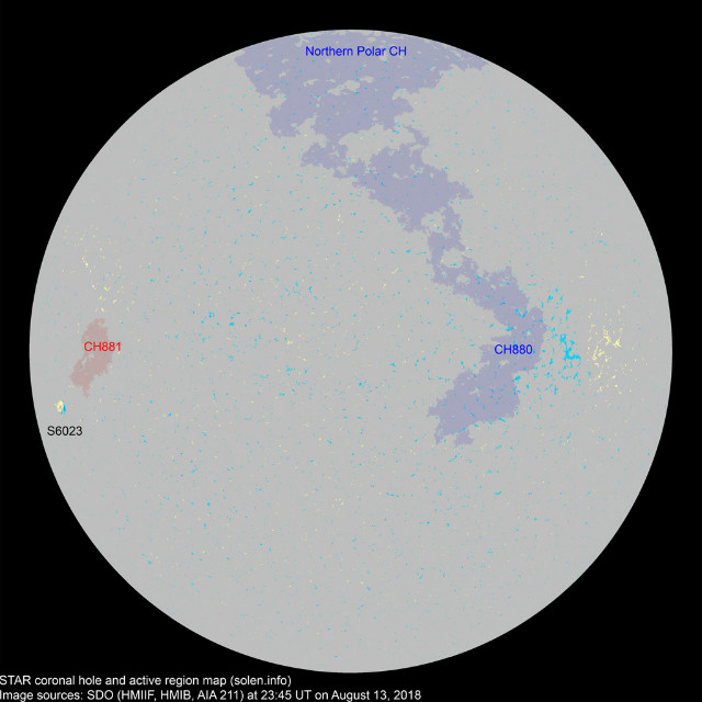
New sunspot emerges on the Sun
New Region 2718 emerged on the Sun over the past 24 hours, but remained inactive. The last time we had a sunspot on the Earth-facing Sun was on August 2 and 3.
So far in 2018, we had 132 spotless days (58%) and the Sun has been without sunspots for 45 of the past 48 days. To find a similar stretch of blank suns, you have to go back to 2009 when the Sun was experiencing the deepest solar minimum in a century. Solar minimum has returned.

Coronal hole high-speed solar wind expected to reach Earth August 16/17
A very long, positive polarity coronal hole turned toward our planet, spewing high-speed solar wind into space and toward us.
Solar wind parameters are expected to become enhanced early on August 15 due to the effects of a CIR preceding the onset of a
positive polarity CH HSS. Enhanced conditions are expected to continue into August 16 as CH HSS influence persists.
Active geomagnetic field conditions are expected on August 15 and 16 due to the effects of a CIR and subsequent positive polarity CH HSS.
Lightning sparks nearly 150 new fires in British Columbia
Smoke from hundreds of wildfires across British Columbia continues darkening skies after weekend lightning sparked nearly 150 new fires in the province.
That brings the total number of wildfires to around 600 so far this season, The Weather Network reports.
2 months' worth of rain in just a few hours floods parts of Ocean County, New Jersey
Nearly 203.2 mm (8 inches) of rain has fallen in just a few hours in parts of Ocean County, New Jersey on August 13, which is almost 2 months' worth of rain. The National Weather Service said radar and automated rain gauges showed some sections of Monmouth County, including Howell, Neptune and Wall, also were hit hard, with as much as 127 to 203.2 mm (5 to 8 inches) of rain.
States of emergency have been declared in Brick and Howell due to flooded roads, officials said, adding that more than 100 evacuations were made in the Greenbriar I section of Brick Township because of flash flooding.
Florida declares state of emergency due to devastating red tide algae bloom
On August 13, Florida Governor Rick Scott declared a state of emergency due to the impacts of red ride in Collier, Lee, Charlotte, Sarasota, Manatee, Hillsborough and Pinellas counties.
This is the worst red tide algae bloom event in Florida since 2006. The Florida Fish and Wildlife Conservation Commission (FWC) is monitoring it since November 2017.
Tropical Cyclones Leepi, Yagi and Bebinca affecting Japan, China and Vietnam
Tropical Cyclone "Lepi" continues moving north-west toward Kyushu island, Japan as a tropical depression and strengthening. On August 14 at 00:00 UTC, its center was located over the sea approximately 530 km (329 miles) south-east of Miyazaki city (Kyushu island, Miyazaki Prefecture) with maximum sustained winds of 111 km/h (69 mph). Over the next 24 hours, it is expected to continue toward Kyushu island. Its center may reach land close to Miyazaki city during the UTC afternoon of August 14, probably as a tropical storm. Heavy rain, storm surges and strong winds may affect Kyushu and Amami islands on August 14 and 15.
Meanwhile, the passage of Tropical Cyclone "Yagi" over the Chinese provinces of Zhejiang, Anhui, and Henan caused fatalities and damages across several areas of the country. According to local media, as of August 13, three people were killed and 200 000 people were evacuated in Zhejiang province.
Tropical Cyclone "Bebinca" continued moving east slightly strengthening. At 00:00 UTC on August 14, its center was located 130 km (80 miles) south of Macau and it had maximum sustained winds of 74 km/h (46 mph). Over the next 48 hours, it is forecast to turn toward the northwest just before making landfall close to Tielucun village (Guangdong province, China), probably as a tropical storm. It may then continue over the land crossing the coastal areas of southern Guangdong, slightly weakening. It may reach the South China Sea on the morning of August 16 and continue toward northern Vietnam as a tropical depression. Heavy rain and strong winds may affect Guangdong, Guangxi, Hainan provinces and northern Vietnam through August 16.
19 dead as heavy rains, floods, landslides hit Himachal Pradesh, India
Heavy rains across Himachal Pradesh since Sunday afternoon caused extensive damage in the state and claimed at least 19 lives.
Hundreds of people were stranded, and dozens of vehicles damaged in flash floods and landslides.
More rainfall is expected over the next 24 hours.
Huge landslide caught on cam near Beijing, China
A massive landslide was filmed falling over a mountain road in Fangshan District, near Beijing on Sunday, temporarily interrupting traffic flow. No injuries were reported, as a local managed to stop a dozen cars from passing from the spot where the land fell, just minutes before it happened.
The first 100 days of new activity on Kīlauea volcano, Hawaii
This PTWC animation begins on April 1, 2018, to start with a more typical earthquake pattern and proceeds forward in time at a rate of one day per second of animation time. Circles indicate the location of earthquakes as they occur, with their size indicating their magnitude and their color representing their depth.
A growing orange field represents lava flows. Black circles represent 'collapse explosions' with their size indicating their energy release in equivalent earthquake magnitude. No explosions have occurred since August 2 but it is too early to tell whether similar explosions will happen again.
The animation includes charts showing some statistics about the earthquake activity. The top graph shows the maximum earthquake magnitude per day.
The bottom graph shows the total number of earthquakes per day.
Shallow M6.1 earthquake hits South Sandwich Islands region
A strong and shallow earthquake registered by the USGS as M6.1 hit South Sandwich Islands region at 03:29 UTC on August 14, 2018. The agency is reporting a depth of 25 km (21.7 miles). EMSC is reporting Mw6.1 at a depth of 30 km (18.6 miles).
More than 35 killed as highway bridge collapses during fierce storm in Genoa, Italy
At least 35 people have been killed and dozens more are feared dead as a huge section of highway bridge collapsed in Italian port city of Genoa during an intense storm on August 14, 2018. The disaster occurred around 09:30 UTC on a highway that connects Italy to France and other vacation resorts on the eve Ferragosto, a major Italian holiday.
Pennsylvania experiencing one of the most dramatic outbreaks of rain in a non-tropical storm setting
Although parts of the northeastern United States have already received record-breaking rainfall this summer, persistent rainfall and flooding are likely to continue.
"The weather pattern this summer is one of the most dramatic outbreaks of rain ever to hit Pennsylvania and other states in the region in a non-tropical storm setting," AccuWeather's Chief Meteorologist Elliot Abrams said.
I'm a dedicated researcher, journalist, and editor at The Watchers. With over 20 years of experience in the media industry, I specialize in hard science news, focusing on extreme weather, seismic and volcanic activity, space weather, and astronomy, including near-Earth objects and planetary defense strategies. You can reach me at teo /at/ watchers.news.
Commenting rules and guidelines
We value the thoughts and opinions of our readers and welcome healthy discussions on our website. In order to maintain a respectful and positive community, we ask that all commenters follow these rules.