
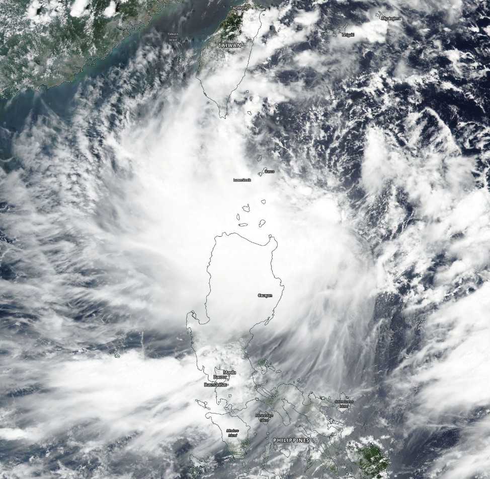
Tropical Storm “Hato” (Isang) passing over the northern Philippines
Featured image: Tropical Storm "Hato" on August 21, 2017. Credit: NASA/NOAA Suomi NPP/VIIRS
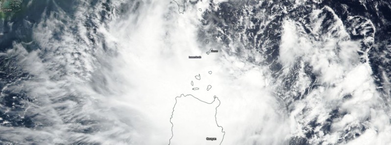
Tropical Storm "Hato" formed August 20, 2017, east of the Philippines as the 13 named tropical cyclone of the 2017 Pacific typhoon season. Hato is known in the Philippines as Isang. The system is already affecting the northern Philippines, dumping heavy rain. It is currently passing over the Batanes group of Islands where a Tropical Cyclone Warning Signal #2 is in effect. After that, Hato's center will pass just south of Taiwan and move toward SE China where it is expected to make a landfall just before midnight UTC on August 23.
As of 17:00 UTC on August 21 (01:00 PHT, August 22), the center of Tropical Storm "Hato" (Isang) was located approximately 45 km (28 miles) east of Basco, Batanes. The system has maximum sustained winds of 80 km/h (50 mph) near the center and gustiness of up to 97 km/h (60 mph), according to the PAGASA. Hato is moving west at 19 km/h (12 mph).
Estimated rainfall amount is from moderate to occasionally heavy rains within the 400 km (248 miles) diameter of the tropical storm.
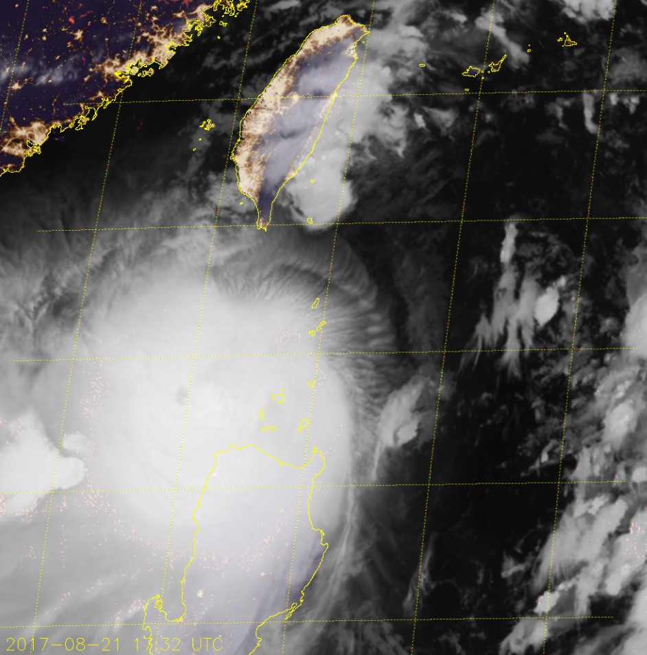
Tropical Storm "Hato" at 17:32 UTC on August 21, 2017. Credit: JMA/Himawari-8
A Tropical Cyclone Warning Signal #2 (61 – 120 km/h / 38 – 74 mph) is in effect for the Batanes group of Islands. TCWS #1 (30 – 60 km/h / 18 – 37 mph) is in effect for the Northern Cagayan including Babuyan group of Islands, Apayao, and Ilocos Norte.
Wave height at open sea is 1.25 to 4 m (4 – 13 feet).
This weather system will continue to enhance the Southwest Monsoon that will bring light up to heavy rains over Visayas and the rest of Luzon particularly over the western section and Cordillera Administrative Region (CAR). Residents of these areas as well as of areas with TCWS are alerted against possible landslides and flash floods.
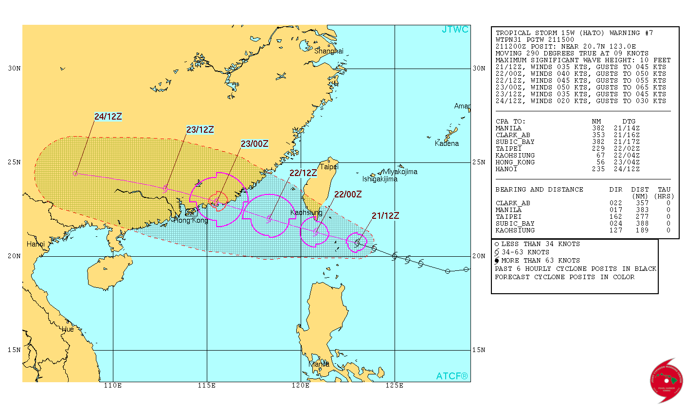
Tropical Storm "Hato" forecast track by JTWC on August 21, 2017
Tropical Storm "Hato" on August 21, 2017. Credit: NASA/NOAA Suomi NPP/VIIRS
After passing through the Batanes group of Islands, Hato's center is expected to pass just south of the southern tip of Taiwan and head toward SE China where it is expected to make landfall north of Hong Kong around midnight UTC on August 23.
I'm a dedicated researcher, journalist, and editor at The Watchers. With over 20 years of experience in the media industry, I specialize in hard science news, focusing on extreme weather, seismic and volcanic activity, space weather, and astronomy, including near-Earth objects and planetary defense strategies. You can reach me at teo /at/ watchers.news.
Commenting rules and guidelines
We value the thoughts and opinions of our readers and welcome healthy discussions on our website. In order to maintain a respectful and positive community, we ask that all commenters follow these rules.