
Strong late-spring snowstorm hits the Rockies
Featured image: Winter Storm "Valerie" dumps heavy snow on Colorado - May 18, 2017. Credit: Denver7 - The Denver Channel
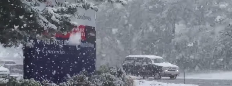
An unusually strong late-spring snowstorm, named Valerie by The Weather Channel, dumped heavy snow on the Rockies, closing roads, damaging trees and causing power outages on Wednesday and Thursday, May 18, 2017.
Valerie dumped more than 3 feet (91.4 cm) of snow and forced officials to issue winter storm warnings and advisories throughout Wyoming and Colorado. For Denver, it was the latest-in-season snow event in 43 years.
Heavy snow forced several Colorado school districts to send students home early Thursday. AP reported up to 2 feet (61 cm) of snow fell on Thursday at Rocky Mountain National Park, forcing the closure of all roads on the eastern side of the park. The storm also forced closed emergency centers to re-open in parts of Colorado.
TWC reported the storm caused crashes along Interstate 25, and portions of U.S. 36 and U.S. 287 in northern Colorado. I-80 in southeast Wyoming was also closed Thursday morning in both directions between Cheyenne and Laramie due to dangerous travel conditions. The wintry weather also forced a part of I-70 to be closed near Vail Thursday morning after multiple spinouts occurred.
In Missoula, Montana, more than 4 000 homes and businesses lost power Wednesday afternoon. Additional outages were reported in the Helena, Cascade, Ulm and Great Falls areas. The 2.7 inches (6.9 cm) that fell in Missoula Wednesday was a daily record, breaking the previous May 17 record of 0.2 inches (5 mm) which stood for 121 years, the National Weather Service (NWS) said.
The Front Range of Colorado, including the Denver metro area, will see its most significant snow through Friday morning, TWC meteorologists said. The greatest impacts, including power outages and tree damage, are expected west of Interstate 25.
Along the front range, heavy snows will continue Friday, May 19, NWS said. Mountain snows of 2 – 4 feet (60 – 122 cm) are forecast. Temperatures will be 15 to 30 °F (8.3 – 16.6 °C) below average over the Central Rockies/Central High Plains.
Snow and lower elevation rain will develop over parts of the Central Rockies that will slowly come to an end by Saturday morning. Showers and thunderstorms will also develop along and ahead of the associated cold front over the Central/Southern Plains that will move eastward to Lower/Middle Mississippi Valley and the Tennessee Valley into parts of the Western Gulf Coast by Saturday evening.
Winter Storm #Valerie has already dumped over 38" in the #Rockies! pic.twitter.com/BrXPLU4WZJ
— AMHQ (@AMHQ) May 19, 2017
I'm a dedicated researcher, journalist, and editor at The Watchers. With over 20 years of experience in the media industry, I specialize in hard science news, focusing on extreme weather, seismic and volcanic activity, space weather, and astronomy, including near-Earth objects and planetary defense strategies. You can reach me at teo /at/ watchers.news.
Commenting rules and guidelines
We value the thoughts and opinions of our readers and welcome healthy discussions on our website. In order to maintain a respectful and positive community, we ask that all commenters follow these rules.