
Hurricane Dora becoming Category 5 hurricane
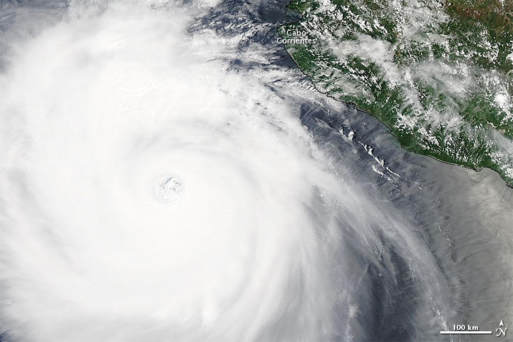
Image credit: TW
By 8:00 a.m. Pacific Daylight Time on July 21, 2011, Dora was nearly a Category 5 hurricane. The U.S. National Hurricane Center (NHC) reported that Dora had maximum sustained winds of 155 miles (250 kilometers) per hour with higher gusts. At that time, the NHC stated, Dora was located about 240 miles (390 kilometers) south-southwest of Cabo Corrientes.
The Moderate Resolution Imaging Spectroradiometer (MODIS) on NASA’s Aqua satellite captured this natural-color image around 1:00 p.m. PDT on July 21. Dora’s eye is southwest of Cabo Corrientes, and storm clouds graze the coast.
By 5:00 a.m. PDT on July 22, the NHC reported, Dora had weakened to a Category 1 hurricane. Located roughly 255 miles (415 kilometers) south of Cabo San Lucas, the storm had maximum sustained winds of 90 miles (150 kilometers) per hour. The storm was expected to continue weakening over the next 48 hours as it remained on a track roughly parallel to Mexico’s southwestern coast. (EarthObservatory)

Commenting rules and guidelines
We value the thoughts and opinions of our readers and welcome healthy discussions on our website. In order to maintain a respectful and positive community, we ask that all commenters follow these rules.