
Fires burn in eastern Russia
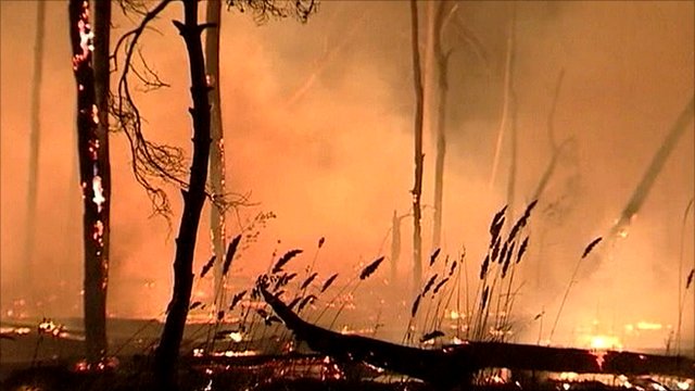
Image credit: TW
140 hotbeds of wildfires with the total area 13 906.28 hectares have been registered in the Russian Federation within twenty four hours. 139 hotbeds with th area 4 832.88 ha have been extinguished. 167 hotbeds, including those emerged earlier and 16 large ones continue burning, the area of active burning is 200.67 ha, 26 995.93 ha have been contained.
Within the past twenty four hours 139 hotbeds of wildfires with the total area of 4 832.88 hectares were extinguished.
Within twenty four hours wildfires have gone 13 906.28 hectares, including 13 361.68 hectares – forest land, 604.55 hectares – steppe land and 0.58 ha – peat land.
167 hotbeds of wildfires (the area of active burning is 200.67 hectares, 26 995.93 ha have been contained) continue burning, all of them on the forest lands (FFA), including 16 large fires in Sakha Republic (Yakutia) (4 hotbeds with the area 9 375.0 ha), Khabarovsk Territory (1 hotbed with the area 520.0 ha) and Krasnoyarsk Region (11 hotbed with the area 1 296.5 ha).
There are 23 uncontrolled agricultural undergrowth burnings and 19 hotbeds of waste burning on the territory of the Russian Federation.
10 355 hotbeds of wildfires on the total area of 439 464,18 hectares have emerged in the Russian Federation since the beginning of the fire-dangerous period of 2011.
Compared to the previous twenty four hours there is an increase of areas in fire (by 9 073.4 ha) and an increase in the number of active hotbeds (by 1 hotbed).
The most difficult situation with fires is developing on the territory of Sakha (Yakutia) Republic, Krasnoyarsk and Khabarovsk Territories, Irkutsk Region and Khanty-Mansi Autonomous District (the reasons are very warm weather, territories difficult to access).
Given the forecast, the most difficult situation may develop in the Far Eastern, Siberian, Urals, Northwestern and Central Federal Districts: in Sakha (Yakutia) and Altai Republics; Khabarovsk, Altai and Zabaikalsky Territories; Chelyabinsk, Orenburg, Saratov and Moscow Regions. (EMERCOM)

Several large, smoky fires burned in the forests of southeastern Russia when the Moderate Resolution Imaging Spectroradiometer (MODIS) on NASA’s Aqua satellite acquired this image. The fires are marked in red.
The image includes parts of two Russian provinces, the Irkutsk Region in the east and the Krasnoyarsk Territory in the west. On June 1, 59 fires burned in the Irkutsk Region, affecting 1,214.3 hectares, said EMERCOM of Russia. 33 fires burned in Krasnoyarsk Territory, affecting 1,834.8 hectares. Most of the fires burned in forest, producing the thick smoke shown in the image.
The two regions were among the areas that posed the greatest challenge to firefighters in early June because of the difficult, remote terrain and warm, fire-friendly weather. So far in 2011, 425,186.16 hectares of land have burned, compared to 187,391.39 hectares for the same period in 2010. (EO)
Commenting rules and guidelines
We value the thoughts and opinions of our readers and welcome healthy discussions on our website. In order to maintain a respectful and positive community, we ask that all commenters follow these rules.