Tornado outbreak in Midwest: SPC reports at least 17 tornadoes, 10 in Iowa and 4 in Nebraska
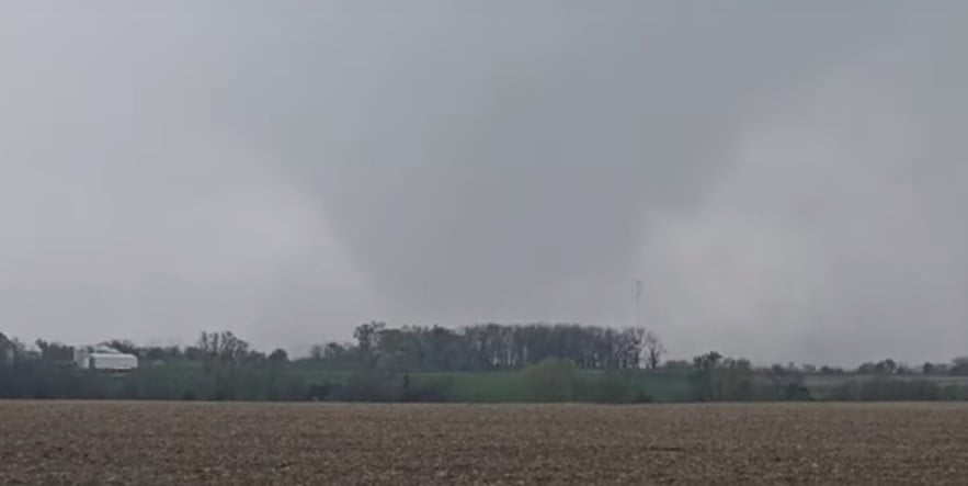
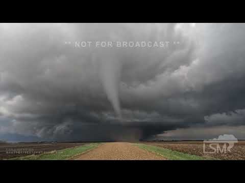
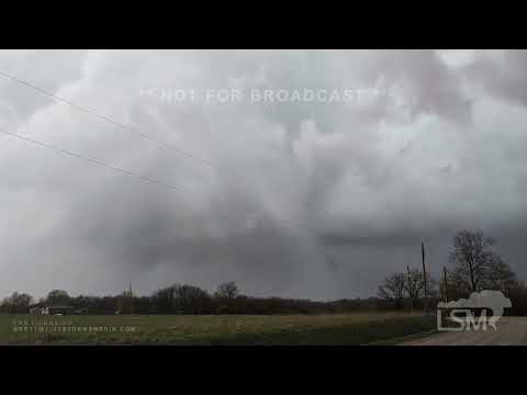
Severe thunderstorms swept across parts of the Plains and Midwest on Tuesday, April 16, 2024, producing multiple damaging tornadoes. The NWS Storm Prediction Center reported at least 17 tornadoes — most of them in Iowa and Nebraska. The tornadoes caused widespread damage, and more severe weather was forecast for Wednesday.
A series of tornadoes swept through parts of the Midwest on April 16, impacting states such as Kansas, Missouri, Iowa, and Nebraska. The most notable among them was an EF2 tornado near Virgil, Kansas, which reached peak winds of 190 km/h (118 mph) and traveled a path 4.3 km (2.7 miles) long, causing severe damage to infrastructure, including steel structures.
In Missouri, the area around Smithville in Clay County experienced damage to trees, and a mobile home was overturned, although fortunately, there were no injuries reported. The damage was estimated based on radar observations.
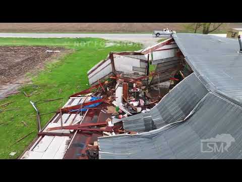
Iowa was also significantly affected, with multiple locations reporting tornado activity. Notable incidents included damage to outbuildings and the scattering of debris such as sheet metal across fields in Dallas County, near Dallas Center and Minburn. Other counties in Iowa also reported various impacts, from structural damages in Henry County to sightings of rope tornadoes in Pocahontas County.
Nebraska had several tornado reports coming from Platte and Colfax Counties. These included multiple touchdowns and re-formations of the tornado, particularly southwest of Platte Center, and damage to property such as a detached garage.


Throughout these events, no fatalities were reported, but the tornadoes left at least 2 people injured in Kansas and a trail of damage across several communities.
More than 20 000 customers were left without power on Tuesday evening across four states, with Missouri leading the way with more than half the outages. As of 06:43 UTC on April 16, Wisconsin had 5 028 customers without power, Missouri 4 800, and Iowa 1 258.
The storm system responsible for the tornado outbreak is forecasted to move northeastward toward the Great Lakes by Wednesday afternoon, April 17. Along its path, it will bring rain and potential thunderstorms across the Corn Belt and extend southward to the Ozarks into early Wednesday (LT). NWS forecaster Fracasso emphasized that the front will continue eastward, with afternoon thunderstorms possible again ahead of the cold front over parts of the Midwest.
Temperature conditions ahead of the cold front will be mild across the Ohio Valley, with low 30s °C (70s to 80s °F) across the Lower Mississippi Valley. Lighter rain is anticipated farther north toward the Canadian border, where cooler temperatures are expected, as well as into the Mid-Atlantic and Northeast as the system begins to weaken.
In the west, colder temperatures following another cold front moving out of eastern Montana will bring snowfall across much of the northern Rockies and into the foothills, particularly over northern Wyoming. Snowfall will persist across western Montana tonight, gradually tapering off on Wednesday as the system moves out of the mountainous regions. This will subsequently introduce some rain to the central Plains starting early Thursday.
References:
1 Preliminary tornado reports – NWS SPC – April 17, 2024
2 Short Range Forecast Discussion – NWS Weather Prediction Center College Park MD – 256 PM EDT Tue Apr 16 2024
Featured image credit: Live Storms Media (stillshot)
Commenting rules and guidelines
We value the thoughts and opinions of our readers and welcome healthy discussions on our website. In order to maintain a respectful and positive community, we ask that all commenters follow these rules.