
Tropical Cyclone “Vayu” strengthening on its way to Gujarat and Pakistan, extremely heavy rain expected
Featured image: Tropical Cyclone "Vayu" at 08:00 UTC on June 11, 2019. Credit: UW-CIMSS, TW
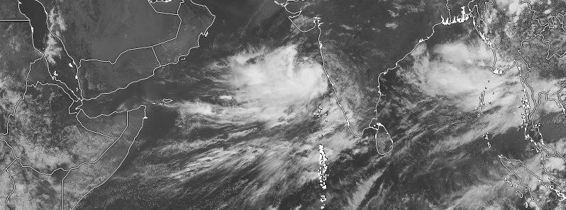
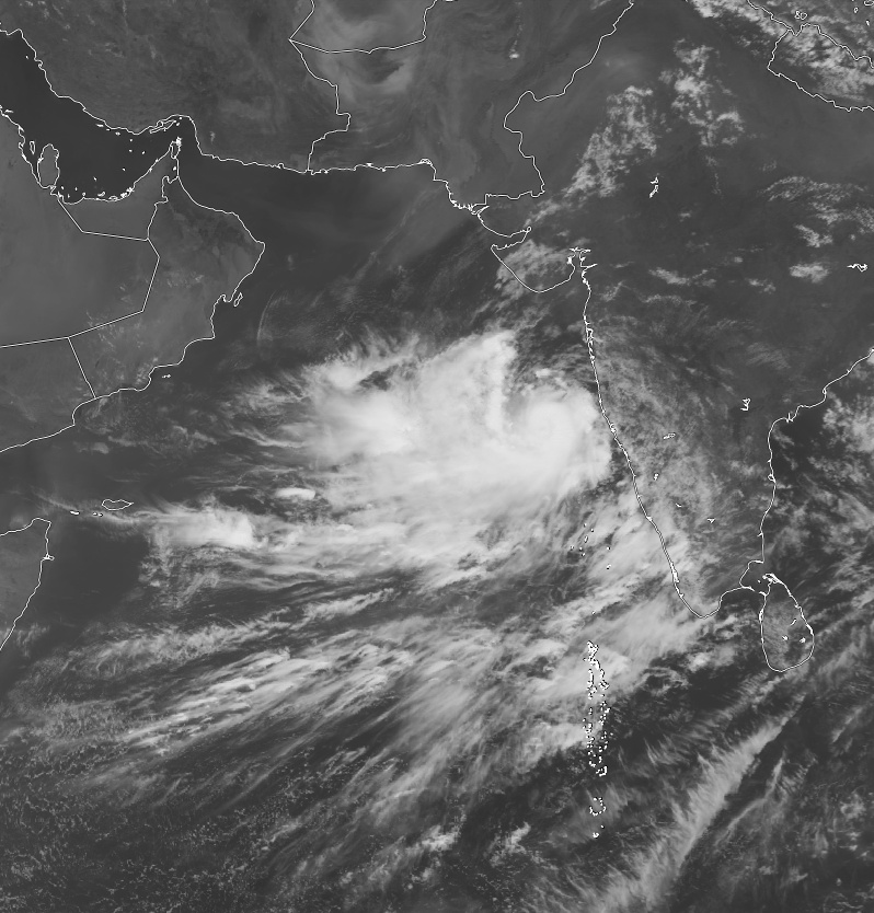
Tropical Cyclone "Vayu" formed June 10, 2019, in the Arabian Sea as the 3rd named storm of the 2019 North Indian Ocean cyclone season. The system is gradually strengthening as it heads toward Gujarat and Pakistan. Heavy rain is expected across coastal India and especially over Pakistan where Vayu might stall before moving further inland.
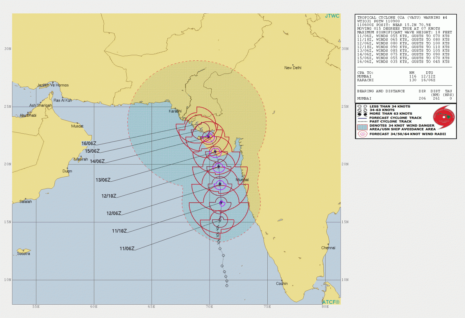
At 03:00 UTC on June 11, the center of Tropical Cyclone "Vayu" was located about 350 km (217 miles) WSW of Goa, 510 km (317 miles) SSW of Mumbai and 650 km (404 miles) S of Veraval (Gujarat). The system is moving northwards at about 15 km/h (9 mph).
RSMC New Delhi expects Vayu to intensify further into a Severe Cyclonic Storm during the next 12 hours while moving nearly northwards toward Gujurat. It is expected to cross Gujarat coast between Porbandar and Mahuva around Veraval and Diu region as a Severe Cyclonic Storm with wind speed 110 – 120 km/h (68 – 75 mph) gusting to 135 km/h (84 mph) during early morning hours of June 13 (local time).
Tropical Cyclone "Vayu" at 08:00 UTC on June 11, 2019. Credit: UW-CIMSS, TW
Wind warning
June 11: Gale Wind speed reaching 70 – 80 km/h (45 – 50 mph) gusting to 90 km/h (55 mph) over East-central Arabian Sea and 50 – 60 km/h (30 – 37 mph) gusting to 70 km/h (43 mph) along and off North Maharashtra coast by the evening of June 11. It is very likely to be 40 – 50 km/h (25 – 30 mph) gusting to 60 km/h (37 mph) over Lakshadweep area, Kerala, Karnataka and south Maharashtra Coasts.
June 12: Wind speed is very likely to increase further becoming gale wind speed reaching 110 – 120 km/h (68 – 75 mph) gusting to 135 km/h (84 mph) over east-central and adjoining northeast Arabian Sea by the night of June 12. It is very likely to be 60 – 70 km/h (37 – 45 mph) gusting to 80 km/h (50 mph) over Gujarat Coast from the morning of June 12 and become gale wind speed reaching 110 – 120 km/h (68 – 75 mph) gusting to 135 km/h (84 mph) by the night. It is very likely to be 50 – 60 km/h (30 – 37 mph) gusting to 70 km/h (43 mph) over Maharashtra Coast.
June 13: Gale wind speed of the order of 110 – 120 km/h (68 – 75 mph) gusting to 135 km/h (84 mph) very likely over the north Arabian Sea and Gujarat coast in morning hours and decrease gradually thereafter. It is very likely to be 50 – 60 km/h (30 – 37 mph) gusting to 70 km/h (43 mph) over north Maharashtra Coasts and northern parts of east-central Arabian Sea.
Sea condition
The Sea condition is very likely to be high to very high over the east-central Arabian Sea on June 11. The sea condition is very likely to become very high to phenomenal over east-central and adjoining northeast Arabian Sea and Gujarat coast from the evening of June 12 and over north Arabian Sea on June 13.
The sea condition is very likely to be rough over Lakshadweep area, along and off Kerala, Karnataka and south Maharashtra Coasts on 11th; rough to very rough along and off Maharashtra Coast on 12th; very rough to high along and off Gujarat, north Maharashtra Coasts and northern parts of east-central Arabian Sea on the 13th.
Fishermen Warning
The fishermen are advised not to venture into Southeast Arabian Sea, Lakshadweep area, along and off Kerala and Karnataka coasts on 11th; East-central Arabian Sea and along and off Maharashtra Coast on 11th and 12th; the northeast Arabian sea and along and off Gujarat coast on 12th and 13th.
Storm Surge Warning
Storm surge of height of about 1.0 – 1.5 m (3.3 – 10.8 feet) above the astronomical tides likely to inundate the low lying coastal areas of Kutch, Devbhoomi Dwarka, Porbandar, Junagarh, Diu, Gir Somnath, Amreli and Bhavnagar districts at the time of landfall.
Damage Expected and Action suggested
for Kutch, Devbhoomi Dwarka, Porbandar, Junagarh, Diu, Gir Somnath, Amreli and Bhavnagar districts of Gujarat:
- Major damage to thatched houses/ huts. Rooftops may blow off. Unattached metal sheets may fly.
- Minor damage to power and communication lines.
- Major damage to Kutcha and some damage to Pucca roads. Flooding of escape routes.
- Breaking of tree branches, uprooting of large avenue trees. Moderate damage to banana and papaya trees. Large dead limbs blown from trees.
- Major damage to coastal crops.
- Damage to embankments/ salt pans.
Action suggested:
- Total suspension of fishing operations.
- Coastal hutment dwellers to be moved to safer places. People in affected areas to remain indoors.
- Movement in motorboats unsafe.
Forecast models
I'm a dedicated researcher, journalist, and editor at The Watchers. With over 20 years of experience in the media industry, I specialize in hard science news, focusing on extreme weather, seismic and volcanic activity, space weather, and astronomy, including near-Earth objects and planetary defense strategies. You can reach me at teo /at/ watchers.news.
Commenting rules and guidelines
We value the thoughts and opinions of our readers and welcome healthy discussions on our website. In order to maintain a respectful and positive community, we ask that all commenters follow these rules.