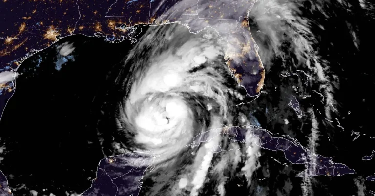
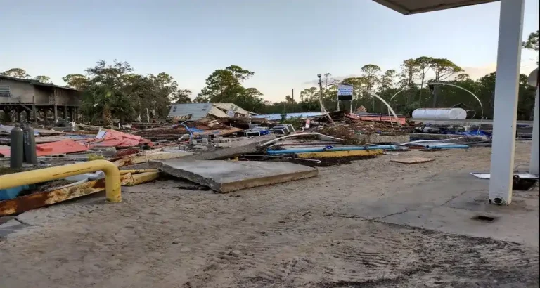
• Hurricane “Ernesto” to pass near Newfoundland, Canada before racing toward Europe

    Hurricane “Ernesto” made landfall on Bermuda’s western coast as a Category 1 hurricane at 09:00 UTC on August 17, 2024. The storm brought maximum sustained winds of 140 km/h (85 mph), heavy rainfall, large surf, and a dangerous storm surge. On the latest forecast track, the center of Ernesto will pass near southeastern Newfoundland tonight, August 19, and early Tuesday, August 20. After that, Ernesto will weaken and race toward Europe.

  • Japan narrowly avoids catastrophic impact as rare Typhoon “Ampil” skirts the Tokyo region

    The Japan Meteorological Agency (JMA) has issued warnings for fierce winds, high waves, and potential landslides as Typhoon “Ampil” grazed the country on August 16, 2024. The storm, currently located off the Pacific coast, has prompted evacuation orders for over 340 000 residents and led to significant disruptions in transportation and power supply.

  • Tropical Storm “Ernesto” forms near Leeward Islands

    Tropical Storm “Ernsesto” formed at 12:00 UTC on Monday, August 12, 2024, near the Caribbean Sea as the 5th named storm of the 2024 Atlantic hurricane season. The system is expected to bring tropical storm force winds and heavy rains to portions of the Leeward Islands beginning late tonight.

  • Debby leaves 8 dead, heavy rainfall and significant flood threats continue in parts of Mid-Atlantic and Northeast

    Category 1 Hurricane “Debby” made landfall near Steinhatchee in Florida’s Big Bend at 11:00 UTC on Monday, August 5, 2024, and continued moving inland, dropping heavy rains. As Debby moved offshore and then back inland, it continued to gather moisture, leading to a second landfall northeast of Charleston, South Carolina, on August 8.

  • Hurricane “Debby” makes landfall in Florida, historic rains expected in parts of Georgia and the Carolinas

    Hurricane “Debby” made landfall near Steinhatchee in Florida’s Big Bend at 11:00 UTC on Monday, August 5, 2024. Debby had minimum central pressure of 979 hPa and maximum sustained winds of 130 km/h (80 mph) at the time of landfall, making it a Category 1 hurricane on the Saffir-Simpson scale. It was moving NNE at 17 km/h (10 mph).