Strong M6.7 earthquake hits near the east coast of Honshu, Japan
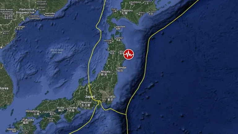
A strong earthquake registered by the USGS as M6.7 hit near the east coast of Honshu, Japan at 11:22 UTC (20:22 LT) on May 15, 2026. The agency is reporting a depth of 44 km (27 miles). EMSC is reporting M6.7 at a depth of 40 km (25 miles). According to the Pacific Tsunami Warning Center (PTWC), there is no tsunami threat from this event.