
Late-season Kona low to strike Hawaii with severe weather
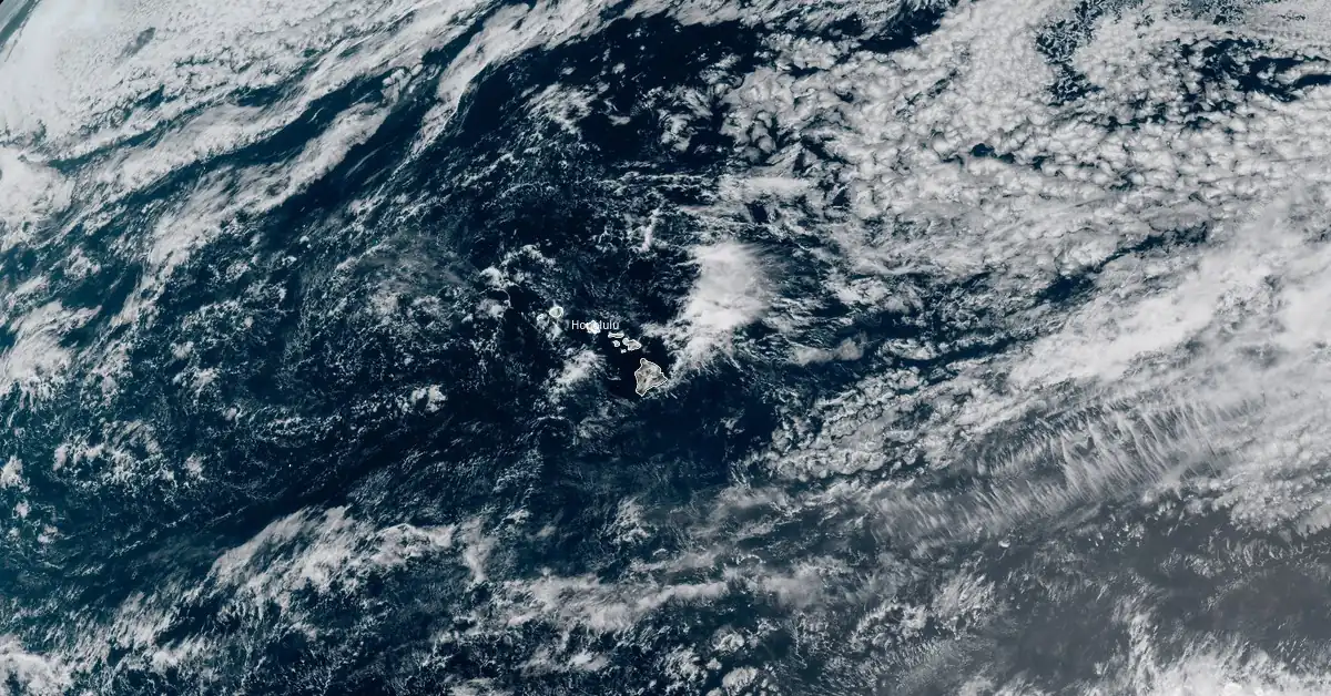
Image credit: NOAA/GOES-West, RAMMB/CIRA, The Watchers. Acquired at 20:40 UTC on May 13, 2024
A late-season Kona low forming north of Hawaii is expected to bring heavy rainfall, thunderstorms, and flash flooding to the islands beginning Tuesday evening, May 14, 2024. The event comes after a weekend of heavy rains flooded major roads in Windward Oahu and triggered landslides on May 13.
- The National Weather Service in Hawaii has issued a warning about an impending Kona low, expected to develop north of the islands on Tuesday evening, May 14, 2024.
- This weather system is forecast to strengthen and remain offshore for several days, bringing more severe weather to the region.
- Excessive rainfall poses a risk of flash flooding, particularly in areas already affected by the recent downpours.
- Kona lows — a type of subtropical cyclones — typically develop during the cooler months, from October through April, making this a very rare event.
- This type of weather system has historically produced a variety of weather-related hazards, including heavy rains, hailstorms, flash floods, landslides, high winds, large surf and swell, waterspouts, and severe thunderstorms.
An upper-level low positioned about 560 km (350 miles) northeast of Honolulu is contributing to an unusual weather pattern for mid-May, resulting in enhanced showers across the Hawaiian Islands, forecasters at the NWS office in Honolulu noted at 14:12 UTC (04:12 HST) on May 14.
Early morning water vapor imagery indicates a relatively large area of moist air, with total precipitable water (TPW) measured at 40-43 mm (1.6-1.7 inches) in the predawn balloon soundings. Light land breezes at the surface will shift to south-southeast winds in the lower levels, drawing showers from the Big Island convergence zone northward to Oahu and Maui County.
Convection-allowing models (CAMs) present varying forecasts for the next few days, but the consensus indicates a continuation of unsettled weather through Wednesday, May 15. Clouds and showers will be drawn northward over the smaller islands, with the potential for afternoon convective development over interior and north shore regions where sufficient morning sunshine occurs.
“The weather pattern is expected to remain unusual for the latter half of the week,” NWS forecaster Ballard said.
Another strong shortwave is anticipated to dig into the mean longwave trough near the islands, generating a Kona low approximately 800 km (500 miles) north of Kauai (near 30°N 160°W) by Tuesday night.
This low is forecast to strengthen and linger several hundred miles northwest of the islands for the rest of the week. A substantial reservoir of deep, moist tropical air with TPW exceeding 50 mm (2 inches) is located about 640 km (400 miles) southwest of the islands. Models predict some of this moisture will be drawn northward along a developing convergence band over Oahu and Maui County by Wednesday night.
As the week progresses, the convergence band is expected to move slowly westward, with another surge of high TPW air approaching the weekend. Although model quantitative precipitation forecasts (QPFs) are not particularly high, this pattern of slow-moving moisture convergence could result in locally excessive rainfall and potential flash flooding, especially given the recent wet conditions.
A land and sea breeze pattern will favor clouds and showers over island interiors for the next few afternoons. A kona low will then bring a threat of heavy rain to the area from Wednesday night into the weekend. https://t.co/StSnEHg1sH pic.twitter.com/PwwUmFJWzp
— NWSHonolulu (@NWSHonolulu) May 12, 2024
Forecast confidence is highest for heavy rain on Wednesday night into Thursday, May 15 into 16, prompting adjustments towards the highest National Blend of Models (NBM) percentile values for QPF.
As the convergence band shifts westward towards the weekend, even greater moisture, potentially exceeding 50 mm (2 inches) TPW, will move towards Kauai and Oahu. Enhanced rainfall could result from a shortwave aloft rotating around the kona low and favorable jet diffluence.
However, this scenario is less certain, as the convergence band may slow and intensify west of Kauai. Additionally, the development of thunderstorm complexes southwest of the islands could deplete some moisture and instability.
“Nevertheless, we want to stress that this is the type of pattern that can lead to some pretty serious flooding,” Ballard said. “We will continue to monitor the situation and expect that details will become more clear as we get closer.”
A Flood Watch has been issued for the entire state starting Wednesday, May 15, and continuing through Friday, May 17.
As the weather action shifts west, the Big Island and potentially Maui County could experience increasing subsidence and warming aloft, with dry air possibly moving in from the east. A mid-level ridge east of the islands may lead to drier conditions with locally breezy east or east-southeast winds over the weekend, driven by a nearly stationary surface high far northeast of the Big Island.
Heavy rain is ongoing for windward Oahu, where there is a flash flood warning in effect until 4:45 PM. Other parts of the state are also starting to experience heavy rain.
— NWSHonolulu (@NWSHonolulu) May 13, 2024
A kona low is expected to bring more rainfall to the state starting Wednesday and into the weekend. pic.twitter.com/QwWsAwDz6F
Windward Oahu #hitraffic #hiwx update 5/13/24 2:10PM:
— Hawaii DOT (@DOTHawaii) May 14, 2024
-Closure at Halekou Interchange is the ramp from the H-3 to Kamehameha Hwy
-Right lane of Pali Hwy Kailua-bound remains closed after 2nd tunnel
-Kamehameha Hwy at Waikane, Waiahole, and Kaalaea remain closed pic.twitter.com/XSh7WLfbed
This unusual weather pattern for mid-May follows another storm that brought heavy rains over the weekend, causing significant flooding and landslides in Windward Oahu and leading to the closure of major roads.
On May 13, the storm brought rainfall rates of 50 mm (2 inches) per hour. Over 72 hours, a gauge at St. Stephens Seminary near Kailua recorded over 460 mm (18 inches) of rain. A gauge in Kaneohe measured over 230 mm (9 inches) in the same period, while the Marine Corps base at Kaneohe reported 127 mm (5.01 inches).
What is Kona low?
A Kona low is a type of subtropical cyclone that forms in the central Pacific, near the Hawaiian Islands. These systems are named after the “kona” winds, which are southwesterly or southerly winds they bring, contrasting with the usual trade winds from the northeast.
Kona lows are characterized by their formation in the mid-latitudes and are associated with upper-level low-pressure systems that can create significant weather disturbances, including heavy rainfall, strong winds, thunderstorms, and sometimes hail.
These systems are often slow-moving, leading to prolonged periods of adverse weather conditions such as flooding and landslides, especially in mountainous regions like Hawaii.
Kona lows typically develop during the cooler months of the year, from October through April.
By mid-May, the central Pacific region generally transitions to a more stable weather pattern dominated by the northeast trade winds, reducing the likelihood of conditions necessary for a kona low to develop.
The formation of a kona low in mid-May indicates an unusual and significant deviation from expected weather patterns.
This anomaly can result in unexpected and severe weather, as the atmosphere retains higher moisture content and instability than usual for this time of year, leading to extreme weather events such as heavy rainfall and flash flooding.
References:
1 Area Forecast Discussion – NWS Honolulu, HI – 412 AM HST Tue May 14 2024
I'm a dedicated researcher, journalist, and editor at The Watchers. With over 20 years of experience in the media industry, I specialize in hard science news, focusing on extreme weather, seismic and volcanic activity, space weather, and astronomy, including near-Earth objects and planetary defense strategies. You can reach me at teo /at/ watchers.news.
Commenting rules and guidelines
We value the thoughts and opinions of our readers and welcome healthy discussions on our website. In order to maintain a respectful and positive community, we ask that all commenters follow these rules.