
Magma accumulation accelerates land rise near Svartsengi, Iceland
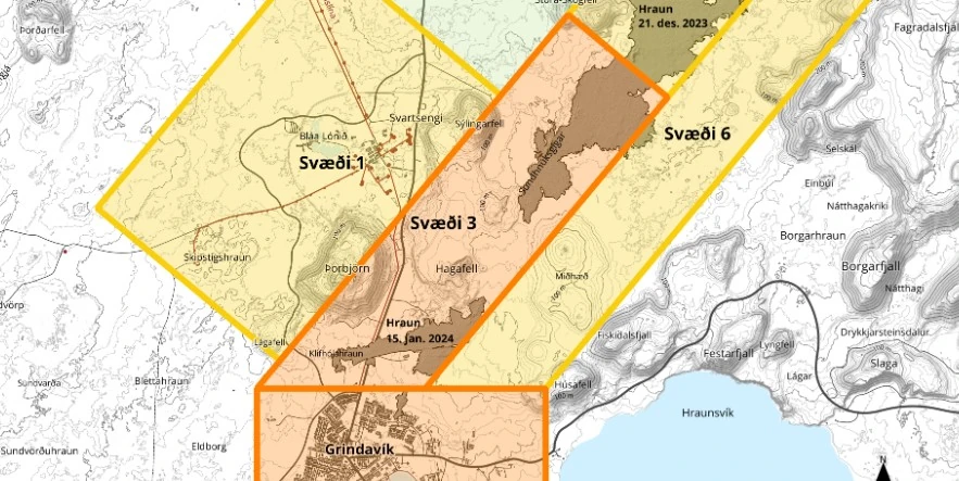
Image credit: IMO
In recent days, Svartsengi, Iceland, has experienced accelerated land rise, reaching up to 8 mm (0.3 inches) daily, attributed to magma accumulation under the area. While seismic activity remains mild, the risk assessment for Grindavík has been downgraded to orange, with a continued high risk for crack collapse.
The Svartsengi area in Iceland is undergoing notable geological changes due to magma accumulation beneath the surface. Recent measurements have indicated a land rise of up to 8 mm (0.3 inches) per day, a rate slightly faster than what was observed prior to the volcanic eruption on January 14, 2024. The eruption, which ended on January 16, has significantly impacted the region’s topography.
Experts are currently facing challenges in estimating the exact volume of magma that has accumulated since the eruption’s end. It is suggested that reaching the same magma levels as before the last eruption may take weeks, not days. Efforts are underway to develop computational models to provide a clearer understanding of the magma accumulation state.
The seismic activity in the area, mostly concentrated around Hagafell, remains mild. The current seismic patterns are consistent with those typically observed in the aftermath of volcanic eruptions. This consistency in seismic behavior provides some predictability in monitoring the region’s geological activity.
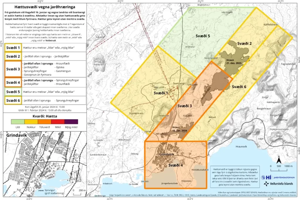
The Icelandic Met Office has recently updated its risk assessment for the area. A significant change is the lowering of the overall risk assessment for the town of Grindavík to orange, indicating a considerable risk level. However, despite this downgrade, the risk associated with crack collapses is still deemed very high. This specific hazard, termed “crack collapse,” refers to the potential danger posed by hidden cracks under unstable surfaces that could suddenly give way.
In contrast, the risk related to “fissure movements” within Grindavík has been reduced. This assessment pertains to the likelihood of existing cracks widening or new cracks forming. GPS data have shown minimal movement within Grindavík in recent days, leading to a lowered risk estimation for fissure movements, now classified as considerable.
References:
1 Magma accumulation continues under the area of Svartsengi – IMO – January 25, 2024
The Watchers team and our contributors bring the latest on extreme weather, earthquakes, volcanic eruptions, space weather, and all things science. We're all about making sense of the natural world and keeping you informed on what’s happening. Got a tip or a question? Hit us up using the form at newstips!
Commenting rules and guidelines
We value the thoughts and opinions of our readers and welcome healthy discussions on our website. In order to maintain a respectful and positive community, we ask that all commenters follow these rules.