
Barren Island volcano erupts, spewing ash to 4.6 km (15 000 feet) a.s.l. and disrupting air travel, India
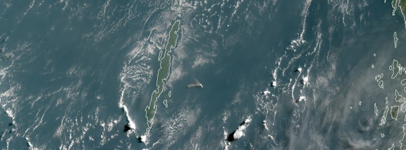
Featured image: Eruption at Barren Island - 01:00 UTC on May 1, 2023. Credit: KARI/GEO-KOMPSAT-2A, RAMMB/CIRA, The Watchers
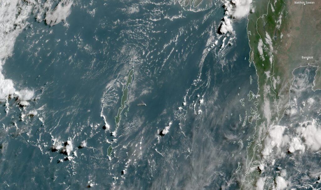
A new volcanic eruption started at Barren Island volcano, India at around 02:00 UTC on May 1, 2023.
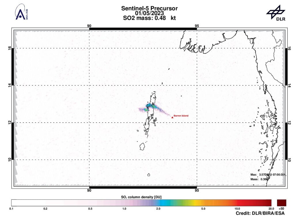
The eruption has sent volcanic ash to an altitude of 4.6 km (15 000 feet) above sea level, according to an advisory issued by the Darwin VAAC (Volcanic Ash Advisory Centre).
The volcanic ash cloud was seen drifting NW at a speed of 9 km/h (5 mph), posing a potential threat to air travel in the region. The volcano is now under an Orange Aviation Color Code. This signifies that the volcano has displayed heightened unrest and is displaying signs of escalating volcanic activity.
Forecasted volcanic ash clouds for the next 6, 12, and 18 hours indicate that the ash cloud will continue to move northwestward, which could potentially impact air travel routes and schedules in the area. Authorities are closely monitoring the situation and will provide updates as needed.
Travelers in the region are advised to stay informed of any developments and to follow instructions from local authorities and aviation officials.
Geological summary
Barren Island, a possession of India in the Andaman Sea about 135 km (84 miles) NE of Port Blair in the Andaman Islands, is the only historically active volcano along the N-S-trending volcanic arc extending between Sumatra and Burma (Myanmar).
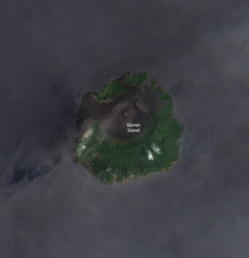
The 354 m (1 161 feet) high island is the emergent summit of a volcano that rises from a depth of about 2 250 m (7 381 feet). The small, uninhabited 3 km (1.8 miles) wide island contains a roughly 2 km (1.2 miles) wide caldera with walls 250 – 350 m (820 – 1 150 feet) high.
The caldera, which is open to the sea on the west, was created during a major explosive eruption in the late Pleistocene that produced pyroclastic-flow and -surge deposits.
Historical eruptions have changed the morphology of the pyroclastic cone in the center of the caldera, and lava flows that fill much of the caldera floor have reached the sea along the western coast.2
References:
1 VA Advisory for Barren Island – Darwin VAAC – May 1, 2023
2 Barren Island – Geological summary – GVP
I'm a dedicated researcher, journalist, and editor at The Watchers. With over 20 years of experience in the media industry, I specialize in hard science news, focusing on extreme weather, seismic and volcanic activity, space weather, and astronomy, including near-Earth objects and planetary defense strategies. You can reach me at teo /at/ watchers.news.
Commenting rules and guidelines
We value the thoughts and opinions of our readers and welcome healthy discussions on our website. In order to maintain a respectful and positive community, we ask that all commenters follow these rules.