
Major storm system bringing heavy mountain snow and coastal rain to the West, U.S.
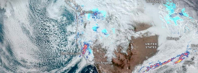
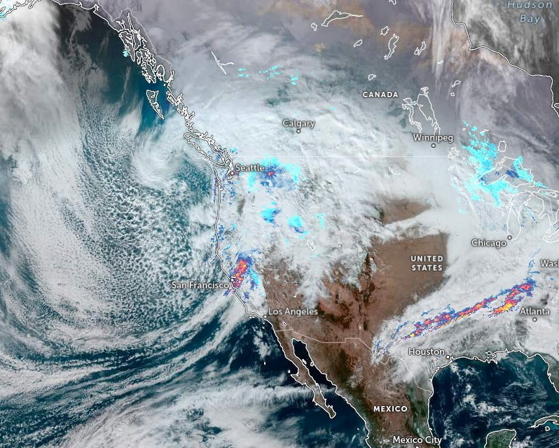
Image credit: NOAA/GOES-East, Zoom Earth, The Watchers. Acquired at 21:00 UTC on December 10, 2022
A powerful storm system with heavy mountain snow and heavy lower-elevation rain is affecting the U.S. West, potentially bringing as much as 150 cm (5 feet) of snow accumulation to California. Flooding and debris flows will be possible on burn scars in southern California.
- Major storm system already bringing heavy mountain snow and coastal rain to the West will begin to shift into the Plains Monday, December 12
Heavy mountain snow and coastal rain will continue in the West Sunday, December 11 under the influence of a deepening upper-level trough and a strong surge of moisture overspreading the region from the Pacific, NWS forecaster Putnam noted.1
Additional snowfall totals generally between 15 and 30 cm (6 – 12 inches), locally higher, are possible through Monday for the mountains of the Great Basin, Central Rockies, Arizona, and southern California.
The heaviest snowfall will continue to be in the Sierra Nevada of California with several feet expected.
While most of the significant snow should remain at higher mountain elevations, some light accumulations are possible in the interior valleys, particularly in the northern Great Basin.
Heavy coastal rainfall intensified by the strong surge of moisture from the Pacific associated with an atmospheric river will shift from the central California coast to southern California on Sunday.
There is a Slight Risk of Excessive Rainfall in effect for the Transverse and Peninsular Ranges of southern California where locally high totals of 50 – 75+ mm (2 – 3+) inches may result in scattered instances of flash flooding, particularly in the vicinity of burn scars.
In addition to the heavy snow and rain, strong winds will also continue to be a concern.
Wind Advisories remain in effect for portions of the central and southern Great Basin and California where gusts running higher than 70 km/h (45 mph) remain possible into the day Sunday.
High temperatures will stay 5 – 10 °C (10 – 20 °F) degrees below average beneath the upper-level trough.
References:
1 Short Range Forecast Discussion – NWS Weather Prediction Center College Park MD – 335 AM EST Sun Dec 11 2022
I'm a dedicated researcher, journalist, and editor at The Watchers. With over 20 years of experience in the media industry, I specialize in hard science news, focusing on extreme weather, seismic and volcanic activity, space weather, and astronomy, including near-Earth objects and planetary defense strategies. You can reach me at teo /at/ watchers.news.
Commenting rules and guidelines
We value the thoughts and opinions of our readers and welcome healthy discussions on our website. In order to maintain a respectful and positive community, we ask that all commenters follow these rules.