
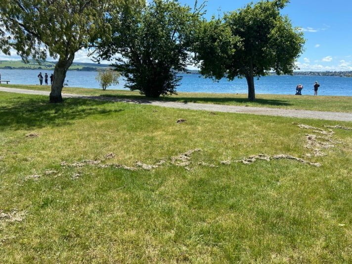
About 20 m (65 feet) of foreshore disappears during a swarm of earthquakes at Taupo volcano, New Zealand
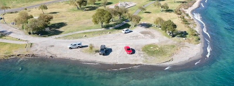
Image credit: Taupō District Council
About 20 m (65.6 feet) of foreshore in Wharewaka, Lake Taupo, New Zealand disappeared after a strong and shallow M5.6 earthquake and numerous aftershocks at Taupō volcano at the end of November 2022.
As a result, the Taupō District Council is urging residents and visitors to keep away well back from the edge until they organize a temporary fence.1
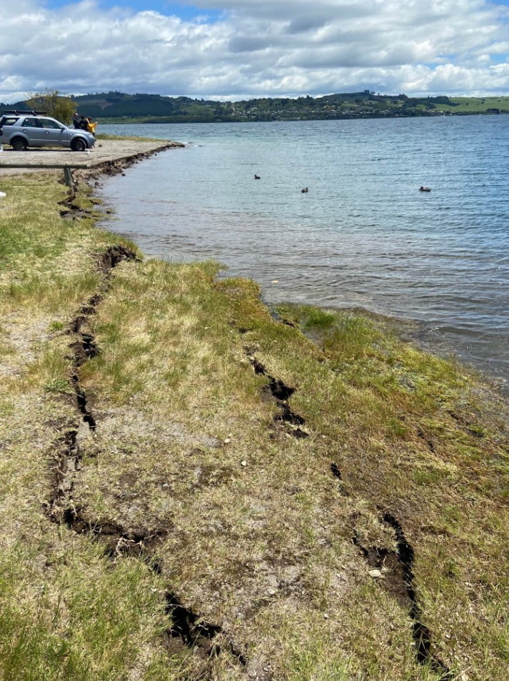
“One of the most visible signs is the damage to the beach area at Wharewaka Point. While we know people are interested in having a look at what’s going on, we have serious concerns about the land stability there.
“We estimate we’ve lost around 20 m of foreshore. Other agencies are investigating the cause, but it may be a result of land slumping with a resultant wave on the lake, rather than a wave alone.
“Our team is working to organize a temporary fence but in the meantime, to keep everyone safe in this area we ask that you please keep yourself, your children and your vehicles well back from the edge.”
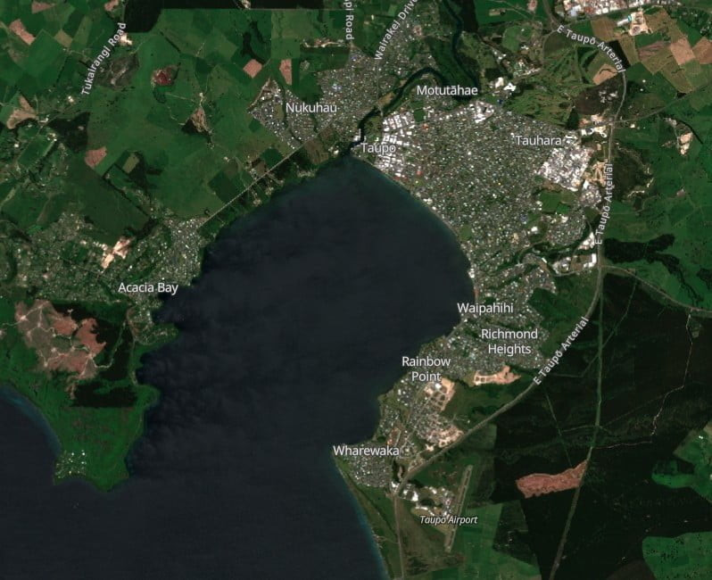
Greg Hadley — Taupō District Council parks operation manager — said they had now closed off the road closest to the water at 4 Mile Bay, Wharewaka, because people were driving right up to the edge.2
There were cracks running parallel to the shore which indicated the area was unstable and the weight of vehicles could cause it to collapse further.
Hadley added there was anecdotal evidence around other areas of the lake, including Kurutau at the southern end, that suggested a large wave or waves had come several meters more than usual up the foreshore but so far, the most significant damage was at 4 Mile Bay in Wharewaka. He said the lake level was very high at the moment which had likely exacerbated the problem.
The M5.6 quake hit at 10:47 UTC (23:47 LT) on November 30 at a depth of 9 km (5.6 miles), according to data provided by GeoNet. EMSC registered it as M5.4 at a depth of 1 km (0.6 miles).3
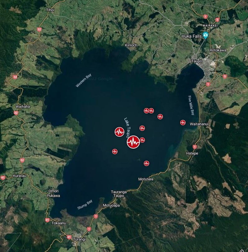
The quake has been followed by more than 300 aftershocks, the largest being a M5.4.
“We have had received a range of reports of damage from items falling off shelves to roof damage at a business in Taupō,” GeoNet said on December 1.4
This is the largest earthquake in the Lake Taupō region since M5.0 earthquake in 2019 and follows an increase in the number of earthquakes in the region since May 2022.
“We believe the earthquake sequence to be caused by activity associated with magma and hydrothermal fluids inside the volcano. This activity could continue for the coming weeks or months, at varying rates or intensities.
“Our experts are still looking into the evidence of a potential seiche or small tsunami on the shorelines around Lake Taupō resulting from the earthquakes last night. At this point, we don’t know if this is due to a seiche, where the lake moves back and forth and “sloshes” or a tsunami, caused by a landslide, or some combination of both.”
“The earthquake was widely felt, causing minor damage and a small tsunami in the lake. Numerous aftershocks have been recorded, with many felt locally. The activity is consistent with ongoing minor volcanic unrest at Taupō volcano and the Volcanic Alert Level remains at 1,” GeoNet said on December 2.5
“Experts are assessing earthquake-related lake wave activity that occurred as a result of the M5.6 quake. This caused run-up along the lakeshore between Wharewaka Point and Taupō township. The wave action is likely the result of a lake-based tsunami, however, we are unsure what has generated it.”
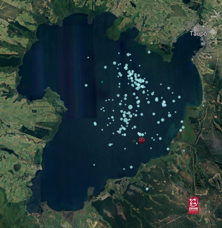
The number of earthquakes located beneath Lake Taupō during 2022 has risen significantly with the additional aftershocks from the M5.6 event and now exceeds those located during the previous period of volcanic unrest in 2019.
At least 100 mm (3.9 inches) of horizontal movement was observed at an instrument at Horomatangi Reef during the quake.
Prior to the M5.6 earthquake, the GNSS network continued to show ground uplift beneath Lake Taupō. The rate at an instrument at Horomatangi Reef was 60 mm (2.3 inches) per year.
“We continue to interpret the ground deformation and earthquake activity to be caused by magma and hydrothermal fluids inside the Taupō volcano. The November 30 earthquake is similar to a M5.0 event during the 2019 unrest. While some of the earthquakes have been felt in areas around Lake Taupō, the deformation is currently only detectable by our sensitive monitoring instruments, including the movement associated with the November 30 event.
“In broad terms, such volcanic unrest occurs when magma or magma-heated hot water and steam moves deep within the ground beneath a volcano, changing stresses and causing earthquakes and ground movement. There have been 17 previous episodes of unrest at Taupō over the past 150 years. None of those have resulted in an eruption.”
Geological summary
Taupo, the most active rhyolitic volcano of the Taupo volcanic zone, is a large, roughly 35 km (21 miles) wide caldera with poorly defined margins. It is a type example of an “inverse volcano” that slopes inward toward the most recent vent location.
The caldera, now filled by Lake Taupo, largely formed as a result of the voluminous eruption of the Oruanui Tephra about 22 600 years before the present (BP).
This was the largest known eruption at Taupo, producing about 1 170 km3 (281 mi3) of tephra. This eruption was preceded during the late Pleistocene by the eruption of a large number of rhyolitic lava domes north of Lake Taupo.
Large explosive eruptions have occurred frequently during the Holocene from many vents within Lake Taupo and near its margins.
The most recent major eruption took place about 1 800 years BP from at least three vents along a NE-SW-trending fissure centered on the Horomotangi Reefs. This extremely violent eruption was New Zealand’s largest during the Holocene and produced the thin but widespread phreatoplinian Taupo Ignimbrite, which covered 20 000 km2 (7 722 mi2) of North Island.6
References:
1 Safety concerns at Wharewaka Point – Taupo District Council – December 2, 2022
2 Lake Taupō earthquake: Public told to stay away from tsunami damage – NZ Herald – December 2, 2022
3 Strong and shallow M5.6 earthquake, numerous aftershocks at Taupō volcano, New Zealand – The Watchers – November 30, 2022
4 Strong earthquake at Lake Taupō – GeoNet – December 1, 2022
5 Strong M5.6 earthquake consistent with continued minor volcanic unrest at Taupō. Volcanic Alert Level remains at Level 1 – GeoNet – December 2, 2022
6 Taupō – Geological summary – GVP
I'm a dedicated researcher, journalist, and editor at The Watchers. With over 20 years of experience in the media industry, I specialize in hard science news, focusing on extreme weather, seismic and volcanic activity, space weather, and astronomy, including near-Earth objects and planetary defense strategies. You can reach me at teo /at/ watchers.news.
Commenting rules and guidelines
We value the thoughts and opinions of our readers and welcome healthy discussions on our website. In order to maintain a respectful and positive community, we ask that all commenters follow these rules.