
Significant seismic activity on Reykjanes peninsula, slight uplift at Svartsengi, Iceland
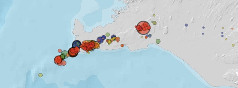
Image credit: IMO
Significant seismic activity has been detected on the Reykjanes peninsula, Iceland over the past 7 days. The greatest activity was at Svartsengi, where slight uplift was recorded, and in the vicinity of Grindavik.
A total of 1 700 earthquakes have been detected in this area, with the largest being M2.9.
Five earthquakes above magnitude 3 were recorded just off Reykjanestá on Friday, May 13.
M3.2 earthquake was recorded in the same area at 19:28 UTC, M3.1 at 17:04 UTC, M3.3 at 16:41 UTC, M3.4 at 15:51 and M3.4 at 11:09 UTC.
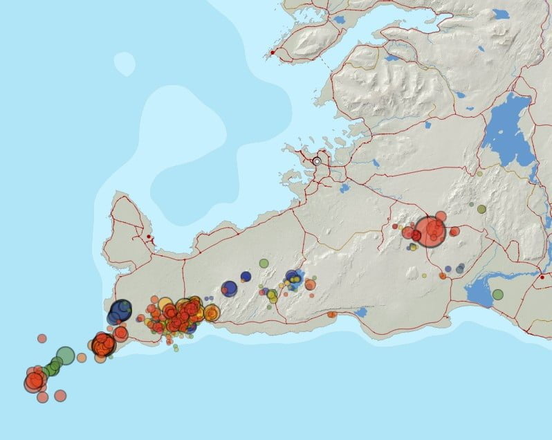
GPS measuring network on the Reykjanes peninsula, which measures movements on the earth’s surface, shows uplift that points to the magma collection at a considerable depth at Fagradalsfjallm, while GPS stations in the vicinity of Þorbjörn shown changes that indicate slight expansion at Svartsengi over the past two weeks.
“These displacements we see are still small, around 10 – 15 mm (0.39 – 0.59 inches) where they are greatest,” said Benedikt G. Ólafsson, a specialist in crustal movements at the Icelandic Meteorological Office.
“The post we are analyzing now is similar to the one we analyzed in the same area in the first half of 2020,” Ólafsson said.
InSAR satellite imagery, which covers the period April 29 – May 7 and April 21 – May 8, shows changes similar to those observed on GPS stations.
“What we have learned from the volcanic eruption on the Reykjanes peninsula is that an increase in seismic activity and deformation can be a precondition for an eruption, but this is not always the case,” said Michelle Maree Parks, one of the scientists on the Meteorological Office’s deformation team.
“As often before, we really need to see what the development will be. We are running models to estimate, for example, the depth of the magma in this particular area. We are also expecting new InSAR images later this month and they are part of the data we will process to better understand the development in the area around Svartsengi,” Parks said.
I'm a dedicated researcher, journalist, and editor at The Watchers. With over 20 years of experience in the media industry, I specialize in hard science news, focusing on extreme weather, seismic and volcanic activity, space weather, and astronomy, including near-Earth objects and planetary defense strategies. You can reach me at teo /at/ watchers.news.
Commenting rules and guidelines
We value the thoughts and opinions of our readers and welcome healthy discussions on our website. In order to maintain a respectful and positive community, we ask that all commenters follow these rules.