
Tsunami waves up to 10 m (33 feet) high hit Ha’apai Islands, Tonga
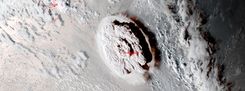
Featured image: Hunga Tonga-Hunga Ha'apai eruption at 05:00 UTC on January 15, 2022. Credit: NOAA/GOES-WEST, RAMMB/CIRA, TW
The Tongan Navy has reported major damage in the Ha’apai Islands after the major eruption at Hunga Tonga-Hunga Ha'apai volcano on January 15, 2022.
Waves that hit Ha'apai Islands were estimated to be 5 – 10 meters (16 – 33 feet) in height, reaching 500 meters (1 640 feet) inland. Ha'apai is a group of islands, islets, reefs, and shoals in the central part of Tonga. Their combined population is 5 419.
Electricity and local mobile phone networks have been restored on the main island of Tongatapu but the power connection is not yet stable, the Council for International Development (CID) reports.1
International and inter-island calls are still not possible due to the damage to the undersea cable. Tonga Cable and other entities are actively working to repair the damage, CID said, adding that there is still no timeframe available for when communications will be restored.
Tonga’s main airport Fua’amotu International Airport is undamaged but heavy ashfall is being cleared and inhibits the airport from being fully operational. The Director of Civil aviation in Tonga advises that the airport runway clearance will take days to complete as this is being conducted manually. The earliest possible clearance is Wednesday, January 19.
Western Tongatapu suffered significant damage and the government has evacuated people from that part of the island.
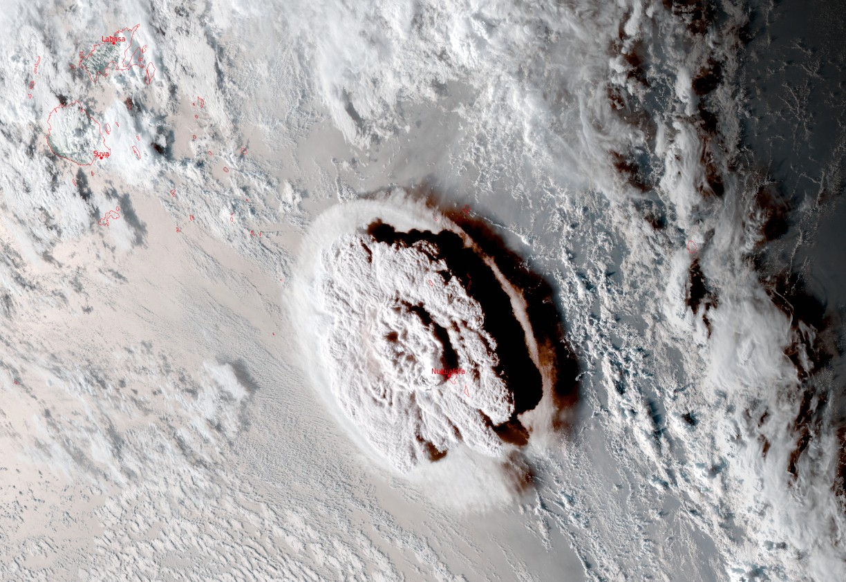
Hunga Tonga-Hunga Ha'apai eruption at 05:00 UTC on January 15, 2022. Credit: NOAA/GOES-WEST, RAMMB/CIRA, TW
Authorities confirmed one fatality in Tonga, a 50-year-old British woman2 who died after she was washed away while trying to rescue her dogs. Two people died in Peru after tsunami waves reached South America several hours later.
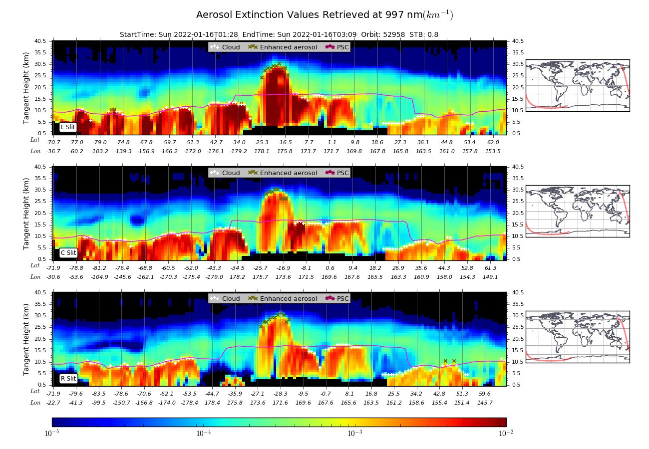
The eruptive column3 reached a height of about 30 km (98 500 feet) above sea level, according to data provided by the Ozone Mapping and Profiler Suite (OMPS) Limb Profiler aboard the Suomi NPP satellite.4
Other estimates suggest the cloud could have reached as high as 39 km (127 900 feet) a.s.l.
The eruption produced a huge shockwave that circled the planet two times.
Sentinel-2 satellite image acquired on January 17 confirms the island created during the eruption in 2014/15 was completely destroyed.
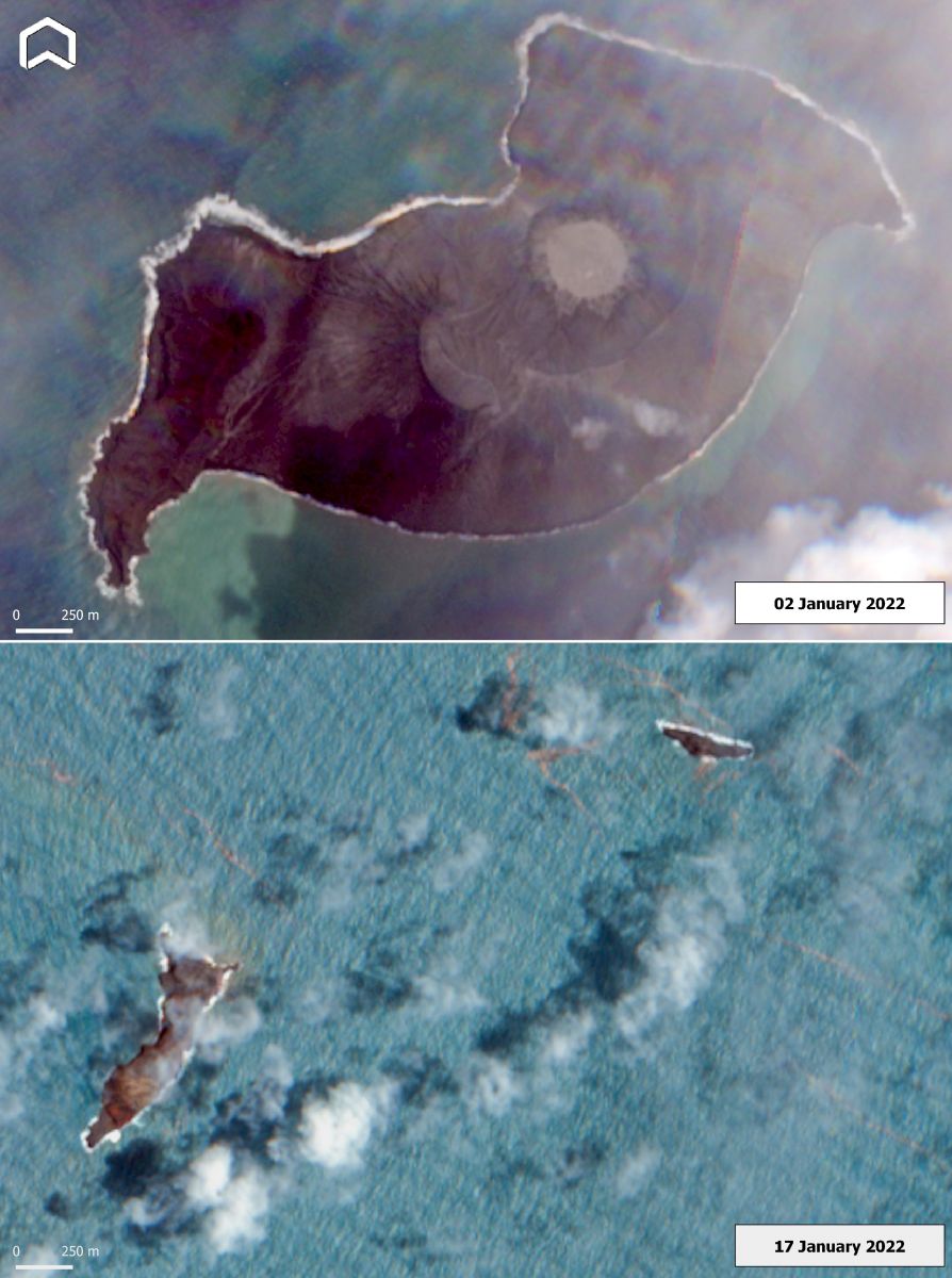
Hunga Tonga-Hunga Ha'apai volcano on January 2 and 17, 2022. Credit: Copernicus EU/Sentinel-2, Adam Platform
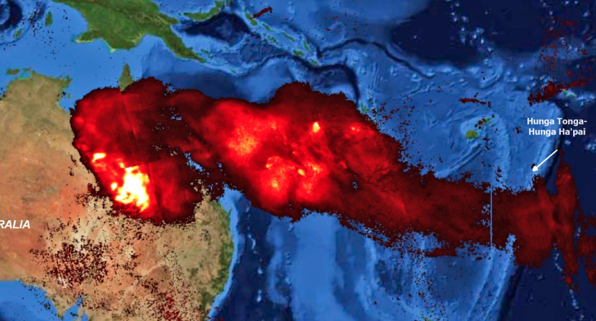
SO2 Total Column on January 17 – produced by the eruption of Hunga Tonga-Hunga Ha'apai volcano on January 15, 2022. Credit: Copernicus EU/Sentinel-5, ADAM Platform
References:
1 Situation in Tonga following the volcano eruption – CID
2 Tonga eruption: Body of British woman Angela Glover swept away in tsunami found – NZ Herald
3 Massive eruption at Hunga Tonga-Hunga Ha'apai produces huge shockwave and 1.2 m high tsunami, Tonga – The Watchers
4 Height of Hunga Tonga-Hunga Ha'apai eruption reached 30 km (98 500 feet) a.s.l., Tonga – The Watchers
I'm a dedicated researcher, journalist, and editor at The Watchers. With over 20 years of experience in the media industry, I specialize in hard science news, focusing on extreme weather, seismic and volcanic activity, space weather, and astronomy, including near-Earth objects and planetary defense strategies. You can reach me at teo /at/ watchers.news.
I wonder if there was a connection with the events of mid December last year. I am pretty sure there was met Office charts give the same sort of signal for tornadoes a jellyfish shaped occlusion ending a storm with the signal running north to south for Pacific based activity, to the right of the Mid Atlantic Ridge.
for Atlantic based eruptions/tornadoes the same type of fronts follow regular storm tracks.
More bad news for hunga dunga,It looks like with a 965 over the Arctic Circle.
https://www.metoffice.gov.uk/public/data/CoreProductCache/SurfacePressureChart/Item/ProductId/160178020
Tornadoes here too, it looks like:
https://www.spc.noaa.gov/climo/reports/220118_rpts.html