
Massive dust storm sweeps through Colorado, Kansas and Nebraska, U.S.

Image credit: NOAA/GOES-16, RAMMB/CIRA, TW. Acquired at 20:40 UTC on December 16, 2021
Strong winds caused by a powerful storm moving through the Plains, produced a massive dust storm in eastern Colorado, Kansas and Nebraska on December 15, 2021.
Strong wind gusts in excess of 160 km/h (100 mph) closed roads and knocked out power to more than 200 000 customers in Kansas and Colorado.
Many areas reported blinding dust storm, with zero or near-zero visibility.
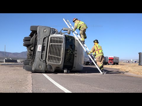
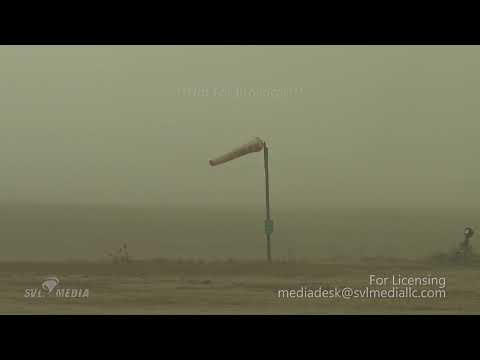
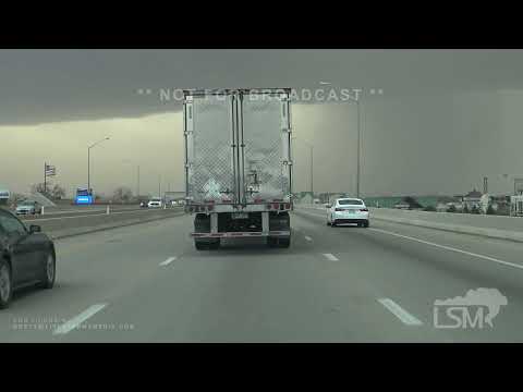
"DUST BOWL 2021" This video from Main Street in Elkhart, Kan. is just one example of the severe conditions wind and dust are creating across Kansas. https://t.co/RaVNioniQB #kwch12 #storm12 #kswx pic.twitter.com/n2QJdzX0RJ
— KWCH Eyewitness News (@KWCH12) December 15, 2021
Wow. This was in western Kansas on I-70. The family was heading back to KC from Denver. #9News
@Jackofhearts33 pic.twitter.com/D66ge1EsdC
— Kelly Reinke (@KellyReinkeTV) December 15, 2021
'It's zero visibility': Blinding #duststorm moving at 90mph 'hurricane-strength' winds blanket HALF of #Kansas and knock out power to nearly 120,000 people: 18-wheelers topple over and roads become no-go zones pic.twitter.com/W8n21obL93
— Hans Solo (@thandojo) December 16, 2021

The Watchers team and our contributors bring the latest on extreme weather, earthquakes, volcanic eruptions, space weather, and all things science. We're all about making sense of the natural world and keeping you informed on what’s happening. Got a tip or a question? Hit us up using the form at newstips!
Earlier reporting
Nothing on Watchers was published in the last 24 hours. These are older articles.
- 2 atmospheric rivers to bring heavy Sierra snow and California flood risk
- On October 22, 2017, a single flash of lightning stretched 515 miles from eastern Texas to near Kansas City, a distance that takes eight hours to drive, and nobody realized how far it had gone until scientists went back through the satellite data years later Epicenter
- CPC posts a slight risk of heavy rain from the Gulf Coast to the Northeast urban corridor November 25-29, and a moderate risk of West Coast wind and Sierra snow on November 25
- Florida's east coast faces a moderate flash flood risk Wednesday through Friday, with 4 to 8 inches of rain forecast and the St. Johns River near Cocoa already in major flood at 17.13 feet
