
Increased seismic activity at Awu volcano, Alert Level raised, Indonesia
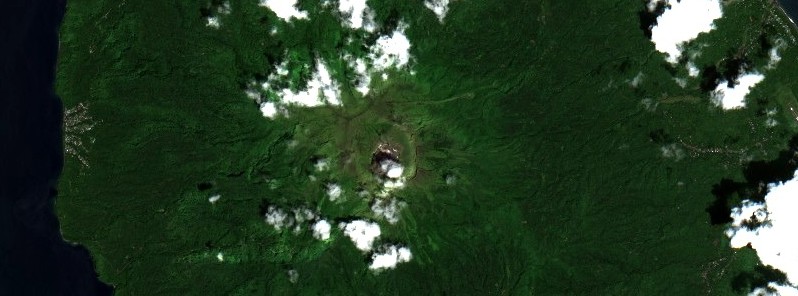
Featured image: Mount Awu on October 20, 2021. Credit: Copernicus EU/Sentinel-2, TW
The Indonesian Center for Volcanology and Geological Hazard Mitigation (CVGHM) has raised the Alert Level for Awu volcano from 1 to 2 (Alert) on December 12, 2021, due to increased seismic activity detected since October. The last eruption at this volcano took place in 2004 (VEI 2). Awu is one of Indonesia's deadliest volcanoes, with a history of VEI 3 and 4 eruptions since 1711.
Shallow volcanic earthquakes were recorded in the range of 7 – 26 events per day, while previously the maximum was recorded at 5 events per day. An increase in deep volcanic earthquakes was also observed.1
Seismic amplitude (RSAM) has been increasing progressively since November.

The potential dangers of Mount Awu at level II (Alert) are as follows:
The main potential hazards that may occur can be in the form of magmatic eruptions with ejection of incandescent material and/or ejection and pyroclastic flows or in the form of phreatic eruptions dominated by steam and volcanic gas as well as previous eruptive materials. The potential for destruction of the lava dome can occur if the pressure in the magmatic system increases significantly.
Other potential hazards can be in the form of volcanic gas emissions such as CO, CO2, H2S, N2 and CH4. These gases can be life-threatening if the inhaled concentration exceeds the safe threshold value.
Potential secondary hazards in the case of eruption can be in the form of lava flows from pyroclastic materials that fall on the slopes and are carried by rainwater following river channels that originate from Mount Awu.
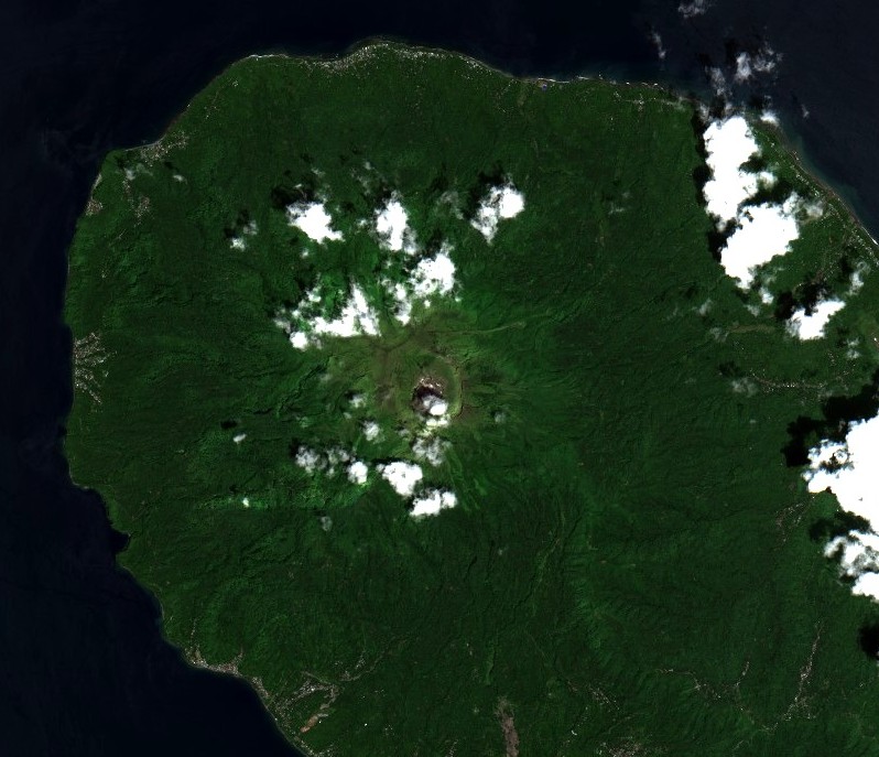
Mount Awu on October 20, 2021. Credit: Copernicus EU/Sentinel-2, TW
The public and visitors/tourists are advised not to approach the volcano within a radius of 1 km (0.62 miles) from the crater.
The communities around Mount Awu are advised to remain calm and not to be provoked by rumors about the activities of Mount Awu that cannot be justified.
The public is expected to follow the directions of the local Regional Disaster Management Agency.
Geological summary
The massive Gunung Awu stratovolcano occupies the northern end of Great Sangihe Island, the largest of the Sangihe arc.
Deep valleys that form passageways for lahars dissect the flanks of the volcano, which was constructed within a 4.5 km (2.8 miles) wide caldera.
Powerful explosive eruptions in 1711, 1812, 1856, 1892, and 1966 produced devastating pyroclastic flows and lahars that caused more than 8 000 cumulative fatalities.
Awu contained a summit crater lake that was 1 km (0.62 miles) wide and 172 m (564 feet) deep in 1922, but was largely ejected during the 1966 eruption.2
References:
1 Peningkatan Tingkat Aktivitas Gunung Awu – CVGHM
2 Awu – Geological summary – GVP
I'm a dedicated researcher, journalist, and editor at The Watchers. With over 20 years of experience in the media industry, I specialize in hard science news, focusing on extreme weather, seismic and volcanic activity, space weather, and astronomy, including near-Earth objects and planetary defense strategies. You can reach me at teo /at/ watchers.news.
Commenting rules and guidelines
We value the thoughts and opinions of our readers and welcome healthy discussions on our website. In order to maintain a respectful and positive community, we ask that all commenters follow these rules.