Category 5 Super Typhoon “Chanthu” (Kiko) impacts extreme Northern Luzon, Philippines
Super Typhoon "Chanthu" — known as Kiko in the Philippines — made its first landfall east of the Babuyan Islands at 21:00 UTC on September 10, 2021, and the second at 00:30 UTC on September 11 over Ivana, Batanes, Philippines.
Chanthu had 1-minute maximum sustained winds of 285 km/h (180 mph) at 18:00 UTC on September 10 and 270 km/h (170 mph) at 00:00 UTC on September 11.
At 06:00 UTC on September 11, its center was about 45 km (28 miles) NNW of Itbayat, Philippines and about 130 km (80 miles) SSE of Hengchun, Taiwan.
Maximum 10-minute sustained winds were 205 km/h (125 mph), with gusts up to 285 km/h (180 mph) while maximum 1-minute sustained winds are at 260 km/h (160 mph).
The minimum central barometric pressure was 910 hPa and the system was moving NNW at 15 km/h (9.2 mph).
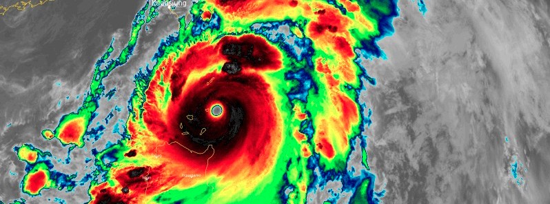
Super Typhoon "Chanthu" at 18:00 UTC on September 10, 2021. Credit: JMA/Himawari-8, RAMMB/CIRA, TW
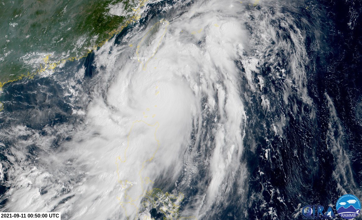
Super Typhoon "Chanthu" at 00:50 UTC on September 11, 2021. Credit: JMA/Himawari-8, RAMMB/CIRA, TW


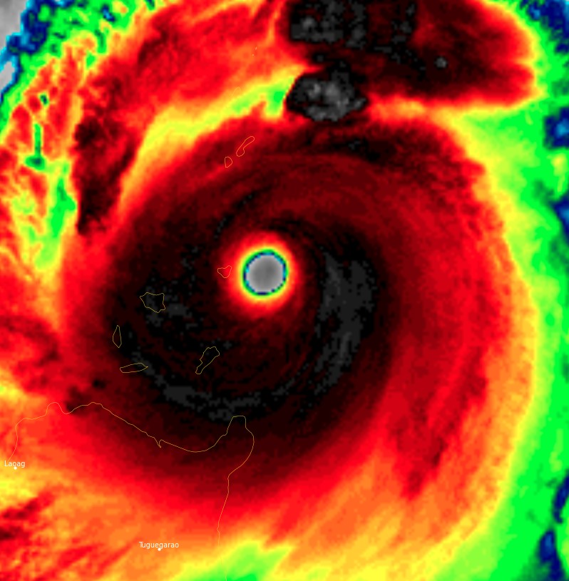
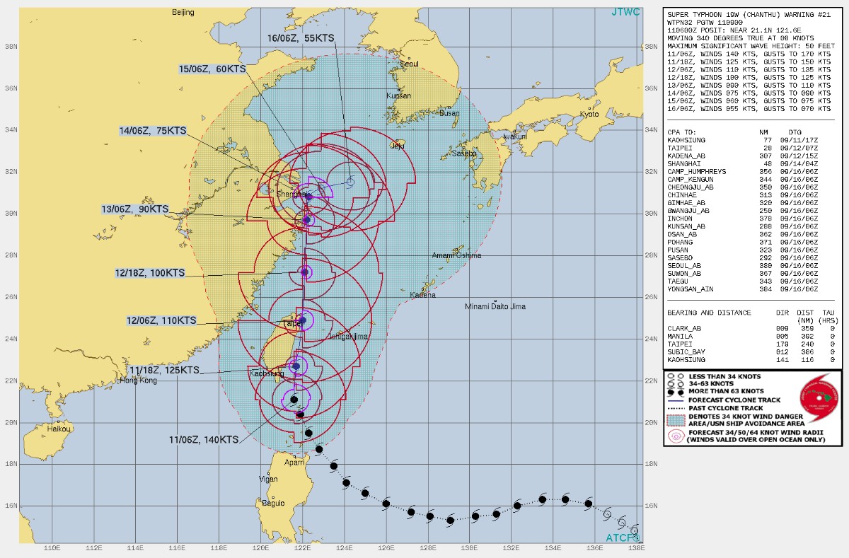
While Super Typhoon "Chanthu" appears to have completed an eyewall replacement cycle (ERC) and would thus be expected to be once again intensifying, radar imagery depicts the presence of a very small inner eye inside of a much larger secondary eyewall, JTWC forecasters said at 09:00 UTC.1
Microwave image acquired at 07:40 UTC today shows the outer eyewall is fairly ragged. There is also the presence of a band of dry air wrapping into the system from the east.
"The combination of these factors, along with the absorbtion of the remnants of Invest 96W, have disrupted the core from rapidly redeveloping," JTWC said.
Though Chanthu is still a super typhoon, recent imagery suggests rapid weakening.
Radar imagery shows the system has turned sharply northward, as the steering ridge has become oriented more north-south.
Chanthu is forecast to continue tracking northward along the western side of the subtropical ridge (STR) over the next 48 hours.
Thereafter the steering pattern becomes highly complex, leading to dramatic changes in the forecast track.
By 09:00 UTC on September 13, a fairly robust STR is expected to develop centered to the southwest of Beijing with ridging extending eastward across South Korea and into the STR southeast of Japan, according to the JTWC.
This will lead to a weak steering environment, in which Chanthu will be trapped between the two ridges.
Between 09:00 UTC on September 13 and 09:00 UTC on September 15, the system is thus expected to remain roughly quasi-stationary or drift slowly north-northeastward as it remains firmly ensconced in the weak steering pattern.
By 09:00 UTC on September 15, the ridge to the west is expected to weaken ahead of an approaching trough, while the eastern ridge strengthens and moves west, allowing Chanthu to breakout and begin a track towards the east through 09:00 UTC on September 16.
The presence of persistent mid-level northerly shear and mid-level dry air entrainment should limit any potential for near-term intensification and the system is expected to steadily weaken over the next 5 days.
JTWC track guidance is in good agreement over the next 48 hours, and highly uncertain thereafter as the system enters the week steering flow. Model solutions spread to 150 km (90 miles) at 09:00 UTC on September 13.
Spread in the deterministic models actually decreases by that time, but this is misleading, as ensemble spread increases dramatically both in terms of direction and speed, with possible solutions at 09:00 UTC on September 16 ranging from dissipation west of Shanghai to a strong typhoon over southern Kyushu, Japan.
In the long term, there is low confidence due to the uncertainties in the timing of the breakout from the weak steering pattern. Intensity guidance is in good agreement on the steady weakening scenario, with only minor deviations from the mean. The JTWC forecast lies above the consensus mean but otherwise tracks the slope of the weakening trend with medium confidence.
References:
1 JOINT TYPHOON WRNCEN PEARL HARBOR HI – PROGNOSTIC REASONING FOR SUPER TYPHOON 19W (CHANTHU) WARNING NR 021
Featured image: Super Typhoon "Chanthu" at 18:00 UTC on September 10, 2021. Credit: JMA/Himawari-8, RAMMB/CIRA, TW
Commenting rules and guidelines
We value the thoughts and opinions of our readers and welcome healthy discussions on our website. In order to maintain a respectful and positive community, we ask that all commenters follow these rules.