Hurricane “Ida” makes landfall over the Isle of Youth, causing island-wide power outages, Cuba
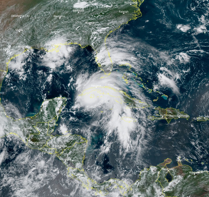
Tropical Storm "Ida" strengthened into a hurricane at 17:10 UTC on Friday, August 27, 2021, just 50 km (31 miles) ESE of the Isle of Youth. Landfall took place at 18:00 UTC with maximum sustained winds of 120 km/h (75 mph) and a minimum central pressure of 987 hPa. The storm then moved over western Cuba and exited into the Gulf of Mexico. Environmental conditions in the Gulf of Mexico support rapid intensification and the next landfall is expected in Louisiana, U.S. possibly as a Category 4 hurricane late Sunday or early Monday.
Ida's second landfall took place over the Cuban Province of Pinar del Rio, about 30 km (20 miles) E of La Coloma just before midnight. At 00:00 UTC on August 28, its center was located 145 km (90 miles) SW of Havana.
The storm had maximum sustained winds of 130 km/h (80 mph) and was moving NW at 24 km/h (15 mph). Its minimum central pressure was 985 hPa.1
Ida downed trees, damaged homes, and left 98.7% of customers without electricity as it moved over the Isle of Youth. The power was available in one hospital and some 400 homes and buildings with power generators.2
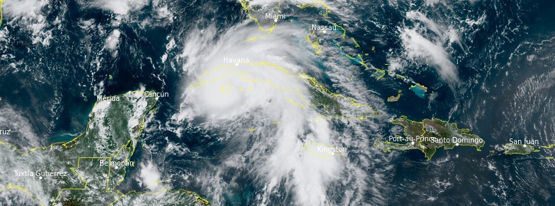
Tropical Storm "Ida" at 18:20 UTC on August 27, 2021. Credit: NOAA/GOES-East, RAMMB/CIRA, TW
Union Electrica reported significant damage across the island which will take several days to fully repair.
The main impact was wind damage to the roofs of homes and buildings, Defense Council said at a meeting.
More than 10 400 people were evacuated in the province of Pinar del Rio.
Two sources of water supply in Havana have been affected by the storm — Cuenca Sur and El Gato.
Hurricane and tropical storm conditions are now ending over Cuba but periods of heavy rain are still expected across western parts of the country through today, which may lead to flash flooding and mudslides.
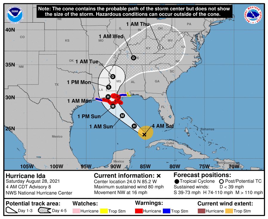
Ida is moving toward U.S. Gulf Coast in an environment favorable for rapid intensification.
There is a danger of life-threatening storm surge inundation Sunday along the coasts of Louisiana and Mississippi, NHC warns.3
Extremely life-threatening inundation of 3 to 4.5 m (10 to 15 feet) above ground level is possible within the area from Morgan City, Louisiana, to the Mouth of the Mississippi River. Interests throughout the warning area should follow any advice given by local officials.
Ida is expected to be an extremely dangerous major hurricane when it reaches the coast of Louisiana, with potentially catastrophic wind damage possible where its core moves onshore. Landfall is expected by late Sunday, August 29, or early Monday.
Actions to protect life and property should be rushed to completion.
 References:
1 BULLETIN – Hurricane Ida Intermediate Advisory Number 6A – NWS National Hurricane Center Miami FL AL092021 – 800 PM EDT Fri Aug 27 2021
2 Special coverage: Ida and its passage through Cuban territory – Juventud REBELDE
3 Hurricane Ida Discussion Number 8 – NWS National Hurricane Center Miami FL AL092021 – 400 AM CDT Sat Aug 28 2021
Featured image: Tropical Storm "Ida" at 18:20 UTC on August 27, 2021. Credit: NOAA/GOES-East, RAMMB/CIRA, TW
Even the wind and the waves obey His voice….. This is NOT ‘climate change’! If you read in the book of Job, God is the One who controls the weather!