
Multiple, discrete, energetic explosion signals at Semisopochnoi volcano, Alaska
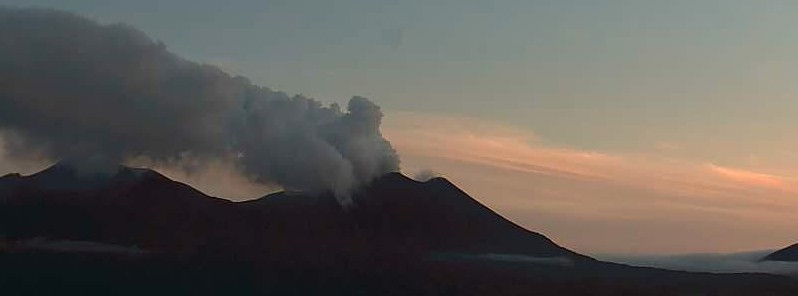
Featured image: Semisopochnoi on June 8, 2021. Credit: Cyrus Read, USGS/AVO
Unrest under Semisopochnoi volcano increased at the end of July, with a marked increase in seismicity on July 31. Increased activity has also been detected on local infrasound stations, suggesting possible low-level (below 3 km / 10 000 feet above sea level) emissions. Due to this increase in activity, the Alaska Volcano Observatory (AVO) has raised the Aviation Color Code to ORANGE and the Alert Level to WATCH on July 31.
Seismicity further increased on August 1. Infrasound has also increased, suggesting low-level emissions. Clouds obscured views of the volcano by satellite, however, web camera views showed steam emissions.
Detection of multiple, discrete, energetic explosion signals on the local seismic and infrasound stations has characterized the unrest on August 2.
Clouds have obscured views of the volcano by satellite, and there were no observations of volcanic emissions or ash clouds, AVO said.
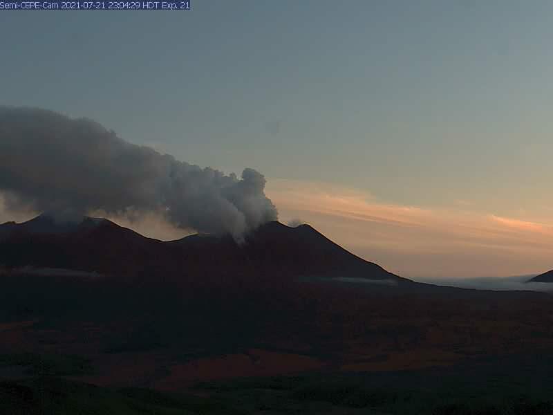
Robust steaming from the active vent and Semisopochnoi were observed in web camera images from station CEPE on July 21, 2021. Credit: AVO/USGS
Web camera views of the active vent at the north crater also were obscured by clouds and fog on August 2. The viewing port on one of the web cameras was covered with dispersed particulate matter that could be ash, but ash emissions have not been confirmed in other data.
Small eruptions producing minor ash deposits within the vicinity of the active north crater of Mount Cerberus and ash clouds under 3 km (10 000 feet) above sea level are typical of recent activity at Semisopochnoi, AVO said.
Small explosions may occur without warning and could be undetected by regional infrasound sensors and cloudy weather conditions.
Semisopochnoi is monitored by local seismic and infrasound sensors, satellite data, regional infrasound, and lightning detection instruments.
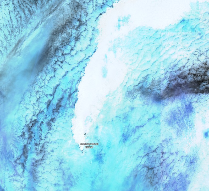
Semisopochnoi on July 26, 2021. Image credit: Copernicus EU/Sentinel-2, TW
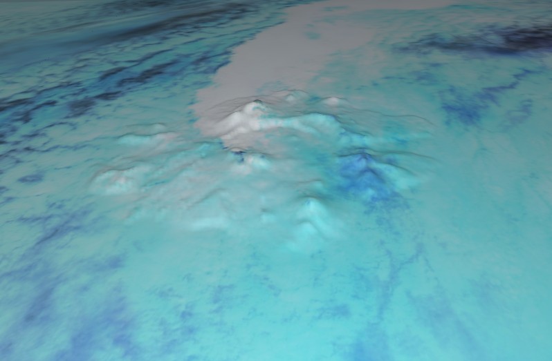
Semisopochnoi on July 26, 2021. Image credit: Copernicus EU/Sentinel-2, TW
Geological summary
Semisopochnoi, the largest subaerial volcano of the western Aleutians, is 20 km (12.4 miles) wide at sea level and contains an 8 km (5 miles) wide caldera. It formed as a result of the collapse of a low-angle, dominantly basaltic volcano following the eruption of a large volume of dacitic pumice.
The high point of the island is 1 221 m (4 005 feet) high Anvil Peak, a double-peaked late-Pleistocene cone that forms much of the island's northern part.
The three-peaked 774 m (2 539 feet) high Mount Cerberus volcano was constructed during the Holocene within the caldera. Each of the peaks contains a summit crater; lava flows on the northern flank of Cerberus appear younger than those on the southern side.
Other post-caldera volcanoes include the symmetrical 855 m (2 903 feet) high Sugarloaf Peak SSE of the caldera and Lakeshore Cone, a small cinder cone at the edge of Fenner Lake in the NE part of the caldera.
Most documented historical eruptions have originated from Cerberus, although Coats (1950) considered that both Sugarloaf and Lakeshore Cone within the caldera could have been active during historical time.
This volcano is located within the Aleutian Islands, a UNESCO Biosphere Reserve property. (GVP)
I'm a dedicated researcher, journalist, and editor at The Watchers. With over 20 years of experience in the media industry, I specialize in hard science news, focusing on extreme weather, seismic and volcanic activity, space weather, and astronomy, including near-Earth objects and planetary defense strategies. You can reach me at teo /at/ watchers.news.
Commenting rules and guidelines
We value the thoughts and opinions of our readers and welcome healthy discussions on our website. In order to maintain a respectful and positive community, we ask that all commenters follow these rules.