
Sirung volcano erupts, Aviation Color Code raised to Orange, Indonesia
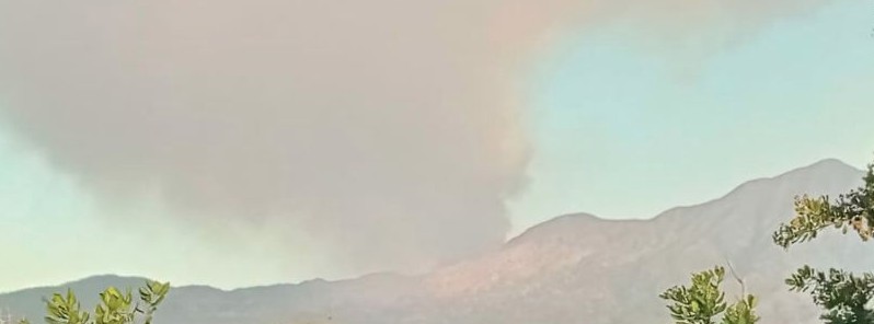
Image credit: PVMBG
Ash emission was observed at the Indonesian Sirung volcano, East Nusa Tenggara starting at 08:44 UTC (16:44 LT) on July 21, 2021. The last known eruption of this volcano took place in 2015, with ash rising up to 1.5 km (5 000 feet) above sea level.
The best estimate of ash-cloud top is around 2.8 km (9 158 feet) above sea level but it may be higher than what can be observed clearly, the Sirung Volcano Observatory said.
Ash-cloud is moving north. Its height was assessed by a ground observer.
Seismicity at the volcano has not shown significant changes, however, ash emission may reoccur.
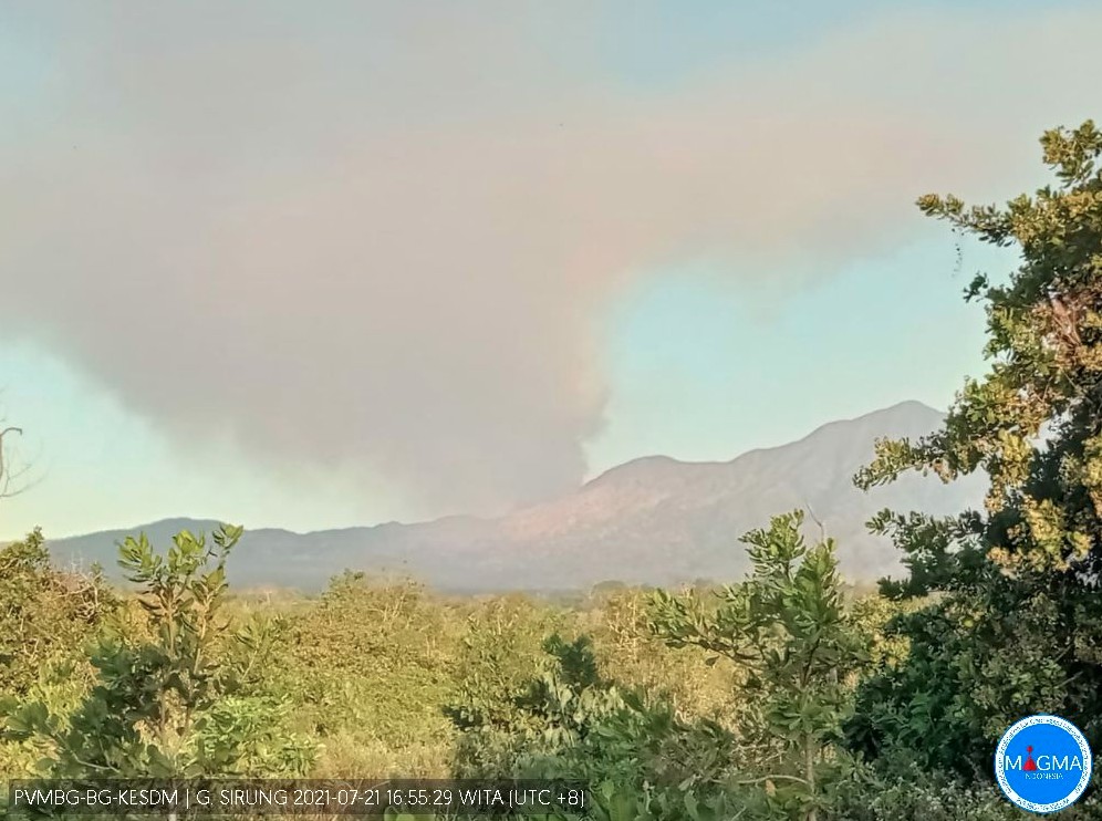
Image credit: PVMBG
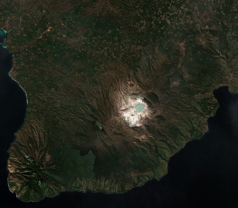
Sirung volcano on July 12, 2021. Credit: Copernicus EU/Sentinel-2, TW
The last eruption at Sirung volcano took place on July 8, 2015, when the ash plume drifted 55 km (34 miles) W of the volcano at an altitude of 1.5 km (5 000 feet) a.s.l.
A 3-hour long eruption took place at Sirung volcano on May 8, 2012. The eruption was accompanied by loud sounds and incandescent tephra observed rising 10 m (33 feet) above the crater.
The explosion created an ash plume that rose up to 3.5 km (11 500 feet) a.s.l. and drifted to the north, producing ashfall up to 4 mm (0.15 inches) thick near the crater.
On May 12 (2012), authorities raised the Alert Level to 3 (on a scale of 1-4) and recommended that visitors not approach the volcano within a 2.5 km (1.5 miles) radius.
Geological summary
Sirung volcano is located at the NE end of a 14 km (8.7 miles) long line of volcanic centers that form a peninsula at the southern end of Pantar Island. The volcano is truncated by a 2 km (1.2 miles) wide caldera whose floor often contains one or more small lakes.
Much of the volcano is constructed of basaltic lava flows, and the Gunung Sirung lava dome forms the high point on the caldera's western rim.
A number of phreatic eruptions have occurred from vents within the caldera during the 20th century.
Forested Gunung Topaki, the high point of the volcanic chain, lies at the SW end and contains a symmetrical summit crater.
I'm a dedicated researcher, journalist, and editor at The Watchers. With over 20 years of experience in the media industry, I specialize in hard science news, focusing on extreme weather, seismic and volcanic activity, space weather, and astronomy, including near-Earth objects and planetary defense strategies. You can reach me at teo /at/ watchers.news.
Commenting rules and guidelines
We value the thoughts and opinions of our readers and welcome healthy discussions on our website. In order to maintain a respectful and positive community, we ask that all commenters follow these rules.