
Unseasonal snowstorm and cold hit Iceland, prompt rescue operations
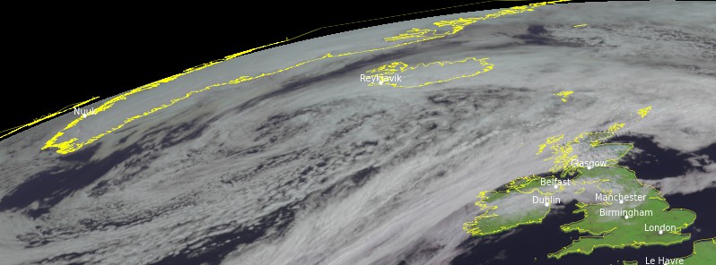
Image credit: EUMETSAT/Meteosat-11, RAMMB/CIRA, TW. Acquired at 09:30 UTC on June 13, 2021
Heavy, unseasonal snow and sleet covered the northern and eastern parts of Iceland on Sunday, June 13, 2021. The snow was so heavy in some areas that tourists had to be rescued after getting trapped. Temperatures also plummeted to freezing levels and are expected to linger across much of the country in the next three weeks.
Residents of Mývatnssveit, Northeast Iceland, woke up to a blanket of snow on Sunday.
Óli Þór Árnason, a meteorologist at the Icelandic Met Office, said although the snow was not heavy in low-lying areas, numerous places from the Yjafjörður fjord in the north and all the way to the East Fjords saw either sleet or snow.
"It has gotten colder in the East Fjords lately, where the temperature is close to 0 °C (32 °F)."
"It gradually gets warmer the farther south you go, but not much– the mercury is reaching just 3 °C (37 °F) in Djúpivogur and 5 °C (41 °F) in Hornafjörður fjord (in the southeast)."
The unseasonal snow was so heavy in some areas that search and rescue crews had to be called to assist a group trapped at a campsite near Vík í Mýrdal at the southern tip of the country, following a severe snowstorm.
Mikill snjór er enn á sunnanverðu hálendinu, svo sem í Hrafntinnuskeri, sem er við Laugaveginn svonefnda. Fannir vetrarins ná upp á miðja veggi skálans og bætt hefur á þær með snjókomu síðustu daga. https://t.co/iBJI66k0Zm pic.twitter.com/UpGpIKnaiS
— mbl.is (@mblfrettir) June 15, 2021
It's finally summer here in Iceland! pic.twitter.com/qVw1YLjP0w
— Jan Ξrik Waider (@JanWaider) June 13, 2021
Drove on my favourite road in #Iceland today – the route 917, over in the east, which has only just opened after the winter – absolutely superb views! pic.twitter.com/dRH8uBbxtP
— Sophie Carr (@SophieCarrPhoto) June 12, 2021
I was not expecting to take photos like this on a visit to #Iceland in June! Ah, she continues to surprise me… pic.twitter.com/M1SKjzUWP6
— Sophie Carr (@SophieCarrPhoto) June 13, 2021
Normally, Iceland sees the least precipitation in June, and snow is considered rare during this time.
In Fáskrúðsfjörður, the East Fjords, the snow continued through Monday, June 14.
As of Tuesday, June 15, there is still a lot of snow in the southern part of the highlands, including Hrafntinnusker.
The cold is expected to linger across much of the country over the next three weeks.
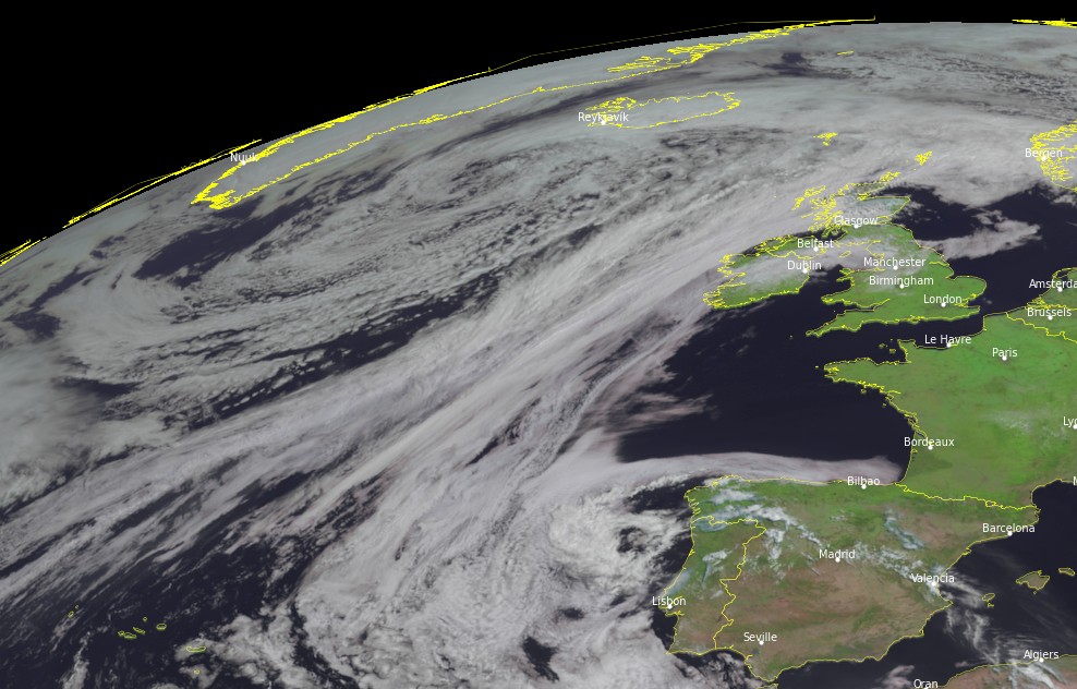
Image credit: EUMETSAT/Meteosat-11, RAMMB/CIRA, TW. Acquired at 09:30 UTC on June 13, 2021
This is getting serious Edgards. Across social media networks, Córdoba was the most used hashtag in Argentina on Wednesday 15/06/21. Stunning photos and videos have captured the incredibly rare snowfall, which is thought to have occurred just a handful of times in the past 100+ years (in 2007, 1975, 1955, 1920, 1918, and 1912 — years which ALL correlate to solar minimums/prolonged periods of reduced solar activity). The National Meteorological Service of Argentina said the snowfall is not confined to the province of Córdoba either, but that others such as Mendoza, San Luis and in elevated areas of San Juan, La Rioja and Catamarca have also received historic flurries. Officially, winter doesn’t begin in Argentina until Monday, June 21, yet the nation’s Meteorological Service is warning of low temperatures all week –until at least next Friday— of between -2C and 5C.
No panic, Oliver. Short-term planetary effects. This and next year will be interesting, no doubt.
Edgars
We’re now just a week away from the summer solstice, yet the temperature in the country’s capital, Reykjavik, is not expected to reach double figures before the weekend. And looking further ahead, according to meteorologist Einar Sveinbjörnsson
who said that the following week (so from 28 June–5 July) will be cold across Iceland, Scandinavia and also mainland Europe. This appears to be backed up by the latest GFS Temperature Anomaly run, which sees an Arctic trough riding anomalously-far south on the back of a weak and wavy ‘meridional’ jet stream flow. While all the while, global average temperatures continue to fall. The COLD TIMES are returning, the mid-latitudes are REFREEZING, in line with the great conjunction, historically low solar activity, cloud-nucleating Cosmic Rays, and a meridional jet stream flow (among other things).