
Major eruption at Lewotolo volcano, ash to 15.2 km (50 000 feet) a.s.l., Indonesia
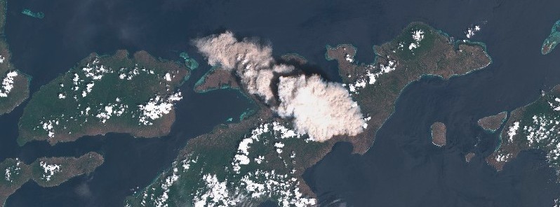
Image credit: Copernicus EU/Sentinel-2, TW
A high-level eruption took place at the Indonesian Lewotolo volcano at 01:50 UTC on November 29, 2020. The Aviation Color Code was raised to Red.
According to the Darwin VAAC, the volcanic ash cloud was discernible on satellite imagery acquired 03:20 UTC to 15.2 km (50 000 feet) a.s.l. moving southeast and to 5.5 km (18 000 feet) a.s.l. moving northwest.
Volcanic ash height was based on Himawari-8, CVGHM VONA issued 02:00 UTC, and model guidance.
The eruption was recorded on a seismograph with a maximum amplitude of 35 mm and a duration of 600 seconds.
Seismic activity is currently characterized by continuous volcanic tremor, the Center for Volcanology and Geological Hazard Mitigation (CVGHM) said.
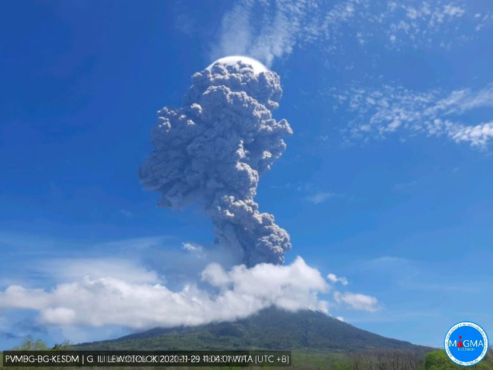
Image credit: MAGMA Indonesia
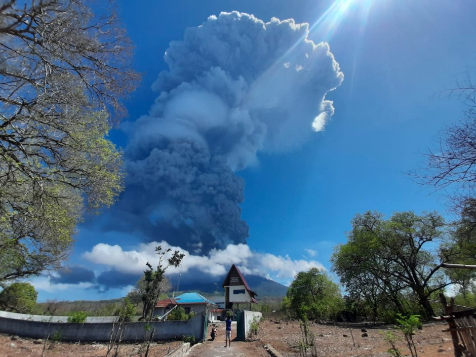
Image credit: Dr. Devy Kamil Syahbana
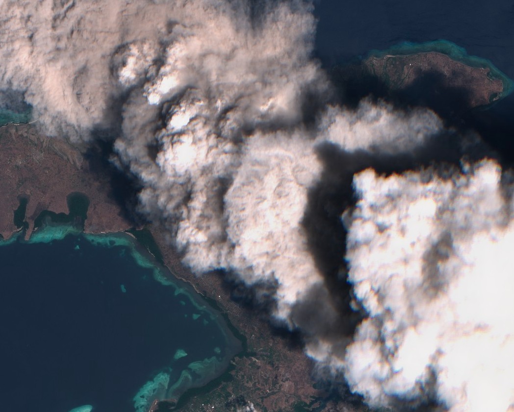
Ash rising above Lewotolo volcano on November 29, 2020. Credit: Copernicus EU/Sentinel-2, TW
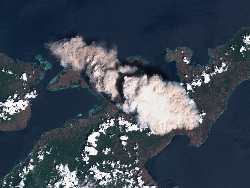
Ash rising above Lewotolo volcano on November 29, 2020. Credit: Copernicus EU/Sentinel-2, TW
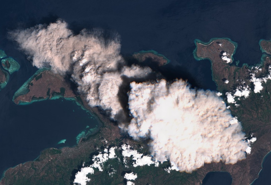
Ash rising above Lewotolo volcano on November 29, 2020. Credit: Copernicus EU/Sentinel-2, TW
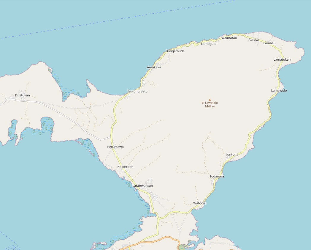
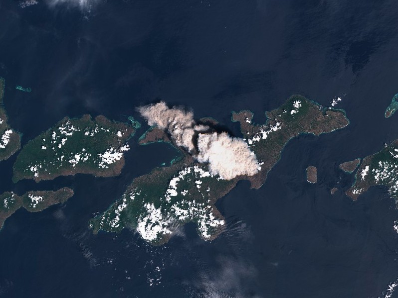
Map of Lewotolo volcano area (scale to fit next 2 images)
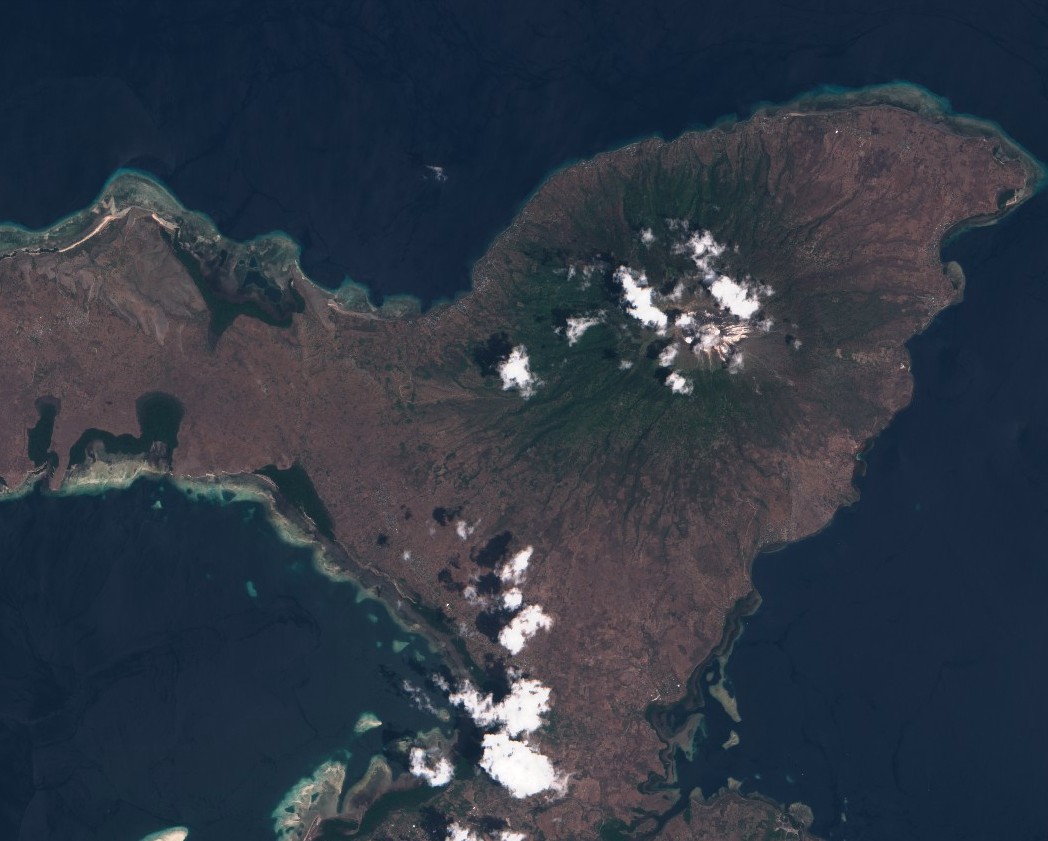
Lewotolo volcano on November 19, 2020 (10 days before the eruption) (scale to fit). Credit: Copernicus EU/Sentinel-2, TW
Lewotolo volcano on November 19, 2020 (scale to fit). Credit: Copernicus EU/Sentinel-2, TW
Based on the currently available data, it is estimated that a total of 487 833 people (108 408 households) and $1.38 Billion USD of infrastructure are exposed to the hazard, according to the ASEAN Coordinating Centre for Humanitarian Assistance (AHA Centre). 12 526 people (2 784 households) and $32.6 Million USD of the infrastructure within 10 km-radius (6.2 miles) are more likely to be adversely impacted.
CVGHM recommends that people around the volcano and anyone who wants to climb do not stay or do activities within the danger zone, around mountain craters, and in all areas within a radius of 2 km (1.2 miles) from the summit of the volcano.
According to CVGHM, Lewotolok has been in Alert Level II status since October 7, 2017. The increase in status was triggered by an increase in volcanic activity in the form of significant seismicity, especially local tectonic earthquakes, deep volcanic and shallow volcanic since mid-September 2017.
The BNPB is still coordinating with relevant authorities to assess the impact of the eruption. The Palang Merah Indonesia (PMI) team identified the urgent need at this time–masks (5000) and shelter for residents who are displaced.
Lewotolo's first eruption since January 2012 took place late Thursday (UTC), November 26, 2020, when the volcano produced an ash plume up to 500 m (1 640 feet) above the summit.
At the time, CVGHM warned of potential hazards, including incandescent rocks and heavy ash rain within a radius of 2 km (1.2 miles) from the summit. Ash rain is likely to reach farther areas, depending on wind direction and speed.
CVGHM also warned of a potential avalanche of weathered material from the top of the volcano, as well as the spread of hazardous volcanic gases on the peak. Activities in the danger zone in the crater area has been prohibited.
Authorities asked residents nearby to remain calm and follow orders from the regional and provincial government, as well as other relevant agencies for mitigation efforts.
Lewotolo's previous eruption occurred in January 2012, when the volcano produced thick, white plumes that rose up to 250 m (820 feet) above the summit.
Update:
Geological summary
Anchoring the eastern end of an elongated peninsula that is connected to Lembata (formerly Lomblen) Island by a narrow isthmus and extends northward into the Flores Sea, Lewotolo rises to 1 423 m (4 668 feet).
Lewotolo is a symmetrical stratovolcano as viewed from the north and east. A small cone with a 130-m-wide (426 feet) crater constructed at the SE side of a larger crater forms the volcano's high point. Many lava flows have reached the coastline.
Historical eruptions, recorded since 1660, have consisted of explosive activity from the summit crater.
I'm a dedicated researcher, journalist, and editor at The Watchers. With over 20 years of experience in the media industry, I specialize in hard science news, focusing on extreme weather, seismic and volcanic activity, space weather, and astronomy, including near-Earth objects and planetary defense strategies. You can reach me at teo /at/ watchers.news.
yes