
Massive blizzard dumps huge amounts of snow on B.C., forces closure of ski resorts
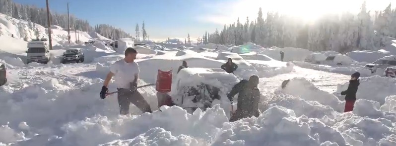
Image credit: Mount Washington Alpine Resort
A powerful storm that hit British Columbia, Canada over the weekend, leaving more than 73 000 people without electricity, dumped massive amounts of snow on Vancouver Island, creating dangerous conditions that forced ski resorts and roads to temporarily close.
Mount Washington Alpine Resort received 110 cm (43 inches) of snow within 24 hours on January 21, closing the resort for the first time since 1999. That year, the resort was closed for 3 days after 6 m (236 inches) of snow fell.
Snow Day | January 21st update
110cm in the last 24 hours with more snow forecasted overnight. Crews have been working hard – check out our big snow day video update to see what is planned for tomorrow. UPDATE: the road for downhill traffic is clear. pic.twitter.com/we6JJNMbYf— Mount Washington (@MountWashington) January 22, 2018
As of early Tuesday, January 23, snow depth at the base of the resort is 272 cm (107 inches) and 278 cm (109 inches) at the summit.
"One of the largest reasons we were not able to open today is that we had a few naturally occurring avalanches which make the human triggered avalanche possibility quite high," said Sheila Rivers Mt. Washington marketing manager.
The resort reopened four of its lifts on Monday, with 44 of the resort’s 81 trails available for use. However, as of Monday afternoon, the Vancouver Island Avalanche Centre is still advising against travel to the area.
"Don’t do it! Widespread evidence of natural avalanche activity is a great indicator of significant snow instability. We just witnessed a massive blizzard that dumped huge quantities of snow (90 – 120 cm fell overnight Saturday-Sunday alone with massive winds)," the center warns.
"This snow will take significant time to gain stability and strength. Slight reprieve from the torrent on Monday is no excuse to stick your neck out into the GNAR. Just because you can see it, does not mean you should ski (snowboard, sled) it! Stick to low angled treed slopes, heck that is where all the soft pow is anyways, the big open slopes and bowls are all wind pressed. Moderate snowfall will continue to load and destabilize slopes during this forecast period with the largest gains Tuesday into Wednesday morning. Strong winds from the southeast to southwest have and will continue to make northwest to northeast slopes in the alpine, treeline and open below treeline extremely dangerous."
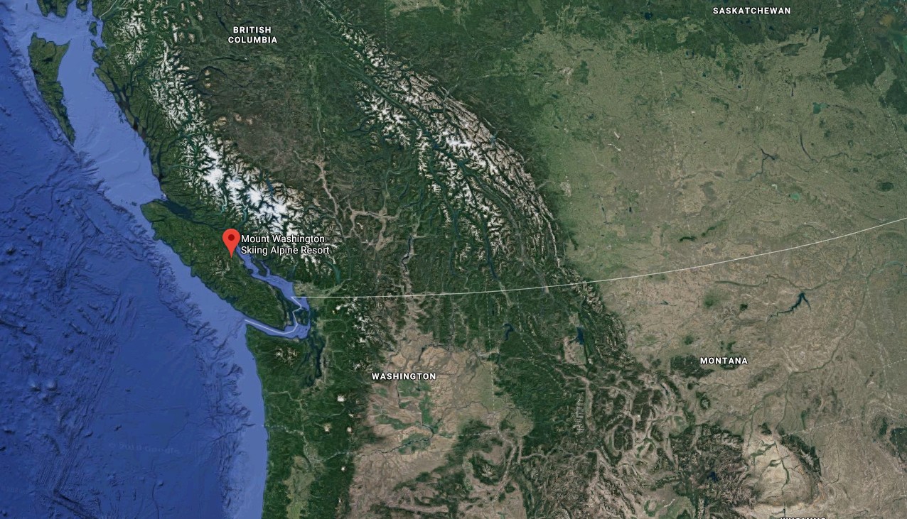
Mount Washington Alpine Resort location. Credit: Google
More snow is expected through the rest of the month. Check the location of the resort on the map above, and play the total snowfall accumulation model below:
I'm a dedicated researcher, journalist, and editor at The Watchers. With over 20 years of experience in the media industry, I specialize in hard science news, focusing on extreme weather, seismic and volcanic activity, space weather, and astronomy, including near-Earth objects and planetary defense strategies. You can reach me at teo /at/ watchers.news.
Commenting rules and guidelines
We value the thoughts and opinions of our readers and welcome healthy discussions on our website. In order to maintain a respectful and positive community, we ask that all commenters follow these rules.