
‘Serious temperature anomaly’ in parts of Siberia, Russia
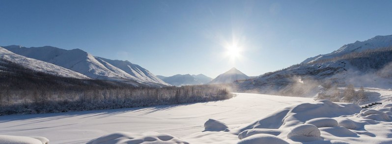
Featured image: Yakutia, Russia. Credit: Maarten Takens
A Siberian High, also known as Siberian Anticyclone, caused serious temperature anomaly Central Siberia on November 18, 2017, causing average daily temperatures to drop 10 – 12 °C (18 – 21.6 °F) below the climatic norm.
Over the past couple of days, extremely low temperatures hit parts of southeastern Evenkia, northern Irkutsk, and neighboring regions of Yakutia, Russia with night temperatures dropping to -42 °C (-43.6 °F) on November 19. In eastern Yakutia, especially Ytyk-Kel and Churapcha, Teply Klyuch and Tompo, the temperatures dropped to -44 °C (-47.2 °F), in Nere to -46 °C (-50.8 °F) and in Deliankir and Oymyakon to -47 °C (-52.6 °F).
According to Meteo Novosti (HMN), such temperatures are quite common in Yakutia on the eve of calendar winter, perhaps a little colder than normal, up to 1 or 2 °C (1.8 to 3.6 °F) below normal.
However, for Central Siberia this is a 'serious temperature anomaly,' HMN said, adding that the temperature for November 18 was 10 – 12 °C (18 – 21.6 °F) below the climatic norm.
SMN meteorologists expected heavy snow in parts of Western Siberia, with temperatures from -30 to -35 °C (-22 to -31 °F) and moderate snow in the Yakutia's northeast on Monday, November 20.
The Siberian High (also Siberian Anticyclone), usually centered on Lake Baikal, is a massive collection of cold dry air that accumulates in the northeastern part of Eurasia from September until April.
It reaches its greatest size and strength in the winter when the air temperature near the center of the high-pressure area is often lower than -40 °C (-40 °F) and the atmospheric pressure often above 1 040 hPa.
The Siberian High is the strongest semi-permanent high in the northern hemisphere and is responsible for both the lowest temperature in the northern hemisphere, of -67.8 °C (-90 °F) on January 15, 1885 at Verkhoyansk, and the highest pressure, 1083.8 hPa at Agata, Krasnoyarsk Krai on December 31, 1968, ever recorded.
It affects the weather patterns in most parts of the northern hemisphere: its influence extends as far west as Italy and as far southeast as Malaysia, where it is a critical component of the northeast monsoon. Occasionally a strong Siberian High can bring unusually cold weather into the tropics as far southeast as the Philippines. It may block or reduce the size of low-pressure cells and generate dry weather across much of the Asian landscape with the exception of regions such as Hokuriku and the Caspian Sea coast of Iran that receive orographic rainfall from the winds it generates.
Siberian air is generally colder than Arctic air, because unlike Arctic air which forms over the sea ice around the North Pole, Siberian air forms over the cold tundra of Siberia, which does not radiate heat the same way the ice of the Arctic does.
During the summer, the Siberian High is largely replaced by the Asiatic low.
I'm a dedicated researcher, journalist, and editor at The Watchers. With over 20 years of experience in the media industry, I specialize in hard science news, focusing on extreme weather, seismic and volcanic activity, space weather, and astronomy, including near-Earth objects and planetary defense strategies. You can reach me at teo /at/ watchers.news.
Commenting rules and guidelines
We value the thoughts and opinions of our readers and welcome healthy discussions on our website. In order to maintain a respectful and positive community, we ask that all commenters follow these rules.