
PHIVOLCS raises Kanlaon volcano alert level to 2
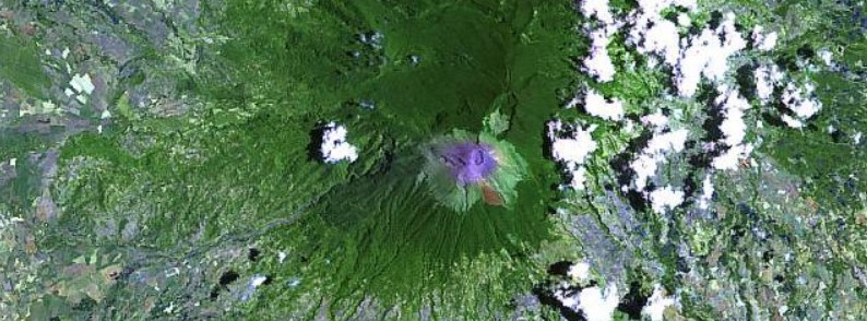
Featured image: NASA/Landsat image of Kanlaon volcano acquired in 2003. Credit: Hawaii Synergy Project, Univ. of Hawaii Institute of Geophysics & Planetology
The Philippine Institute of Volcanology and Seismology (PHIVOLCS) has raised the alert status for Kanlaon volcano from Alert Level 1 (Low Level of Unrest) to Alert Level 2 (Moderate Level of Unrest) on Wednesday, November 15, 2017. The last eruption of this volcano took place in June 2016.
Kanlaon Volcano’s seismic monitoring network recorded a total of 279 deep volcanic earthquakes during the past 24 hours, PHIVOLCS said 01:45 UTC today.
Since August 18, 2017, the number of volcanic earthquakes detected per day has continued to increase. There has been no visible degassing or steaming from the active vent this year, although increased unrest could possibly develop into steam-driven or phreatic eruptions at the summit.
Alert Level 2 status now currently prevails over Kanlaon Volcano, which means that the volcano is undergoing a moderate level of unrest. There is a probable intrusion of magma at depth which may or may not lead to a magmatic eruption.
The local government units and the public are strictly reminded that entry into the 4-km (2.5 miles) radius Permanent Danger Zone (PDZ) is strictly prohibited due to the further possibilities of sudden and hazardous steam-driven or phreatic eruptions.
Civil aviation authorities must also advise pilots to avoid flying close to the volcano’s summit as ejecta from any sudden phreatic eruption can be hazardous to aircraft.
The last eruption of this volcano (phreatic) took place on June 15, 2016. There has been a general decline in activity since then, with seismicity at baseline levels, no significant deformation, low sulfur dioxide emissions and no steaming since September 29, 2016.
Geological summary
Kanlaon volcano (also spelled Canlaon), the most active of the central Philippines, forms the highest point on the island of Negros. The massive 2435-m-high (7 989 feet) andesitic stratovolcano is dotted with fissure-controlled pyroclastic cones and craters, many of which are filled by lakes.
The largest debris avalanche known in the Philippines traveled 33 km (20.5 miles) to the SW from Kanlaon. The summit of Kanlaon contains a 2-km-wide (1.2 miles), elongated northern caldera with a crater lake and a smaller, but higher, historically active vent, Lugud crater, to the south.
Historical eruptions from Kanlaon, recorded since 1866, have typically consisted of phreatic explosions of small-to-moderate size that produce minor ashfalls near the volcano. (GVP)
I'm a dedicated researcher, journalist, and editor at The Watchers. With over 20 years of experience in the media industry, I specialize in hard science news, focusing on extreme weather, seismic and volcanic activity, space weather, and astronomy, including near-Earth objects and planetary defense strategies. You can reach me at teo /at/ watchers.news.
Commenting rules and guidelines
We value the thoughts and opinions of our readers and welcome healthy discussions on our website. In order to maintain a respectful and positive community, we ask that all commenters follow these rules.