
Meteotsunamis, an underrated hazard in the Great Lakes
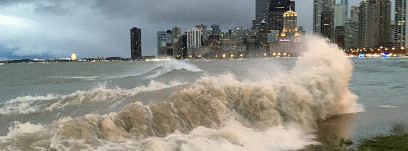
Image credit: NOAA
A team of scientists led by the University of Wisconsin-Madison has found that small, 30 cm (1 foot), meteotsunamis happen more than 100 times per year on the Great Lakes, while larger ones of nearly 90 cm (3 feet) occur once per year on average. The timing of most meteotsunamis in the Great Lakes is the cause for concern.
Meteotsunamis are single waves, often mistaken for seiches. They are similar to, but smaller than, tsunamis caused by earthquakes or landslides. Instead of being caused by seismic activity, meteotsunamis are formed by strong storms that move over the water.
These waves are mainly associated with atmospheric gravity waves, pressure jumps, frontal passages, squalls and other types of atmospheric disturbances, which normally generate barotropic ocean waves in the open ocean and amplify them near the coast through specific resonance mechanisms. These waves can produce severe damage to coastal structures and can cause the loss of human life.
The team analyzed 20 years of data from 32 water-level stations on the US side of the Great Lakes and found that most meteotsunamis occur in late spring to early summer, coinciding with the beginning of the recreational season on the lakes. Most occur in the southwest part of the Great Lakes, with Lake Michigan having the most and lakes Ontario and Superior having the least.
"Because it coincides with the beginning of summer swimming and recreation, this puts many lake users at risk," said Adam Bechle, lead researcher. "These findings indicate that meteotsunamis have been an underrated hazard for the Great Lakes region."
"In the past," he said, "we tended to only think of meteotsunamis as being large and destructive events that were 1.8 m (6 feet) high and washed dozens of people off shore.” "We thought of them as rare. And it’s true – events of that magnitude are quite rare. But with this study, we wanted to get a picture of the more moderately sized events. A one-foot water level change over a short time period can be dangerous for coastal infrastructure and can cause coastal bluff erosion, dangerous rip currents ,and nearshore sediment transport.”
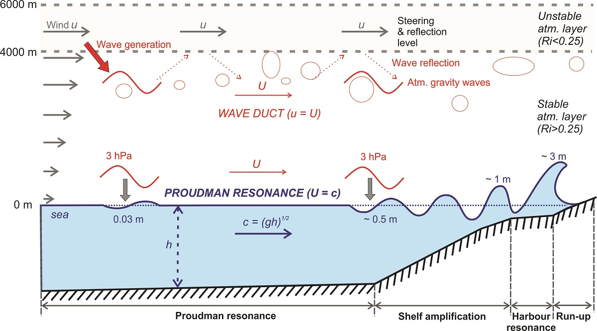
Illustration of the meteotsunami generation processes. Numerous atmospheric gravity waves (represented by bubbles) are generated at the interface of unstable and stable atmospheric layer at places of strong wind shear. Air pressure change (a surface manifestation of atmospheric gravity waves) generates long-ocean waves which can be amplified through several processes: (1) Proudman resonance (due to matching of long-ocean waves speed and speed of atmospheric gravity wave); (2) shelf amplification (due to shoaling); and (3) harbour resonance (due to matching of frequency of incoming long-ocean waves and harbour eigenfrequencies). Incoming ocean waves can be amplified more than 100 times before hitting the coast as a destructive meteotsunami (figure taken from Šepić et al., 2015).
Notable Great Lakes meteotsunamis happened recently in 2012, when three swimmers were rescued after being swept offshore into Lake Erie near Cleveland, and in 2014, when a Lake Superior meteotsunami overtopped the Soo Locks, interrupting shipping operations and prompting homes to be evacuated in Sault Ste. Marie, Ontario.
The researchers, who looked at meteotsunamis in Lake Michigan previously, wanted a larger perspective on when and where they were happening in the Great Lakes with this project. They analyzed water level measurements taken from 1994 to 2015.
Although they didn’t notice any trends in meteotsunami frequency during that time span, they did see peaks in the number of meteotsunamis during 2000 and 2011. Lower meteotsunami activity occurred during 2005 through 2007.
“That may mean there’s some sort of oscillation going on possibly,” Bechle said. “We still need to look at things like El Nino or other sorts of interannual weather patterns to see if there’s some sort of a tie-in with climatic variables.”
The team also looked at what future climate conditions might hold for meteotsunamis.
Larger meteotsunamis tend to be associated with convective thunderstorms, and more such storms are projected for the Great Lakes. “It’s not a strong tie-in, but it’s logical to think that if the potential for convective thunderstorms increases, then meteotsunamis might be more frequent as well,” Bechle said.

Meteotsunamis with wave heights more than 3 meters. Credit: Jadranka Šepić
Historically, the biggest identified meteotsunami happened in Vela Luka, Croatian island of Korčula on June 21, 1978. Its height was 5.9 m (19.3 feet). The event lasted for several hours and was observed on both Italian and Croatian coast. Luckily, this one didn't cause any fatalities.
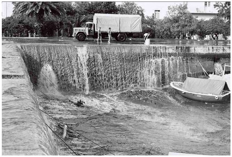
Meteotsunami in Vela Luka, Korcula, Croatia on June 21, 1978. Credit: Jadranka Šepić
The next one, size-wise, happened on March 31, 1979 in Nagasaki Bay, Japan. Its height was 5 m (16.4 feet) and it caused 3 known fatalities.
In the United States, the biggest known meteotsunami happened on June 26, 1954 in Chicago, Illinois. Its height was 3 m (9.8 feet) and it caused 7 fatalities. The most ever recorded as a result of this phenomenon.
The Watchers team and our contributors bring the latest on extreme weather, earthquakes, volcanic eruptions, space weather, and all things science. We're all about making sense of the natural world and keeping you informed on what’s happening. Got a tip or a question? Hit us up using the form at newstips!
Commenting rules and guidelines
We value the thoughts and opinions of our readers and welcome healthy discussions on our website. In order to maintain a respectful and positive community, we ask that all commenters follow these rules.