
Tropical depression brings heavy rain and strong winds to SE China, Hong Kong
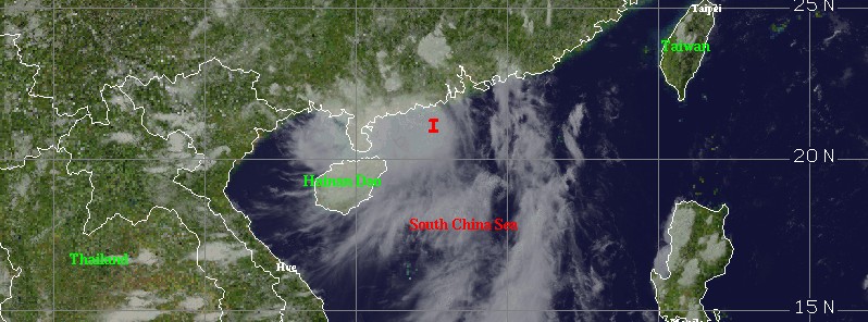
Image credit: UW-CIMSS
A tropical depression that formed over the South China Sea on May 26 is about to make landfall over the SE China's Guangdong province, bordering Hong Kong. The system is bringing heavy rain and strong winds.
According to Hong Kong Observatory, the depression had maximum sustained winds of about 45 km/h (28 mph) at 08:30 UTC today. The system is forecast to move north or northwest at about 20 km/h (12.4 mph) edging closer to the coast of western Guangdong. The observatory expects scattered squally showers, thunderstorms, and moderate to rough seas.
The depression has already drenched Hainan over the past couple of days as it passed just east of the island.

Tropical depression over the East China Sea – IR NHC image – 07:30 UTC on May 27, 2016. Credit: UW-CIMSS
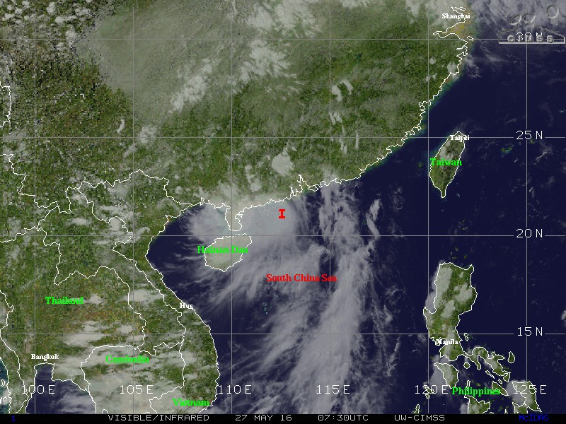
Tropical depression over the East China Sea – VIS/SWIR image – 07:30 UTC on May 27, 2016. Credit: UW-CIMSS
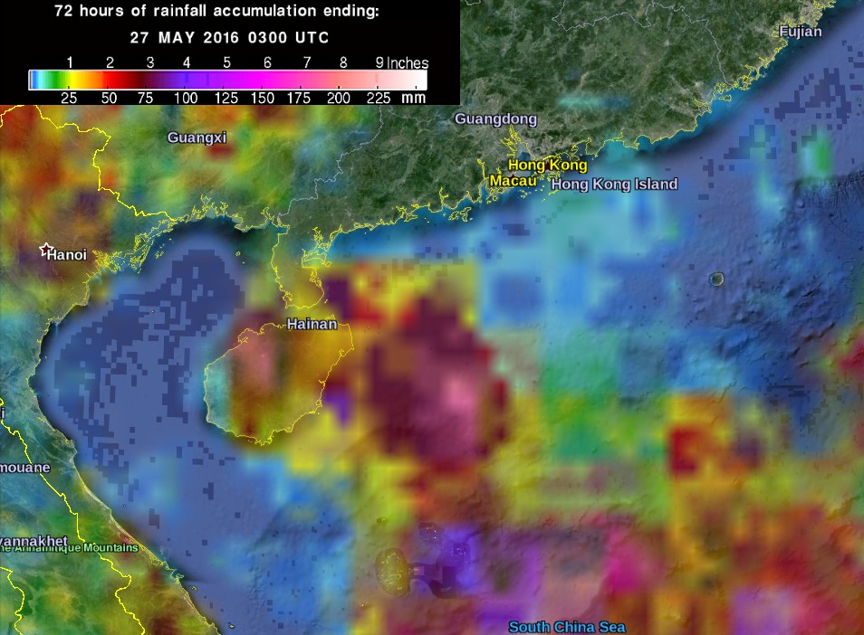
72 hours of rainfall accumulation by 03:00 UTC on May 27, 2016. Credit: NASA/JAXA GPM; Google
The Watchers team and our contributors bring the latest on extreme weather, earthquakes, volcanic eruptions, space weather, and all things science. We're all about making sense of the natural world and keeping you informed on what’s happening. Got a tip or a question? Hit us up using the form at newstips!
Commenting rules and guidelines
We value the thoughts and opinions of our readers and welcome healthy discussions on our website. In order to maintain a respectful and positive community, we ask that all commenters follow these rules.