
Active volcanoes in the world: December 12 – December 18, 2012
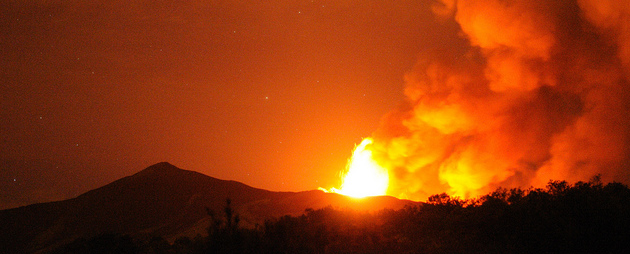
Image credit: Etna Volcano Paroxysmal Eruption July 30 2011 - CC by gnuckx
New unrest has been noticed around 8 volcanoes, ongoing activity was reported for 12 volcanoes. This report covers active volcanoes in the world recorded from December 12 – December 18, 2012 based on Smithsonian/USGS criteria.
New activity/unrest: | Chirpoi, Kuril Islands (Russia) | Karangetang
Ongoing activity: | Bagana, Bougainville | Batu Tara, Komba Island (Indonesia) | Fuego, Guatemala |Karymsky, Eastern Kamchatka (Russia) | Kizimen, Eastern Kamchatka (Russia) | Manam, Northeast of New Guinea (SW Pacific) | Mayon, Luzon | Paluweh, Lesser Sunda Islands (Indonesia) | Popocatépetl, México | Sakura-jima, Kyushu | Santa María, Guatemala | Shiveluch, Central Kamchatka (Russia)
The Weekly Volcanic Activity Report is a cooperative project between the Smithsonian’s Global Volcanism Program and the US Geological Survey’s Volcano Hazards Program. Updated by 23:00 UTC every Wednesday, notices of volcanic activity posted on these pages are preliminary and subject to change as events are studied in more detail. This is not a comprehensive list of all of Earth’s volcanoes erupting during the week, but rather a summary of activity at volcanoes that meet criteria discussed in detail in the “Criteria and Disclaimers” section. Carefully reviewed, detailed reports on various volcanoes are published monthly in the Bulletin of the Global Volcanism Network.
New activity/unrest
CHIRPOI, Kuril Islands (Russia)
46.525°N, 150.875°E; summit elev. 742 m
SVERT reported that a thermal anomaly was detected over Snow, a volcano of Chirpoi, during 11 and 13-15 December. A steam-and-gas plume was observed on 15 December. Cloud cover prevented observations of the volcano on other days during 10-17 December.
Geologic summary: Chirpoi, a small island lying between the larger islands of Simushir and Urup, contains a half dozen volcanic edifices constructed within an 8-9 km wide, partially submerged caldera. The southern rim of the caldera is exposed on nearby Brat Chirpoev Island. Two volcanoes on Chirpoi Island have been historically active. The symmetrical Cherny volcano, which forms the 691 m high point of the island, erupted twice during the 18th and 19th centuries. The youngest volcano, Snow, originated between 1770 and 1810. It is composed almost entirely of lava flows, many of which have reached the sea on the southern coast. No historical eruptions are known from 742-m-high Brat Chirpoev, but its youthful morphology suggests recent strombolian activity.
KARANGETANG , Siau I
2.78°N, 125.40°E; summit elev. 1784 m
Based on analyses of satellite imagery and wind data, the Darwin VAAC reported that on 16 December an ash plume from Karangetang rose to an altitude of 3 km (10,000 ft) a.s.l. and drifted 110 km SW.
Geologic summary: Karangetang (also known as Api Siau) lies at the northern end of the island of Siau, N of Sulawesi, and contains five summit craters strung along a N-S line. One of Indonesia’s most active volcanoes, Karangetang has had more than 40 recorded eruptions since 1675. Twentieth-century eruptions have included frequent explosions, sometimes accompanied by pyroclastic flows and lahars.
KILAUEA, Hawaii (USA)
19.421°N, 155.287°W; summit elev. 1222 m
During 12-18 December HVO reported that on most days the circulating lava lake periodically rose and fell in the deep pit within Kilauea’s Halema’uma’u Crater. Occasional measurements indicated that the gas plume from thevent continued to deposit variable amounts of ash, spatter, and Pele’s hair onto nearby areas.
At Pu’u ‘O’o Crater, glow emanated from spatter cones on the SE part of the crater floor, from a spatter cone at the NW edge of the floor, and from a lava lake on the NE part of the floor which was mostly covered by a spatter cone. The lava lake overflowed during 12-13 December, and on 13 December lava flowed from the SW spatter cone. On 14 December the N rim of the NE spatter cone/lava lake collapsed and was followed by a brief overflow of the lake. A larger lava flow issued from a spatter cone on the N edge of the crater floor, followed by another smaller flow; both flows traveled W, then split and flowed N and S. Another rim collapse from the NE spatter cone/lava lake and small overflow were observed the next day.
Lava flows remained active in two branches on the coastal plain: a small W branch, and a larger E branch with scattered activity extending from the pali to the coast E of the easternmost boundary of Hawai’i Volcanoes National Park. An ocean entry was marked by a weak and variable plume near Kupapa’u, with lava entering the water in at least two different areas. A new lava flow at the top of the pali was observed on 11 December. On 15 December observers noted that lava flows were active in a 1-km-wide area that stretched from near the base of the pali to the coast. On 16 December HVO noted that a lava delta at the ocean entry had slowly grown to be 50 m wide.
Geologic summary: Kilauea, one of five coalescing volcanoes that comprise the island of Hawaii, is one of the world’s most active volcanoes. Eruptions at Kilauea originate primarily from the summit caldera or along one of the lengthy E and SW rift zones that extend from the caldera to the sea. About 90% of the surface of Kilauea is formed of lava flows less than about 1,100 years old; 70% of the volcano’s surface is younger than 600 years. A long-term eruption from the East rift zone that began in 1983 has produced lava flows covering more than 100 sq km, destroying nearly 200 houses and adding new coastline to the island.
KLIUCHEVSKOI, Central Kamchatka (Russia)
56.057°N, 160.638°E; summit elev. 4835 m
KVERT reported that during 7-14 December video footage and satellite imagery showed Strombolian explosions at Kliuchevskoi, along with crater incandescence and gas-and-steam emissions. A thermal anomaly was detected in satellite images during 7-8, 10, and 12-13 December; cloud cover obscured views on the other days. The Aviation Color Code remained at Orange.
Geologic summary: Kliuchevskoi is Kamchatka’s highest and most active volcano. Since its origin about 7,000 years ago, the beautifully symmetrical, 4,835-m-high basaltic stratovolcano has produced frequent moderate-volume explosive and effusive eruptions without major periods of inactivity. More than 100 flank eruptions, mostly on the NE and SE flanks of the conical volcano between 500 m and 3,600 m elevation, have occurred during the past 3,000 years. The morphology of its 700-m-wide summit crater has been frequently modified by historical eruptions, which have been recorded since the late-17th century. Historical eruptions have originated primarily from the summit crater, but have also included major explosive and effusive events from flank craters.
LOKON-EMPUNG, Sulawesi
1.358°N, 124.792°E; summit elev. 1580 m
Based on ground reports from CVGHM, the Darwin VAAC reported that ash plumes rose from Lokon-Empung on 17 December.
Geologic summary: The twin volcanoes Lokon and Empung, rising about 800 m above the plain of Tondano, are among the most active volcanoes of Sulawesi. Lokon, the higher of the two peaks (whose summits are only 2.2 km apart) has a flat, craterless top. The morphologically younger Empung volcano has a 400-m-wide, 150-m-deep crater that erupted last in the 18th century, but all subsequent eruptions have originated from Tompaluan, a 150 x 250 m wide double crater situated in the saddle between the two peaks. Historical eruptions have primarily produced small-to-moderate ash plumes that have occasionally damaged croplands and houses, but lava-dome growth and pyroclastic flows have also occurred.
TOLBACHIK, Central Kamchatka (Russia)
55.830°N, 160.330°E; summit elev. 3682 m
KVERT reported that the S fissure along the W side of Tolbachinsky Dol, a lava plateau on the SW side of Tolbachik, continued to produce very fluid lava flows that traveled 17-20 km during 7-17 December. Strong seismicity was detected. Ash plumes rose less than 1 km and drifted in multiple directions, and at least two cones grew above the fissure. A very large thermal anomaly on the N part of Tolbachinsky Dol was visible in satellite imagery. The Aviation Color Code remained at Orange.
Geologic summary: The massive Tolbachik basaltic volcano is located at the southern end of the dominantly andesitic Kliuchevskaya volcano group. The Tolbachik massif is composed of two overlapping, but morphologically dissimilar volcanoes. The flat-topped Plosky Tolbachik shield volcano with its nested Holocene Hawaiian-type calderas up to 3 km in diameter is located east of the older and higher sharp-topped Ostry Tolbachik stratovolcano. The summit caldera at Plosky Tolbachik was formed in association with major lava effusion about 6500 years ago and simultaneously with a major southward-directed sector collapse of Ostry Tolbachik volcano. Lengthy rift zones extending NE and SSW of the volcano have erupted voluminous basaltic lava flows during the Holocene, with activity during the past two thousand years being confined to the narrow axial zone of the rifts. The 1975-76 eruption originating from the SSW-flank fissure system and the summit was the largest historical basaltic eruption in Kamchatka.
TUNGURAHUA, Ecuador
1.467°S, 78.442°W; summit elev. 5023 m
IG reported that on 1 December there was 47 mm of rainfall on the upper E and NE flanks of Tungurahua, generating lahars that descended the Vazcún drainage on the N flank. Seismic stations began recording signals representing the lahars at 1556, and by 1605 contingency plans were activated to warn people downstream. People at the resort of El Salado had been evacuated by the time the lahars reached the area. The lahar was 6 m deep, carried blocks 1-3 m in diameter, and covered drinking water tanks in some areas.
Seismicity at Tungurahua reported by IG increased during 12-14 December. A large explosion at 1435 on 14 December produced a “cannon shot” sound and shook the ground. An ash-and-steam plume rose 6-7 km and drifted NW. Pyroclastic flows traveled down the SW flank. The Washington VAAC reported that an 11-km-wide detached ash plume was observed in satellite imagery drifting 17 km SE. On 15 December IG reported that an explosion was followed by an ash-and-gas plume that rose 2 km above the crater and drifted S and SE. Small amounts of ash fell in Runtún (6 km NNE).
On 16 December a large explosion generated ash plumes that rose to a maximum height of 7 km and contained lightning. Other explosions generated ash plumes that rose 2 km. Satellite imagery showed ash plumes drifting 140 km NW, and 110 km NE at an altitude of 7.9 km (26,000 ft) a.s.l. Tephra fell in Cotaló (8 km NW), Pondoa (8 km N), Runtún, and Pillate (8 km W), and coarse ash fell in Baños (8 km N), Vascún, and Ulba (NNE). Medium-to-fine-grained ash fell in Palitahua (S), Choglontús (SW), Manzano (8 km SW), Capil, Guadalupe Observatory (11 km N), Cevallos (23 km NW), Tisaleo (29 km NW), Ambato (31 km NW), Patate (NW), Píllaro, Pelileo (8 km N), Salcedo, and Pujilí Latacunga, Rio Verde, Agoyán, and Palora. The larger explosions during the morning produced “cannon shots” that broke a window in a local building, and were followed by pyroclastic flows that descended the SW and NW flanks. During 16-17 December incandescent blocks were ejected from the crater and rolled down the flanks.
On 17 December satellite images showed ash plumes drifting 50-130 km NE, and a dense ash plume drifting over 200 km NE at an altitude of 7 km (23,000 ft) a.s.l. A thermal anomaly was also detected. IG noted that explosions continued to generate ash plumes, but with progressively decreasing ash content. Ash plumes drifted NNE and NE, causing ashfall in communities downwind. According to a news article, some of these communities were evacuated.
The VAAC noted that a thermal anomaly was detected on 18 December. Ash plumes drifted 70 km W and 40 km SW. IG reported that seismicity remained elevated, and two pyroclastic flows traveled at most 3-4 km down the flanks and burned vegetation. Explosions rattled structures and ejected incandescent blocks. Ash plumes rose 2-3 km above the crater and drifted NW, W, and SW. Ash fell in multiple areas, and accumulated between 1 and 2 mm during 17-18 December in Juive (7 km NNW).
Geologic summary: The steep-sided Tungurahua stratovolcano towers more than 3 km above its northern base. It sits ~140 km S of Quito, Ecuador’s capital city, and is one of Ecuador’s most active volcanoes. Historical eruptions have all originated from the summit crater. They have been accompanied by strong explosions and sometimes by pyroclastic flows and lava flows that reached populated areas at the volcano’s base. The last major eruption took place from 1916 to 1918, although minor activity continued until 1925. The latest eruption began in October 1999 and prompted temporary evacuation of the town of Baños on the N side of the volcano.
ULAWUN, New Britain
5.05°S, 151.33°E; summit elev. 2334 m
RVO reported that dense gray-brown ash plumes that began rising from Ulawun on 6 November ceased on 11 December. During 12-16 December variable amounts of white vapor plumes rose from the crater.
Geologic summary: The symmetrical basaltic to andesitic Ulawun stratovolcano is the highest volcano of the Bismarck arc, and one of Papua New Guinea’s most frequently active. Ulawun rises above the N coast of New Britain opposite Bamus volcano. The upper 1,000 m of the 2,334-m-high volcano is unvegetated. A steep-walled valley cuts the NW side of the volcano, and a flank lava-flow complex lies to the S of this valley. Historical eruptions date back to the beginning of the 18th century. Twentieth-century eruptions were mildly explosive until 1967, but after 1970 several larger eruptions produced lava flows and basaltic pyroclastic flows, greatly modifying the summit crater.
Ongoing activity
BAGANA, Bougainville
6.140°S, 155.195°E; summit elev. 1750 m
RVO reported that white vapor from Bagana was emitted during 1 November-12 December. Occasional weak incandescence from the crater was observed at night during 3-8, 10, 17-20, and 29-30 November. An eruption during 1200-1300 on 13 December was followed by light ashfall in Arawa (40 km SE) and heavier ashfall in Manetai (11 km E). A small amount of ashfall was reported in Arawa the next day; the volcano was mostly quiet during 14-15 December.
Geologic summary: Bagana volcano, occupying a remote portion of central Bougainville Island, is one of Melanesia’s youngest and most active volcanoes. Bagana is a massive symmetrical lava cone largely constructed by an accumulation of viscous andesitic lava flows. The entire lava cone could have been constructed in about 300 years at its present rate of lava production. Eruptive activity at Bagana is characterized by non-explosive effusion of viscous lava that maintains a small lava dome in the summit crater, although explosive activity occasionally producing pyroclastic flows also occurs. Lava flows form dramatic, freshly preserved tongue-shaped lobes up to 50-m-thick with prominent levees that descend the volcano’s flanks on all sides.
BATU TARA, Komba Island (Indonesia)
7.792°S, 123.579°E; summit elev. 748 m
Based on analyses of satellite imagery and wind data, the Darwin Volcanic Ash Advisory Centre (VAAC) reported that on 14 December ash plumes from Batu Tara rose to an altitude of 2.4 km (8,000 ft) a.s.l. and drifted 75 km NW.
Geologic summary: The small isolated island of Batu Tara in the Flores Sea about 50 km north of Lembata (formerly Lomblen) Island contains a scarp on the eastern side similar to the Sciara del Fuoco of Italy’s Stromboli volcano. Vegetation covers the flanks of Batu Tara to within 50 m of the 748-m-high summit. Batu Tara lies north of the main volcanic arc and is noted for its potassic leucite-bearing basanitic and tephritic rocks. The first historical eruption from Batu Tara, during 1847-52, produced explosions and a lava flow.
FUEGO, Guatemala
14.473°N, 90.880°W; summit elev. 3763 m
INSIVUMEH reported that during 12-14 December explosions from Fuego produced ash plumes that rose about 140-190 m and drifted SW. Incandescent lava flows traveled 150-200 m down the flanks. During 15-16 December lava flows traveled 200 m SW down the Taniluya drainage, producing incandescent block avalanches from the lava-flow fronts. Explosions during 17-18 December produced ash plumes that rose 400 m and drifted 7 km W and SW. Incandescence emanated 150 m above the crater. Blocks from lava-flow fronts in the Taniluya drainage rolled down the flanks, reaching vegetated areas.
Geologic summary: Volcán Fuego, one of Central America’s most active volcanoes, is one of three large stratovolcanoes overlooking Guatemala’s former capital, Antigua. The scarp of an older edifice, Meseta, lies between 3,763-m-high Fuego and its twin volcano to the N, Acatenango. Construction of Meseta volcano continued until the late Pleistocene or early Holocene, after which growth of the modern Fuego volcano continued the southward migration of volcanism that began at Acatenango. Frequent vigorous historical eruptions have been recorded at Fuego since the onset of the Spanish era in 1524, and have produced major ashfalls, along with occasional pyroclastic flows and lava flows. The last major explosive eruption from Fuego took place in 1974, producing spectacular pyroclastic flows visible from Antigua.
KARYMSKY, Eastern Kamchatka (Russia)
54.05°N, 159.45°E; summit elev. 1536 m
KVERT reported that weak-to-moderate seismic activity at Karymsky was detected during 7-14 December. Seismic data indicated that ash plumes possibly rose to an altitude of 3 km (9,800 ft) a.s.l. on 12 December. Satellite imagery showed a thermal anomaly on the volcano on 9 and 12-13 December. The Aviation Color Code remained at Orange.
Geologic summary: Karymsky, the most active volcano of Kamchatka’s eastern volcanic zone, is a symmetrical stratovolcano constructed within a 5-km-wide caldera that formed about 7,600-7,700 radiocarbon years ago. Construction of the Karymsky stratovolcano began about 2,000 years later. The latest eruptive period began about 500 years ago, following a 2,300-year quiescence. Much of the cone is mantled by lava flows less than 200 years old. Historical eruptions have been Vulcanian or Vulcanian-Strombolian with moderate explosive activity and occasional lava flows from the summit crater. Most seismicity preceding Karymsky eruptions has originated beneath Akademia Nauk caldera, which is located immediately S of Karymsky volcano and erupted simultaneously with Karymsky in 1996.
KIZIMEN, Eastern Kamchatka (Russia)
55.130°N, 160.32°E; summit elev. 2376 m
KVERT reported that seismic activity at Kizimen had gradually decreased. Video data showed incandescence from the crater and moderate gas-and-steam activity. Satellite images detected a thermal anomaly over the volcano but the intensity of the anomaly had also gradually decreased. On 12 December the Aviation Color Code was lowered to Yellow.
Geologic summary: Kizimen is an isolated, conical stratovolcano that is morphologically similar to Mount St. Helens prior to its 1980 eruption. The summit of Kizimen consists of overlapping lava domes, and blocky lava flows descend the flanks of the volcano, which is the westernmost of a volcanic chain north of Kronotsky volcano. The 2,376-m-high Kizimen was formed during four eruptive cycles beginning about 12,000 years ago and lasting 2,000-3,500 years. The largest eruptions took place about 10,000 and 8300-8400 years ago, and three periods of longterm lava-dome growth have occurred. The latest eruptive cycle began about 3,000 years ago with a large explosion and was followed by lava-dome growth lasting intermittently about 1,000 years. An explosive eruption about 1,100 years ago produced a lateral blast and created a 1.0 x 0.7 km wide crater breached to the NE, inside which a small lava dome (the fourth at Kizimen) has grown. A single explosive eruption, during 1927-28, has been recorded in historical time.
MANAM, Northeast of New Guinea (SW Pacific)
4.080°S, 145.037°E; summit elev. 1807 m
RVO reported that during 8-14 December both diffuse and dense ash plumes rose 400 m above Manam’s Southern Crater and drifted NW. Ejected incandescent tephra was observed at night, and small volumes of lava continued to flow from two vents located on the upper slopes of the SE valley. White vapor plumes rose from Main Crater during the reporting period.
Geologic summary: The 10-km-wide island of Manam, lying 13 km off the northern coast of mainland Papua New Guinea, is one of the country’s most active volcanoes. Four large radial valleys extend from the unvegetated summit of the conical 1807-m-high basaltic-andesitic stratovolcano to its lower flanks. These “avalanche valleys,” regularly spaced 90 degrees apart, channel lava flows and pyroclastic avalanches that have sometimes reached the coast. Two summit craters are present; both are active, although most historical eruptions have originated from the southern crater, concentrating eruptive products during much of the past century into the SE avalanche valley. Frequent historical eruptions, typically of mild-to-moderate scale, have been recorded at Manam since 1616. Occasional larger eruptions have produced pyroclastic flows and lava flows that reached flat-lying coastal areas and entered the sea, sometimes impacting populated areas.
MAYON, Luzon
13.257°N, 123.685°E; summit elev. 2462 m
PHIVOLCS reported that since the Alert Level for Mayon was lowered to 1 on 2 March, seismicity decreased, and ground and tilt monitoring data suggested regional faulting and not magmatic intrusion. Steaming from the crater was diffuse and crater incandescence had ceased in March. Sulfur dioxide emissions had decreased to below baseline levels. On 27 November the Alert Level was lowered to 0 and the public was reminded not to enter the 6-km-radius Permanent Danger Zone (PDZ).
Geologic summary: Beautifully symmetrical Mayon volcano, which rises to 2,462 m above the Albay Gulf, is the Philippines’ most active volcano. The structurally simple volcano has steep upper slopes that average 35-40° and is capped by a small summit crater. The historical eruptions of this basaltic-andesitic volcano date back to 1616 and range from Strombolian to basaltic Plinian. Eruptions occur predominately from the central conduit and have also produced lava flows that travel far down the flanks. Pyroclastic flows and mudflows have commonly swept down many of the approximately 40 ravines that radiate from the summit and have often devastated populated lowland areas. Mayon’s most violent eruption, in 1814, killed more than 1,200 people and devastated several towns. Eruptions that began in February 2000 led PHIVOLCS to recommend on 23 February 2000 the evacuation of people within a radius of 7 km from the summit in the SE and within a 6 km radius for the rest of the volcano.
PALUWEH, Lesser Sunda Islands (Indonesia)
8.32°S, 121.708°E; summit elev. 875 m
Based on analyses of satellite imagery and wind data, the Darwin VAAC reported that during 14-15 Decemberash plumes from Paluweh rose to an altitude of 3 km (10,000 ft) a.s.l. and drifted 35-65 km NW and W. On 17 December an ash plume rose to an altitude of 1.5 km (5,000 ft) a.s.l. and drifted 55 km E. The next day an ash plume drifted 55 km E at altitudes of 3.4-3.7 km (11,000-12,000 ft) a.s.l.
Geologic summary: Paluweh volcano, also known as Rokatenda, forms the 8-km-wide island of Paluweh N of the volcanic arc that cuts across Flores Island. Although the volcano rises about 3,000 m above the sea floor, its summit reaches only 875 m above sea level. The broad irregular summit region contains overlapping craters up to 900 m wide and several lava domes. Several flank vents occur along a NW-trending fissure. The largest historical eruption of Paluweh occurred in 1928, when a strong explosive eruption was accompanied by landslide-induced tsunamis and lava-dome emplacement.
POPOCATEPETL, México
19.023°N, 98.622°W; summit elev. 5426 m
CENAPRED reported that during 12-18 December seismicity at Popocatépetl indicated continuing gas-and-steam emissions that contained minor amounts of ash. Variable incandescence from the crater was observed most nights. During 13-15 December gas-and-steam plumes rose at most 1 km above the crater and drifted NE, E, and SE. On 17 December ejected incandescent tephra landed 500 m away from the crater on the NE flank. The Alert Level remained at Yellow, Phase Two.
Geologic summary: Popocatépetl, whose name is the Aztec word for smoking mountain, towers to 5,426 m 70 km SE of Mexico City and is North America’s second-highest volcano. Frequent historical eruptions have been recorded since the beginning of the Spanish colonial era. A small eruption on 21 December 1994 ended five decades of quiescence. Since 1996 small lava domes have incrementally been constructed within the summit crater and destroyed by explosive eruptions. Intermittent small-to-moderate gas-and-ash eruptions have continued, occasionally producing ashfall in neighboring towns and villages.
SAKURA-JIMA, Kyushu
31.585°N, 130.657°E; summit elev. 1117 m
JMA reported that during 10-14 December explosions from Sakura-jima’s Showa Crater ejected tephra as far as 1.8 km from the crater. Very small eruptions occurred at Minami-dake Crater periodically. Based on information from JMA, the Tokyo VAAC reported that explosions during 12-18 December often produced plumes that rose to altitudes of 1.5-2.4 km (5,000-8,000 ft) a.s.l. and drifted N, NE, E, and SE. Pilots reported that ash plumes rose to an altitude of 2.1 km (7,000 ft) a.s.l. on 13 and 16 December.
Geologic summary: Sakura-jima, one of Japan’s most active volcanoes, is a post-caldera cone of the Aira caldera at the northern half of Kagoshima Bay. Eruption of the voluminous Ito pyroclastic flow was associated with the formation of the 17 x 23-km-wide Aira caldera about 22,000 years ago. The construction of Sakura-jima began about 13,000 years ago and built an island that was finally joined to the Osumi Peninsula during the major explosive and effusive eruption of 1914. Activity at the Kita-dake summit cone ended about 4,850 years ago, after which eruptions took place at Minami-dake. Frequent historical eruptions, recorded since the 8th century, have deposited ash on Kagoshima, one of Kyushu’s largest cities, located across Kagoshima Bay only 8 km from the summit. The largest historical eruption took place during 1471-76.
SANTA MARIA, Guatemala
14.756°N, 91.552°W; summit elev. 3772 m
INSIVUMEH reported that during 12-13 December incandescence from Santa María’s Santiaguito lava-dome complex was visible and lava flows were active on the flanks. During 13-14 December avalanches were produced from the fronts of lava flows on the SE flank. Ash plumes that rose from the avalanches drifted 10 km S, producing ashfall in La Florida (5 km S) and El Faro (SW flank). During 15-18 December incandescence emanated from the SW part of the lava dome. Avalanches were again produced from the fronts of lava flows on the SE flank. Ash plumes from the avalanches drifted 8 km during 15-16 December.
Geologic summary: Symmetrical, forest-covered Santa María volcano is one of a chain of large stratovolcanoes that rises dramatically above the Pacific coastal plain of Guatemala. The stratovolcano has a sharp-topped, conical profile that is cut on the SW flank by a large, 1-km-wide crater, which formed during a catastrophic eruption in 1902 and extends from just below the summit to the lower flank. The renowned Plinian eruption of 1902 followed a long repose period and devastated much of SW Guatemala. The large dacitic Santiaguito lava-dome complex has been growing at the base of the 1902 crater since 1922. Compound dome growth at Santiaguito has occurred episodically from four westward-younging vents, accompanied by almost continuous minor explosions and periodic lava extrusion, larger explosions, pyroclastic flows, and lahars.
SHIVELUCH. Central Kamchatka (Russia)
56.653°N, 161.360°E; summit elev. 3283 m
Based on visual observations and analyses of satellite data, KVERT reported that during 7-14 December a viscous lava flow continued to effuse on the NW flank of Shiveluch’s lava dome, accompanied by hot avalanches, incandescence, and fumarolic activity. Satellite imagery showed a daily thermal anomaly on the lava dome. The Aviation Color Code remained at Orange.
Geologic summary: The high, isolated massif of Shiveluch volcano (also spelled Sheveluch) rises above the lowlands NNE of the Kliuchevskaya volcano group and forms one of Kamchatka’s largest and most active volcanoes. The currently active Molodoy Shiveluch lava-dome complex was constructed during the Holocene within a large breached caldera formed by collapse of the massive late-Pleistocene Strary Shiveluch volcano. At least 60 large eruptions of Shiveluch have occurred during the Holocene, making it the most vigorous andesitic volcano of the Kuril-Kamchatka arc. Frequent collapses of lava-dome complexes, most recently in 1964, have produced large debris avalanches whose deposits cover much of the floor of the breached caldera. Intermittent explosive eruptions began in the 1990s from a new lava dome that began growing in 1980. The largest historical eruptions from Shiveluch occurred in 1854 and 1964.
Source: Global Volcanism Program
I'm a dedicated researcher, journalist, and editor at The Watchers. With over 20 years of experience in the media industry, I specialize in hard science news, focusing on extreme weather, seismic and volcanic activity, space weather, and astronomy, including near-Earth objects and planetary defense strategies. You can reach me at teo /at/ watchers.news.
Commenting rules and guidelines
We value the thoughts and opinions of our readers and welcome healthy discussions on our website. In order to maintain a respectful and positive community, we ask that all commenters follow these rules.