
Floods and landslides hit Philippines, evacuations as Urduja becomes a tropical storm
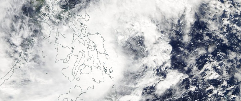
Featured image: Tropical Storm "Urduja" (Kai-Tak) on December 14, 2017. Credit: NASA Aqua/MODIS
Tropical Depression "Urduja" strengthened into a tropical storm, internationally known as Kai-Tak, early Thursday, December 14, 2017, on its way toward Samar Province, the Philippines. The cyclone is already causing floods and landslides, prompting officials to issue evacuation orders. This is the 26th named storm of the 2017 Pacific typhoon season.
Some 900 people were evacuated today after 12 hours of heavy rains triggered flash floods and landslides in the province of Misamis Oriental, the Provincial Disaster Risk, Reduction Management Office (PDRRMO) reported after flash floods hit Lagonglong.
The head of PDRRMO, Francisco Dy, said that five houses, made of light materials, were destroyed while another house in Balingasag was destroyed after it was hit by a landslide. Dy added that the city of El Salvador and the towns of Claveria, Opol, and Initao, all in the province’s west coast, were also on the PDRRMO’s watchlist. At this time, there are no reports of injuries.
The main bridge in Balingasag highway was temporarily closed after a crack was noticed and its approach caved in due to rising floodwaters, The Manila Times reported.
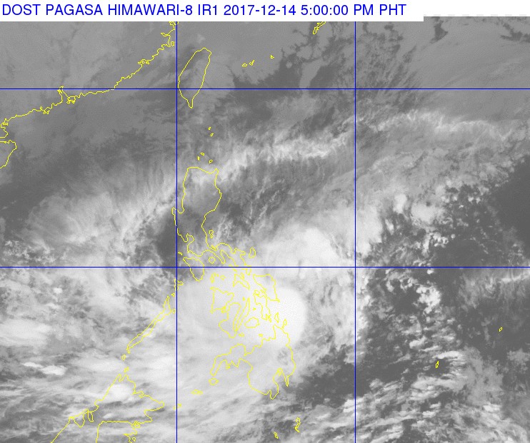
Tropical Storm "Urduja" (Kai-Tak) at 09:00 UTC on December 14, 2017. Credit: PAGASA, JMA/Himawari-8
At 09:00 UTC (17:00 PHT), the center of Tropical Storm "Urduja" was located 85 km (53 miles) ESE of Guiuan, Eastern Samar (see image above). Its maximum sustained winds were 65 km/h (40 mph) and gusts to 90 km/h (56 mph), according to PAGASA. The system is moving west at 7 km/h (4 mph)
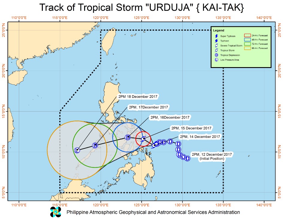
Urduja is expected to make landfall over Eastern Samar Friday morning (local time), December 15.
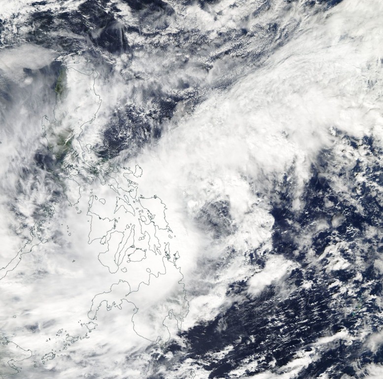
Tropical Storm "Urduja" (Kai-Tak) on December 14, 2017. Credit: NASA Aqua/MODIS
Estimated rainfall amount is from moderate to heavy within the 400 km (250 miles) diameter of the Tropical Storm.
Scattered to widespread rains is expected over the Visayas and the regions of Bicol, Caraga and Northern Mindanao within 24 hours. Residents in these areas are alerted against possible flashfloods and landslides.
Fisherfolks and those with small seacrafts are advised not to venture out over the eastern seaboard of Bicol Region and in the seaboards of Visayas due to rough to very rough seas associated with the approaching Tropical Storm.
Tropical Cyclone Warning Signal #2 (TCWS) is currently in effect for Eastern Samar, Samar and Biliran, Visayas. TCWS #1 is in effect for Catanduanes, Camarines Sur, Albay, Sorsogon, Masbate and Romblon, Luzon, and Northern Samar, Leyte, and Southern Leyte, Northern Cebu including Bantayan Island, Capiz, Aklan and Northern Iloilo, Visayas.
I'm a dedicated researcher, journalist, and editor at The Watchers. With over 20 years of experience in the media industry, I specialize in hard science news, focusing on extreme weather, seismic and volcanic activity, space weather, and astronomy, including near-Earth objects and planetary defense strategies. You can reach me at teo /at/ watchers.news.
Commenting rules and guidelines
We value the thoughts and opinions of our readers and welcome healthy discussions on our website. In order to maintain a respectful and positive community, we ask that all commenters follow these rules.