
One hell of a storm: Cape Town braces for major winter storm
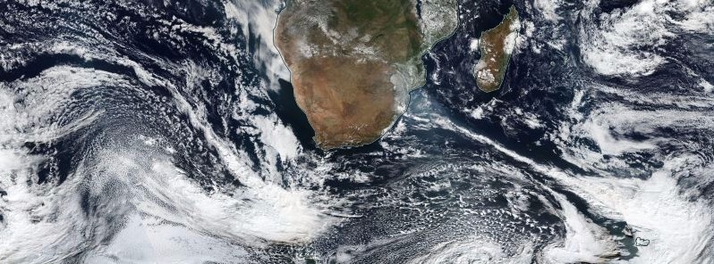
Image credit: NASA/NOAA Suomi NPP/VIIRS. Acquired: June 5, 2017.
South Africa's city of Cape Town is bracing for what is expected to be the worst winter storm in at least three years. Described by state forecasters as 'one hell of a storm,' this potent weather system is expected to start affecting the region late Tuesday, June 6, 2017. The storm will bring much-needed precipitation to drought-stricken region, but is not expected to end city's worst drought in more than 100 years. Officials have issued severe weather warnings and urged residents to take the storm seriously.
South African Weather Service is monitoring a potent cold front projected to affect the southern parts of the country starting late Tuesday, June 6 and into early hours of Wednesday, June 7. Their forecasters are unofficially calling the system moving into Cape Town 'one hell of a storm,' warning residents to make real preparations and be on high alert. Severe Weather Warnings are in place Tuesday for much of the country's south.
The storm is expected to bring 12 to 15 m (40 – 50 feet) swells, gale force winds of about 90 km/h (56 mph), and about 80 mm (3.15 inches) of rain within 24 hours.
"Residents should make real preparations for the storm and not take it lightly," South African Weather Service (SAWS) communications manager Hannelee Doubell said. "They should be prepared to stay inside their homes. Outside, they should tie down their belongings as we are expecting abnormally strong winds."
"We are on standby to minimize damage should the cold front became dangerous," Disaster Management Center spokeswoman Charlotte Powel said.
According to eNCA, the city hasn't seen a storm of this magnitude in a few years.
"It will have everything; rain, wind, cold, snow and big waves. Much-needed rain will fall from late Tuesday night and continue through Thursday, raising threat for localized urban flooding. Heavy rain will extend to Overberg and is expected over the western mountains of the Western Cape," their meteorologists said.
"Widespread snowfall will be associated with this system, with significant snowfalls possible for the western mountains of the Western Cape and the high ground of the Northern Cape, with models indicating up to 20 cm (7.9 inches) of snowfall in the vicinity of Sutherland."
The storm is coming amid the worst drought the city has seen in over a century.
Three dry winters have brought its dams at critically low levels, with less than 10% of available drinking water. However, the rain, although expected to fall in exactly the right places, is not expected to replenish city's water reserves. Experts say it will take at least three wet winters for the dams to reach normal levels.
I'm a dedicated researcher, journalist, and editor at The Watchers. With over 20 years of experience in the media industry, I specialize in hard science news, focusing on extreme weather, seismic and volcanic activity, space weather, and astronomy, including near-Earth objects and planetary defense strategies. You can reach me at teo /at/ watchers.news.
Let’s hope there’s no extended power failures!
Koeberg Nuclear Power Station
“It is located 30 km north of Cape Town…”
https://en.m.wikipedia.org/wiki/Koeberg_Nuclear_Power_Station