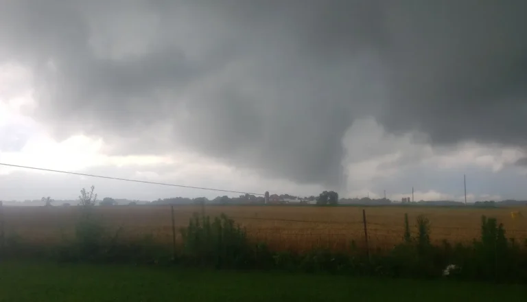
Damaging tornado touches down near Elberta, Alabama
A damaging tornado touched down near Elberta, Alabama, causing significant damage to multiple structures as a tornado-warned storm moved through Baldwin County on Sunday night, October 26, 2025.

A damaging tornado touched down near Elberta, Alabama, causing significant damage to multiple structures as a tornado-warned storm moved through Baldwin County on Sunday night, October 26, 2025.

Severe storms swept across parts of Texas through Friday night, October 24, 2025, leaving over 260 000 customers without power on Saturday morning, October 25. The storms caused significant damage in parts of northern and southeastern Texas, while heavy rainfall triggered widespread flooding across the Houston and Dallas–Fort Worth areas.

A potential tornado caused widespread damage near South Fort Worth, as severe storms moves through north and central Texas on Friday, October 24, 2025.
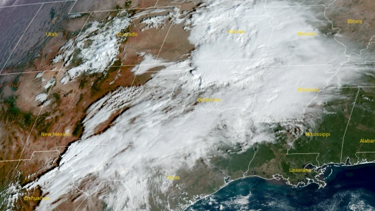
Heavy rain and severe thunderstorms are forecast to continue spreading across Texas and the southern Plains late Friday into early Saturday, October 24 into 25, 2025 bringing the threat of flash flooding, damaging winds, large hail, and isolated tornadoes.
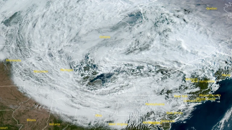
A multi-day lake-effect rain event is forecast to unfold over the Great Lakes starting Thursday, October 23, 2025. The event is forecast to drop 25 – 50 mm (1 – 2 inches) of rainfall along the I-90 corridor between Buffalo, New York, and Cleveland, Ohio, through the weekend.
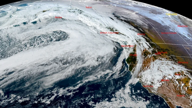
Two atmospheric rivers are forecast to hit the Pacific Northwest and northern California, starting late Thursday, October 23, 2025. The systems are forecast to bring in heavy rainfall of over 130 mm (5 inches) along with mountain snow across Washington, Oregon, and northern California.
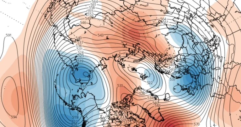
Forecast data indicate an early weakening and displacement of the stratospheric polar vortex over the Arctic in October 2025, as a developing high-pressure anomaly over Greenland interacts with the circulation earlier than usual, increasing the chances of colder air movement toward the mid-latitudes of North America and Europe.
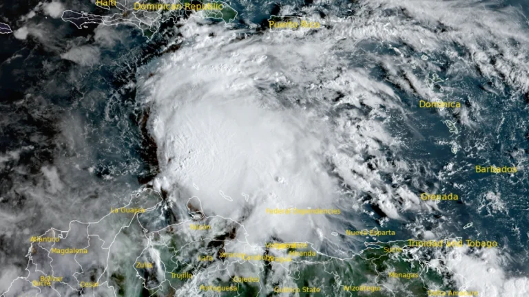
A low-pressure area in the Caribbean Sea, designated AL98, is forecast to develop into the 13th named storm of the 2025 Atlantic hurricane season, “Melissa,” later on October 21, 2025, with a 100% probability of cyclonic development within the next 48 hours.
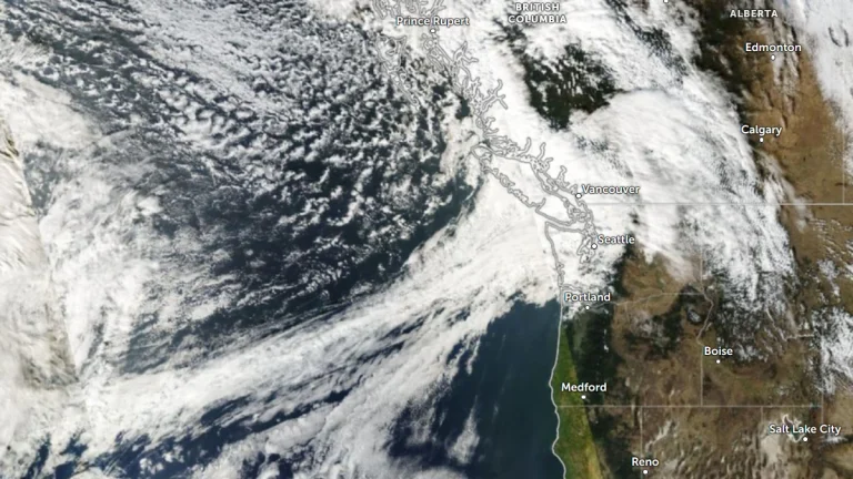
The Pacific Northwest will see back-to-back atmospheric rivers (ARs) beginning late Thursday, October 23, 2025, bringing significant precipitation and unsettled weather conditions through the end of October.The Weather Prediction Center has issued a Marginal Risk of excessive rainfall for coastal areas of Washington, Oregon, and northern California as the AR approaches.
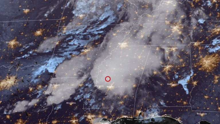
Several tornadoes were reported across Arkansas, Louisiana, and Mississippi on the evening of October 18, 2025, including a radar-confirmed tornadic debris signature 3 km (2 miles) southwest of Yazoo City, Mississippi, at 21:34 LT. Earlier, a tornado caused structural damage in Hot Spring County, Arkansas, near De Roche, while another debris signature was detected near Warsaw, Louisiana, as supercells moved east across the Lower Mississippi Valley.