Freeze Warning for all areas in Quad Cities region, U.S.
A freeze warning was issued for the Quad Cities region on Monday, October 14, 2024, the area braces for subfreezing temperatures.

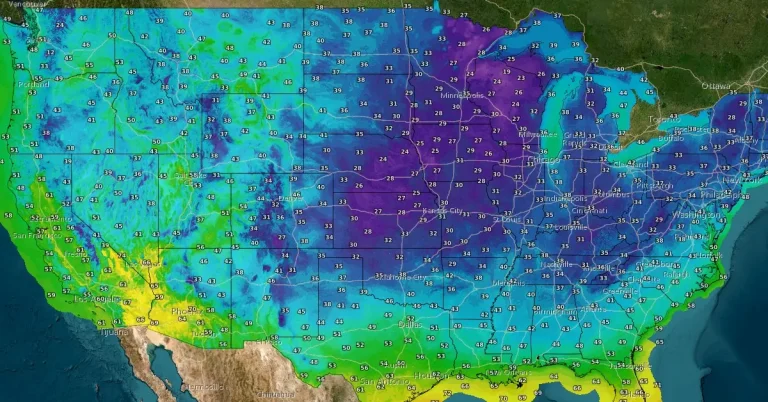
A freeze warning was issued for the Quad Cities region on Monday, October 14, 2024, the area braces for subfreezing temperatures.

An unusual buildup of snow from Siberia to North America in late October could destabilize the polar vortex, leading to colder and snowier conditions across the United States, Canada, and Europe this winter.
Frost and subfreezing temperatures are forecast for northern Illinois through the nights of October 15 and 16, 2024.
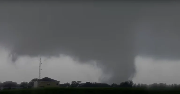
A rare EF-3 tornado tore through the Avenir community in Palm Beach Gardens, Florida on October 9, 2024, as Hurricane “Milton” unleashed a tornado outbreak across Florida.

Seismic activity at Mount Spurr volcano in Alaska remains elevated, with over 900 earthquakes detected so far in 2024, according to the Alaska Volcano Observatory (AVO). Despite the persistent unrest, no major shifts in earthquake frequency or intensity have been observed since the increase in seismic activity was first noted in April.

Georgia farmers have suffered over $6 billion worth of losses due to Hurricane “Helene” according to preliminary estimates released on Thursday, October 10, 2024.

Hurricane “Milton” made landfall near Siesta Key in Sarasota County along the west coast of Florida at 00:30 UTC on October 10, 2024, with maximum sustained winds of 205 km/h (120 mph) and a minimum central pressure of 954 hPa, making it a Category 3 hurricane.

Meteorologists at the National Weather Service in Miami have confirmed the 7th tornado linked to Hurricane “Milton” just hours before its expected landfall in Florida. As of 14:40 LT, 39 Tornado Warnings have been issued, with more tornadoes possible through the night. Tropical-storm-force winds have begun impacting Florida’s west coast, while rising water levels at the Naples Pier indicate the start of Milton’s storm surge across southwestern coastal areas. Multiple warnings remain in effect across the Florida peninsula.
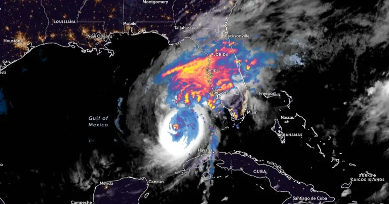
Category 5 Hurricane “Milton” is moving NE toward Florida, U.S. at 22 km/h (14 mph) with maximum sustained winds of 260 km/h (160 mph). Milton is forecast to make landfall late tonight or early Thursday along the Florida Gulf Coast, threatening large area with severe storm surges, destructive winds, and heavy rainfall.
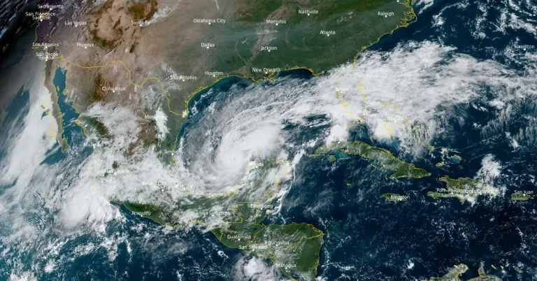
Hurricane “Milton” rapidly intensified on Monday, October 7, 2024, and is now a major category 4 hurricane on the Saffir-Simpson Hurricane Wind Scale. The National Hurricane Center (NHC) expects Milton to become a Category 5 hurricane today, making it the strongest Gulf of Mexico hurricane this late in the calendar year in the satellite era (since 1966). Milton is forecast to move near or just north of the Yucatán Peninsula today and Tuesday, then cross the eastern Gulf of Mexico and approach the west coast of the Florida Peninsula by Wednesday.
