
Scientists capture seafloor spreading in action for the first time beneath the Indian Ocean
Scientists have documented the first complete seafloor spreading event ever observed in real time, capturing how magma, fault movement, earthquakes and volcanic activity combine to create new oceanic crust beneath the Indian Ocean. Published in Nature on July 8, 2026, the study describes an event recorded by a dense network of instruments on the Southeast Indian Ridge that released deformation equivalent to nearly 39 years of steady plate motion in just over two weeks, providing the clearest direct record yet of how an oceanic ridge grows.
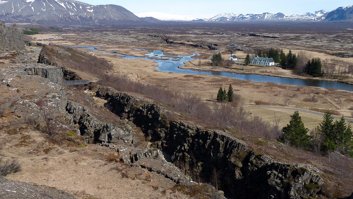
Rift zone in Þingvellir National Park, Iceland. Credit: Rob Young
The observations stem from the OHA-GEODAMS project, an international effort led by researchers from CNRS Terre & Univers to monitor deformation along the Southeast Indian Ridge near Amsterdam Island.
During February 2024, the team deployed hydrophones, acoustic geodetic transponders, bottom-pressure recorders and repeated multibeam surveys across an active spreading segment where the Australian and Antarctic plates separate at approximately 61–63 mm (2.4–2.5 inches) per year.
The observatory was designed to capture one of the short-lived tectono-magmatic episodes through which new oceanic crust forms, although no one knew how soon such an opportunity would arrive.
On April 26, 2024, just weeks after deployment, the instruments recorded an intense earthquake swarm beneath the ridge axis as a magma-filled dyke forced its way into the crust. The data remained on the seafloor until the observatory was revisited during a maintenance cruise in February 2025, when researchers recovered the instruments and realized they had recorded an entire spreading episode from beginning to end.
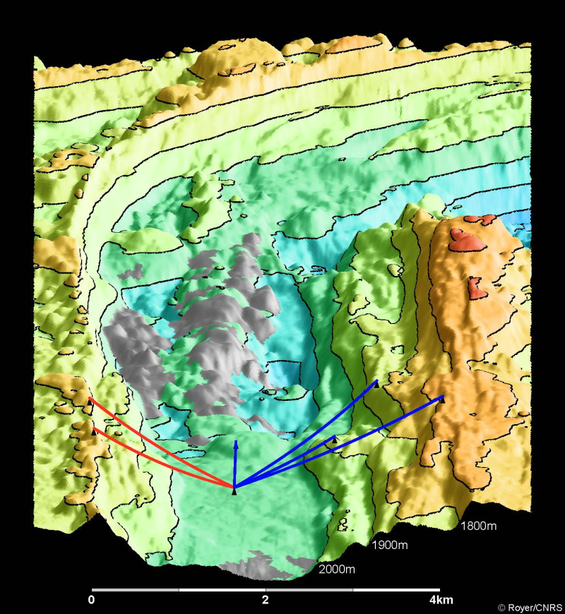
The intrusion propagated along the ridge axis at roughly 2–3 m (6.6–9.8 feet) per second, initially advancing southeast before encountering a structural barrier and reversing toward the northwest. As magma migrated through the crust, the ridge widened by more than 1 m (3.3 feet) within hours while the axial valley subsided by about 4 m (13 feet) as a shallow magma reservoir deflated. The intrusion ultimately fed a submarine eruption that emplaced approximately 160 million m³ (5.6 billion ft³) of lava over the following 16 days, with flows reaching nearly 100 m (328 feet) thick in places.
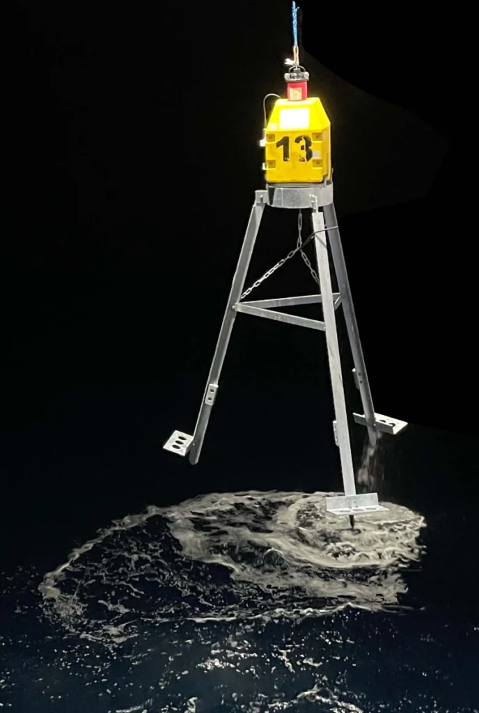
The eruption was detected not only through deformation measurements but also acoustically. Hydrophones recorded distinctive H-waves generated as lava entered seawater nearly 3 km (1.9 miles) beneath the surface, accompanied by a rise in bottom-water temperature.
Together, these observations allowed the researchers to reconstruct the timing of magma migration, eruption and fault movement with a level of detail that has not previously been possible beneath a mid-ocean ridge.
The geodetic measurements also resolved a long-standing problem in marine geophysics. Geological evidence has long shown that normal faults along oceanic ridges accumulate far more displacement than can be explained by earthquake records alone. During the April 2024 event, the researchers found that 76% of the total fault slip occurred aseismically, while only 24% was released through earthquakes, demonstrating that slow fault motion driven by magma intrusion accommodates most of the extension during this type of spreading episode.
In total, the deformation released during the event corresponds to the geometric moment accumulated during approximately 39 years of steady plate divergence at this section of the ridge. Rather than being released gradually through frequent earthquakes, decades of accumulated strain were accommodated during a tectono-magmatic episode lasting only days.
As stresses were redistributed through the surrounding crust, activity migrated toward the neighboring Amsterdam and Boomerang transform faults, culminating in a Mw 5.9 earthquake.
The authors conclude that the observations explain why earthquake catalogs have consistently underestimated deformation along intermediate-spreading ridges.
As stated in the CNRS release, the results “resolve the long-standing enigma of the deficit of extensional earthquakes on mid-ocean ridges” by showing that most fault displacement occurs through silent, aseismic slip triggered by magma emplacement rather than by earthquakes alone.
Although mid-ocean ridges continuously create new oceanic crust, directly observing these episodes has proved exceptionally difficult because they occur beneath several kilometers of water, last only days, and recur infrequently at any given location. By combining continuous seismic, geodetic, acoustic and bathymetric monitoring, the OHA-GEODAMS observatory captured the complete sequence linking magma intrusion, crustal deformation, submarine volcanism and fault slip.
The results provide a rare field record of one of the fundamental processes driving plate tectonics and offer a benchmark for future seafloor observatories deployed along the global ridge system.
References:
1 Royer, JY., Olive, JA., Bazin, S. et al. Anatomy of a seafloor spreading event captured by in situ seismogeodesy. Nature 655, 655–662 (2026). https://doi.org/10.1038/s41586-026-10785-0
2 Une dorsale océanique surprise en pleine action – Résultat scientifique Terre Solide – July 8, 2026

I’m a science journalist and researcher at The Watchers, contributing to the Epicenter edition, where I cover peer-reviewed scientific research and emerging discoveries across Earth and space sciences. With a background in astronomy and a passion for environmental science, I’ve worked in shark and coral conservation in Fiji, conducting reef and shark-behavior research, contributing to mangrove restoration, and earning PADI Open Water and Coral Reef Certifications. I bring a blend of scientific rigor and storytelling to illuminate the discoveries shaping our planet and beyond.
Published in the last 24 hours
- In the winter of 1811–12, earthquakes near New Madrid, Missouri, shook so hard that witnesses saw the Mississippi River flow backward, and the shaking left a brand-new lake in Tennessee Epicenter
- In 2019, the Ronald Reagan Presidential Library hired hundreds of goats to eat 13 acres of brush around it; months later the Easy Fire surrounded the library, and the fire break the goats left behind slowed the flames before they reached the building Epicenter
- A fish filmed 600 meters below the Pacific has a transparent head, and its eyes rotate inside it to follow prey Epicenter
- In 1927, Louisiana dynamited a Mississippi River levee to save New Orleans, flooding the homes of about 10,000 people downstream, and the city turned out never to need it Epicenter
