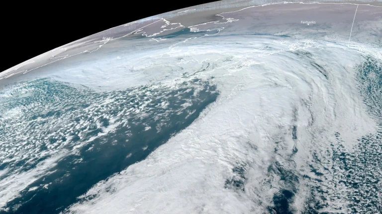
• Tornado-like devastation stretches for miles in Black River after Hurricane Melissa’s historic landfall, Jamaica

    Hurricane Melissa made landfall near Black River, St Elizabeth Parish, Jamaica, at approximately 10:15 LT (15:15 UTC) on October 28, as a Category 5 hurricane with maximum sustained winds of 295 km/h (185 mph) and a minimum central pressure of 915 hPa. This was the strongest hurricane to strike Jamaica on record, causing catastrophic damage…

  • Early-season freeze impacts large parts of the Texas and Oklahoma Panhandles and New Mexico

    Widespread Freeze Warnings are in effect across the Texas and Oklahoma Panhandles and parts of New Mexico on Thursday, October 30, 2025, with temperatures forecast to drop to −6°C to −2°C (20°F–28°F). The event marks the first significant freeze of the season across the southern High Plains. The warnings remain valid through early Friday morning as clear skies and light winds enable rapid radiational cooling. Residents are advised to protect plants, pipes, and pets.

  • Jamaica declared a disaster area after Hurricane Melissa leaves over half a million without power

    The historic landfall of Hurricane Melissa over Jamaica on October 28, 2025, has left behind a trail of destruction, prompting authorities to declare the island a disaster area on October 29. Over half a million people were left without power as Melissa ripped through the island. While some fatalities have been reported in Jamaica, official confirmation is yet to be made.

  • Dangerous storm surge forecast in the Bahamas as Hurricane Melissa moves across the islands toward Bermuda

    Hurricane Melissa is forecast to produce a dangerous storm surge and life-threatening coastal flooding across the southeastern and central Bahamas on Wednesday, October 29, 2025. The system is expected to pass near or just west of Bermuda late Thursday and Thursday night, bringing hurricane-force winds and heavy rainfall to the island.

  • Two atmospheric rivers forecast to bring heavy rain to the Pacific Northwest through early November

    Two atmospheric rivers are forecast to affect the Pacific Northwest between October 28 and November 2, 2025, bringing periods of heavy rainfall to western Washington and northern Oregon. The first system is expected to reach AR1 strength, while the second could intensify to AR3 or AR4 as it moves inland later in the week. Hydrologic models indicate notable river rises but no significant flooding at this time.

  • Rare Flash Flood Emergency declared in Lake County after 480 mm (19 inches) of rain, Florida

    More than 19 inches (483 mm) of rain fell within a few hours across Lake County, Florida, on October 26, 2025, prompting the National Weather Service in Melbourne to issue a rare Flash Flood Emergency. Severe thunderstorms caused extensive inundation in Central Florida, submerging vehicles and closing roads in Eustis, Mount Dora, and Titusville. Flood Warnings remain in effect along the St. Johns River as additional storms affect the region on October 27.

  • Catastrophic and life-threatening winds, flooding and storm surge forecast as Category 5 Hurricane Melissa nears Jamaica landfall

    Hurricane Melissa reached Category 5 strength on Monday, October 27, 2025, becoming the third Category 5 hurricane of the 2025 Atlantic hurricane season. On the forecast track, the center of Melissa will be near or over Jamaica late tonight or early Tuesday, cross eastern Cuba Tuesday night or early Wednesday, and then move near or over the Bahamas and the Turks and Caicos on Wednesday. After that, the cyclone could reach the vicinity of Bermuda on Thursday night.