I'm a dedicated researcher, journalist, and editor at The Watchers. With over 20 years of experience in the media industry, I specialize in hard science news, focusing on extreme weather, seismic and volcanic activity, space weather, and astronomy, including near-Earth objects and planetary defense strategies. You can reach me at teo /at/ watchersnews.bigscoots-staging.com.

  • Seismic event linked to renewed eruption at Barren Island volcano, India

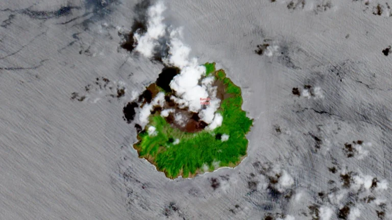
    A minor eruption was reported at Barren Island volcano in the Andaman Sea at around 10:15 LT (04:45 UTC) on September 20, 2025, two days after a shallow M4.2 earthquake in the region. The National Centre for Seismology suggested the quake may have disturbed the magma system, although no independent confirmation of the link is available.
  • CME forecast to strike interstellar Comet 3I/ATLAS on September 24-25

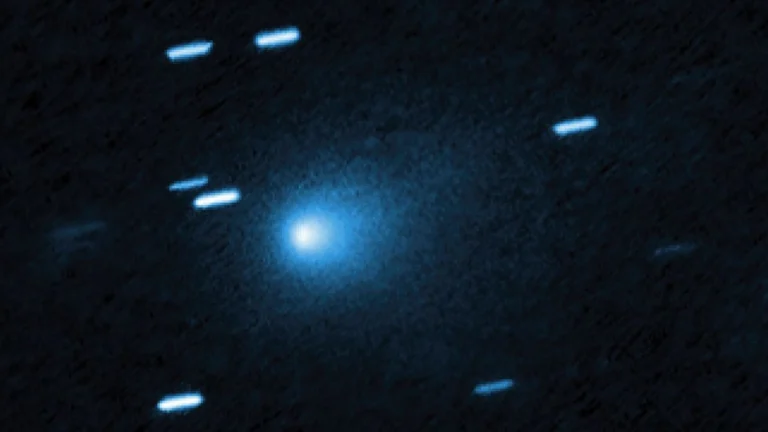
    A coronal mass ejection (CME) launched from the Sun on September 19 is forecast by NASA’s ENLIL model to strike interstellar Comet 3I/ATLAS on September 24 or 25, an extremely rare event that comes as the comet brightens 40-fold and prepares to disappear into the Sun’s glare.

  • Thunderstorms shift east bringing flood risk for New England and New York City area

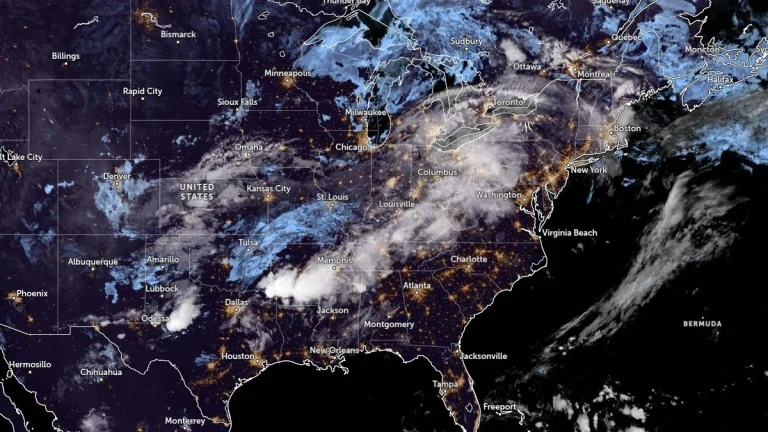
    Widespread thunderstorms are forecast across the United States on Wednesday and Thursday, September 24 and 25, 2025, as a cold front advances eastward. The Weather Prediction Center (WPC) has issued a Slight Risk of Excessive Rainfall for parts of the Ohio and Tennessee Valleys, while isolated flash flooding is possible in southern New England and the New York City metropolitan area as storms reach the Northeast.

  • NHC monitoring two tropical waves in the Atlantic basin

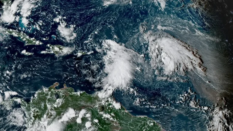
    A tropical wave over the northeastern Caribbean Sea is producing showers, thunderstorms, and gusty winds across the Windward and Leeward Islands on September 24, 2025. The National Hurricane Center (NHC) said the disturbance will spread heavy rainfall and gusty winds into Puerto Rico and the Virgin Islands later today and into the Dominican Republic tonight, with conditions becoming more favorable for development later this week near the Bahamas. Another wave, located about 1 125 km (700 miles) east of the Leeward Islands, also has a high chance of becoming a tropical depression in the coming days.

  • Hurricane Gabrielle forecast to approach Azores on Thursday, September 25

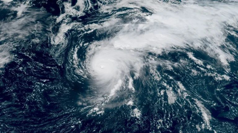
    A Hurricane Watch was issued for all islands of the Azores at 11:00 AST (15:00 UTC) on Tuesday, September 23, 2025, as Category 4 Hurricane Gabrielle moves east-northeastward over the North Atlantic. The system is forecast to approach the archipelago late Thursday, bringing the risk of hurricane-force winds, storm surge, and 75–125 mm (3–5 inches) of rainfall to the central and western islands. Swells are already affecting Bermuda, the U.S. East Coast, and Atlantic Canada.

  • Severe thunderstorms with tornado risk forecast for eastern Oklahoma and western Arkansas

    The southern Plains and Ozarks face a severe weather outbreak on September 23, 2025, with the Storm Prediction Center warning of supercells capable of producing tornadoes, very large hail, and damaging winds from eastern Oklahoma and northeast Texas into western Arkansas. Storms are expected to intensify this afternoon and evening (local time), with tornado potential maximized across northeastern Oklahoma into western Arkansas.

  • Eye of Super Typhoon Ragasa moves over Calayan Island, Cagayan, Philippines

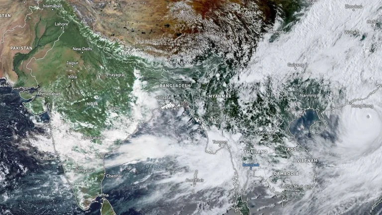
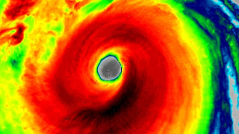
    Super Typhoon Ragasa, locally named Nando, began crossing Calayan Island in Cagayan province, northern Philippines, at around 03:00 UTC (11:00 LT) on September 22, 2025, bringing destructive winds, extreme seas, and life-threatening storm surge. The Philippine weather bureau reported maximum 10-minute sustained winds of 215 km/h (134 mph) and gusts up to 295 km/h (183 mph).