Shallow M6.2 earthquake hits Prince Edward Islands region

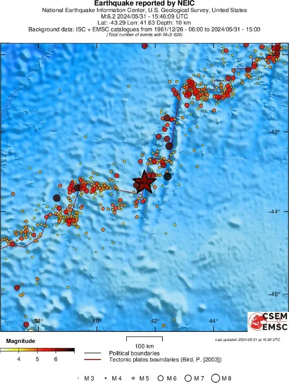
A strong and shallow earthquake registered by the USGS as M6.2 hit the Prince Edward Islands region at 15:46 UTC on May 31, 2024. The agency is reporting a depth of 10 km (6.2 miles). EMSC is reporting the same magnitude and depth.
The epicenter was located 1 649 km (1 025 miles) SE of East London, Eastern Cape, South Africa.
There is no tsunami threat from this earthquake.
The USGS issued a Green alert for shaking-related fatalities and economic losses. There is a low likelihood of casualties and damage.
There are likely to be no affected structures in this region.

Regional seismicity
Featured image credit: TW/SAM, Google
Commenting rules and guidelines
We value the thoughts and opinions of our readers and welcome healthy discussions on our website. In order to maintain a respectful and positive community, we ask that all commenters follow these rules.