
Strong M 6.1 struck near Marion Island, Prince Edward Islands
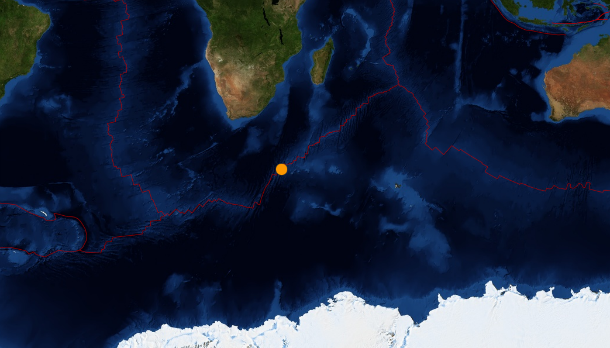
Image credit: USGS/Leaflet
Strong earthquake, registered as M 6.1 (USGS), occurred 244 km (152miles) WNW of Marion Island, at remote Prince Edward Islands on July 22, 2013 at 07:01 UTC. USGS registered M 6.1 at depth of 10 km, EMSC registered initially M 6.1 but later changed to M 6.3 at depth of 33 km, GEOFON registered M 6.3 at depth of 10 km. The epicenter was located at coordinates 46.042°S 34.825°E.
.jpg)
This is remote area, located about 1500 km beneath mainland South Africa, between Africa continent and Antarctic in sub-Antarctic Indian Ocean. The only human inhabitants of the islands are the staff of a meteorological and biological research station run by the South African National Antarctic Programme on Marion Island. There are no populated areas in 100 km radius from the epicenter.
Commenting rules and guidelines
We value the thoughts and opinions of our readers and welcome healthy discussions on our website. In order to maintain a respectful and positive community, we ask that all commenters follow these rules.